Blowhard Flat
1952
2005
Description:
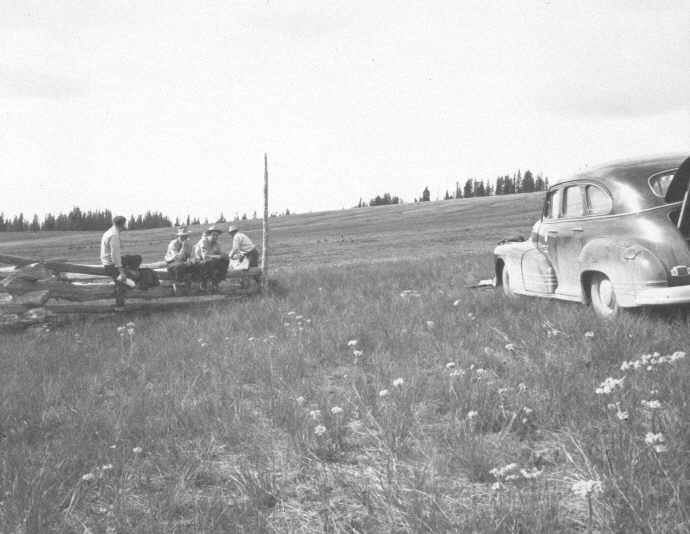
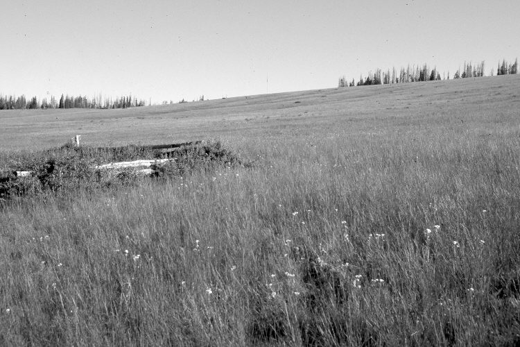
Plate 1090X. Blowhard Flat 1952 – 2005 Viewed north to the grazing exclosure on Blowhard Flat. The exclosure was built in 1925 but is of an improper design as the logs trap snow. This has lead to an increase in currants adjacent to the fence and to an increase in tall larkspur inside the exclosure. Stipa spp. has increased outside the exclosure. The tall post on the eastern corner of the exclosure seen in the 1952 image marks the starts of the Parker Three-Step Transect on Blowhard Flat - - see Plates 1092x to 1095X. Many spruce on the far ridge were recently killed by insects and disease. The area is grazed yearly by domestic sheep, but had not yet been grazed when the 2005 retake was made. The white flowers in the original and the retake are yarrow. This area is just south of Cedar Breaks National Monument.
Photo Information:
U.S. Forest Service photograph (unnumbered) taken on July 18, 1952; retake by Charles E. Kay on September 1, 2005 - - Photo No. 5539-13. Original photographs, negatives, and narrative reports held in the range files on the Cedar City Ranger District, Dixie National Forest, Cedar City, UT.
Vegetative Community:
Dry Meadow, Conifer
Location:
South West: Section 14, Range 9 West, Township 37 South; UTM of the exclosure 337100 E, 4162900 N; elevation 10,280 ft.