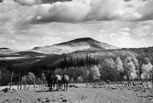
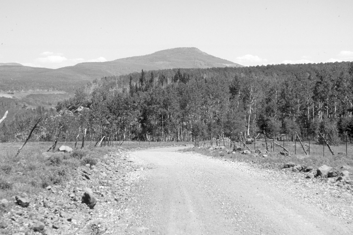
Black Mountain
1942
2006
Description:
Plate 1321X. Black Mountain 1942 – 2006 Viewed southeast to Black Mountain (10,400 ft) from the northern edge of Cedar Mountain. The old stock driveway is now a public road. Aspen has increased in height, but most stands have not successfully regenerated due to excessive ungulate browsing (Ohms 2003). Conifers appear to have increased. The retake was made with a 70 mm telephoto lens.
Photo Information:
Original photograph taken by Gregory (No. 1134) in 1942; retake by Charles E. Kay on July 12, 2006 - - Photo No. 5686-34. Original photograph held by the U.S. Geological Survey Photographic Library, Denver, CO.
Vegetative Community:
Aspen, Conifer
Location:
South West: Section 6, Range 10 West, Township 37 South; UTM 322230 E, 4164700 N; elevation 9,160 ft.
January 2018