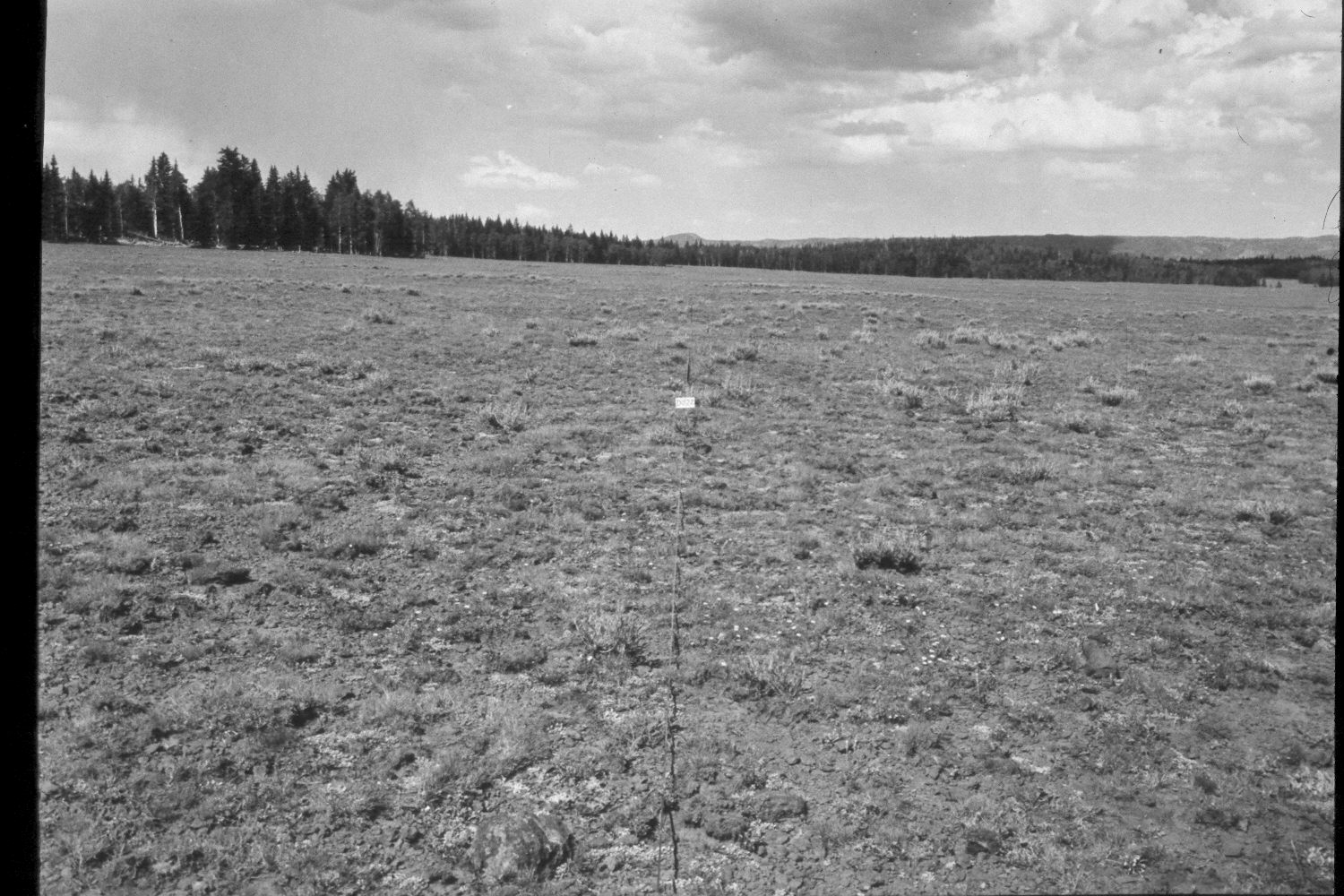
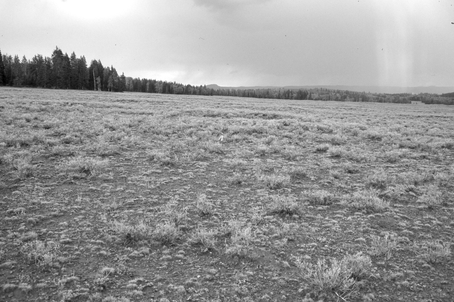
Big Lake Ridge
1952
2003
Description:
Plate 325X. Big Lake Ridge 1952 - 2003 Viewed east-northeast approximately 600 yards northeast of Big Lake on the Awapa Plateau. Boulder Top is in the distance. The original photographs (Plates 323x, 324x, and 325x) were part of an old Parker 3-step range transect - - white flagging marks the steel stakes in the retakes. Plate 325x is viewed from the transect’s fourth steel stake down the transect centerline. Spruce has increased, while aspen has declined. The meadow is dotted with mima mounds - - slightly-elevated circular landforms created by pocket gophers over hundreds or thousands of years. Silver sage appears to have increased and grows the tallest on top of mima mounds where the soil is deepest. The area was heavily grazed by cattle in 2003 and was also used by elk, mule deer, and pronghorn antelope.
Photo Information:
U.S. Forest Service photograph (unnumbered) taken on July 22, 1952; retake by Charles E. Kay on August 24, 2003 - - Photo No. 5247-19. Original photograph held in the range files on the Teasdale Ranger District, Dixie National Forest, Teasdale, UT.
Vegetative Community:
Conifer, Aspen, Dry Meadow
Location:
South West: Section 28, Range 2 East, Township 31 South; UTM of transect starting point 440000 E, 4215350 N; elevation 9,880 ft.