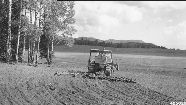
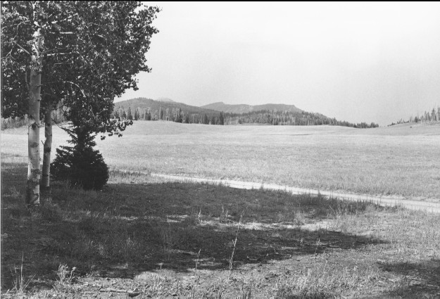
Betenson Flat Beaver Mountain
1944
2000
Description:
Plate 230. BETENSON FLAT BEAVER MOUNTAIN 1944-2000 Viewed northeast across Betenson Flat (a.k.a. Dry Flat) on Beaver Mountain. In the original, a spike-tooth harrow was being used to prepare the area for reseeding - - see Plates 127-142 and 228. The photopoint for the retake had to be moved forward as the forest has grown-out and now blocks the original view. Part of the forest on the distant hillside was burned by the 1996 Pole Creek wildfire and subsequently salvage logged. A Forest Service road has also been added around the edge of the meadow.
Photo Information:
U.S. Forest Service photo 425025 taken in 1944; retake by Charles E. Kay on August 1, 2000 - - Photo No. 4653-29; Original photo (2200 Fishlake-24) held by Forest Service Regional Office Photographic Collection housed at Weber State University, Ogden, UT.
Vegetative Community:
Conifer, Aspen, Dry Meadow
Location:
South Central: Section 1, Range 5 W, Township 30 S; UTM 380000 E, 4231400 N; elevation 9,680 ft.