Betenson Flat Beaver Mountain
1936
2000
Description:
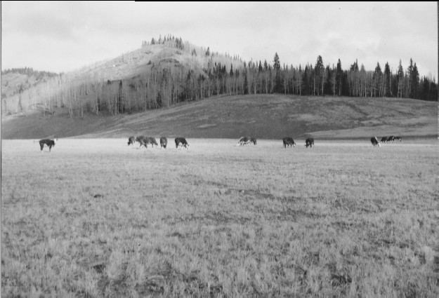
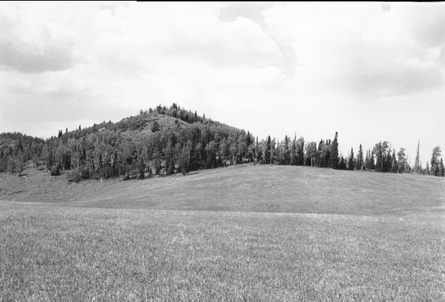
Plate 228. BETENSON FLAT BEAVER MOUNTAIN 1936-2000 Viewed north across Betenson Flat (a.k.a. Dry Flat) on Beaver Mountain. The meadow in the original photo was plowed and reseeded during the 1940’s - - see Plates 127-142 and 230. Part of the forest on the distant hillside (photo right center) was burned by the 1996 Pole Creek wildlife and subsequently salvaged logged. Conifers have increased while aspen has declined.
Photo Information:
U.S. Forest Service photo (unnumbered) taken by C.J. Olsen in October 1936; retake by Charles E. Kay on August 1, 2000 - - Photo No. 4653-24;Original photo (2200-I-1) held by Beaver Ranger District, Fishlake National Forest, Beaver, UT.
Vegetative Community:
Dry Meadow, Aspen
Location:
South Central: Section 1, Range 5 W, Township 30 S; UTM 380100 E, 4232050 N; Elevation 9,650 ft.