Bentenson Flat Beaver Mountain
1948
2000
Description:
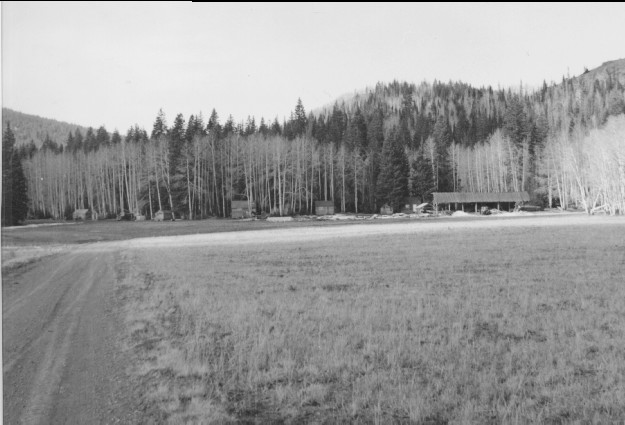
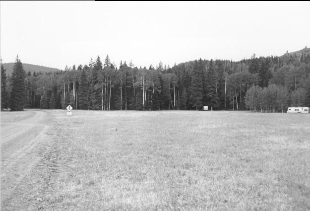
Plate 239. BENTENSON FLAT BEAVER MOUNTAIN 1948-2000 Viewed west from Bentenson Flat (a.k.a. Dry Flat) along USFS Road 137. Pictured in the original is a small, local sawmill that ceased operation a number of years ago. Aspen has increased in height but has otherwise declined. Conifers have increased and have invaded most aspen stands.
Photo Information:
U.S. Forest Service photo (unnumbered) taken on October 19, 1948; retake by Charles E. Kay on August 3, 2000 - - Photo No. 4659-24; Original photo (Timber) held by Beaver Ranger District, Fishlake National Forest, Beaver, UT.
Vegetative Community:
Conifer, Aspen
Location:
South Central: Section 1, Range 5 W, Township 30 S; UTM 380000 E, 4231800 N; elevation 9,680 ft.
January 2018