Bee Lake
1872
1996
Description:
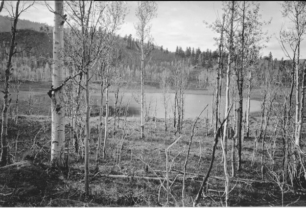
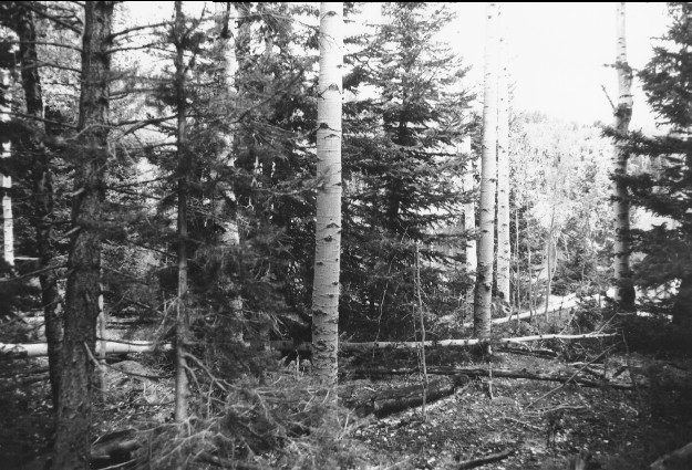
Plate 32. BEE LAKE : 1872 - 1996 This photo set is similar to Plate 31. Hillers referred to this body of water as Bee Lake, but it is not named on either U.S. Forest Service or U.S. Geological Survey maps. This lake is simply marked on USGS’s 1:24,000 Jacobs Reservoir map with its elevation of 9,547 feet and is located approximately 400 yards east of Bear Lake. The 1872 photo shows a multi-aged, regenerating aspen (Populus tremuloides) community between the camera and lake. The picture was taken in early spring before the aspen were fully leafed out and the undergrowth not regrown. The vegetation in the 1872 photo had never been grazed by livestock because the area had not yet been settled. The aspen in 1872 show no sign of browsing by either deer or elk, unlike today, and suggest that present wildlife numbers are not reflective of historical conditions. By 1996, the tall willows (Salix spp.) originally seen behind the lake have been largely eliminated by livestock grazing; the remaining plants are generally less than a foot tall and have been repeatedly browsed. There is no dam on this lake nor is there any natural or man-made outlet. The original photo point could not be precisely relocated because a dense forest has now become established, probably because of the absence of the frequent, low intensity fires that once swept this area. The second 1996 photo was made in an opening approximately 100 yards east of the original. Aspen trees have matured only to be invaded by conifers, primarily spruce (Picea sp.) and subalpine fir (Abies lasiocarpa). Across the lake, the large, old conifers in the 1872 photo were all Douglas-fir (Pseudotsuga menziesii) that survived repeated, ground fires, judging by the interspersed regenerating aspen. Most of those trees occurred on rocky outcrops where the sparse ground cover once limited the spread of fire. Many of the trees, however, are fire scarred. In 1996, however, that area is covered with dense growths of regenerating conifers, primarily spruce and fir, and would now support high intensity, stand-replacing crown fires, something that seldom happened in the past. The photo is viewed north to Boulder Top.
Photo Information:
1872 photo [#488] taken by John Hillers; 1996 photos are Kay #4061-32 and #4058-34, taken on Sept, 17. Hillers’ photo [RG-057-PS] held by the National Archives, Washington D.C.
Vegetative Community:
Aspen, Riparian, Conifer
Location:
South Central: On Boulder Mountain, Fishlake N.F., T32S, R4E., Sect. 18, UTM 4208700 N, 455800 E; elevation 9,580 ft.; view to north.