Barney Top
1935
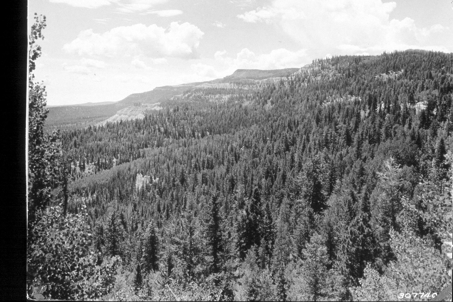
2002
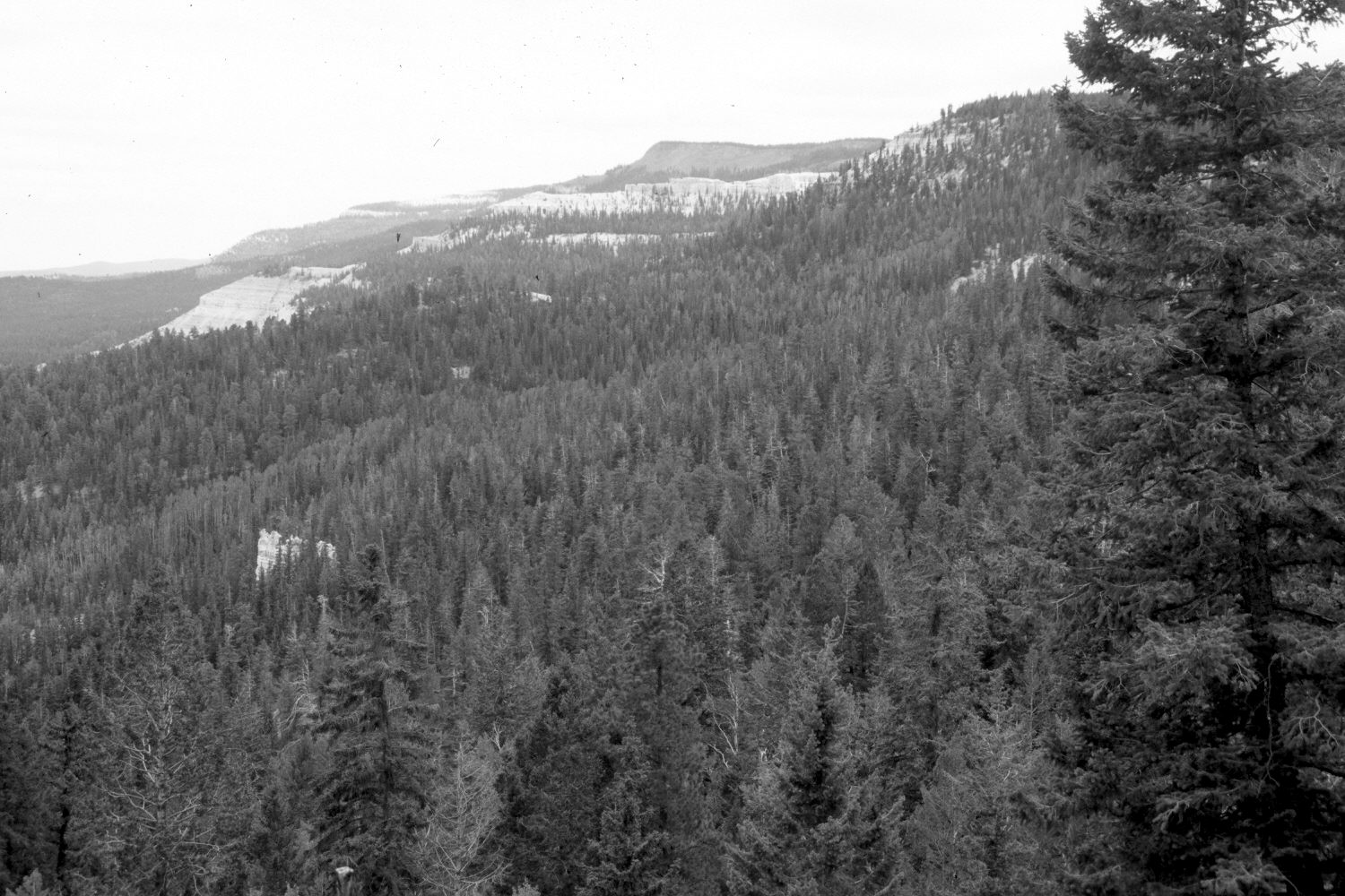
Description:
Plate 100X. Barney Top 1935-2002 Viewed south-southeast to Barney Top (10,577 ft.) from just east of the summit on the Escalante to Widtsoe Road (FH 17). Conifers have increased despite selective logging, while aspen has declined. All aspen stands have been heavily invaded by conifers. Conifers have grown-up and now block the original photopoint so the camera station for the retake was moved to the nearest open area on the road.
Photo Information:
U.S. Forest Service photograph 307740 taken ca. 1935; retake by Charles E. Kay on August 6, 2002 - - Photo No. 5010-26. Original photograph held by Southern Utah University Archives and Special Collections, Cedar City, UT.
Vegetative Community:
Conifer, Aspen
Location:
South West: Section 27, Range 1 East, Township 34 South; UTM 422500E, 4186800N; elevation 9,250 ft.