Barafitts Creek
1936
2006
Description:
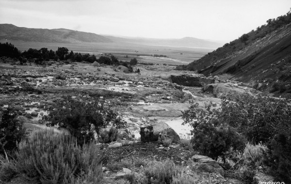
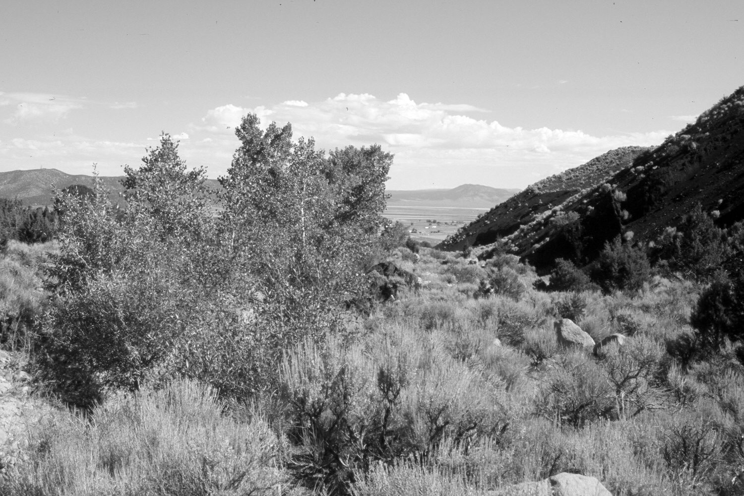
Plate 1405X. Barafitts Creek 1936 – 2006 Viewed northwest down Barafitts Creek at the southern end of the Parowan Valley. Summit, Utah is just off the photo to the right in the valley. The original camera station is now blocked by woody vegetation, so the retake was made from the nearest open area. The hillside on the right has been cut-away to extract cinders for road construction. Pinyon and juniper have increased, as have cottonwoods and willows. Erosion has declined and the stream channel has stabilized. The creek has downcut and is out-of-sight to the left along the line of cottonwoods. Sagebrush too has increased. Parts of the stream have been contained by wire gabions.
Photo Information:
U.S. Forest Service photograph (378498) taken in July 1936; retake by Charles E. Kay on August 7, 2006 - - Photo No. 5720-32. Original photograph held by the Utah Historical Society, Reed W. Bailey Collection (Box 7), Salt Lake City, UT.
Vegetative Community:
Pinyon, Juniper, Riparian, Sagebrush
Location:
South West: Section 10, Range 10 West, Township 35 South; UTM 327300 E, 4182400 N; elevation 6,240 ft.