Antimony
1915
2003
Description:
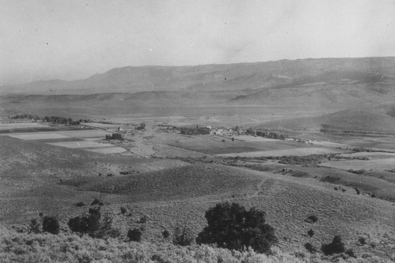
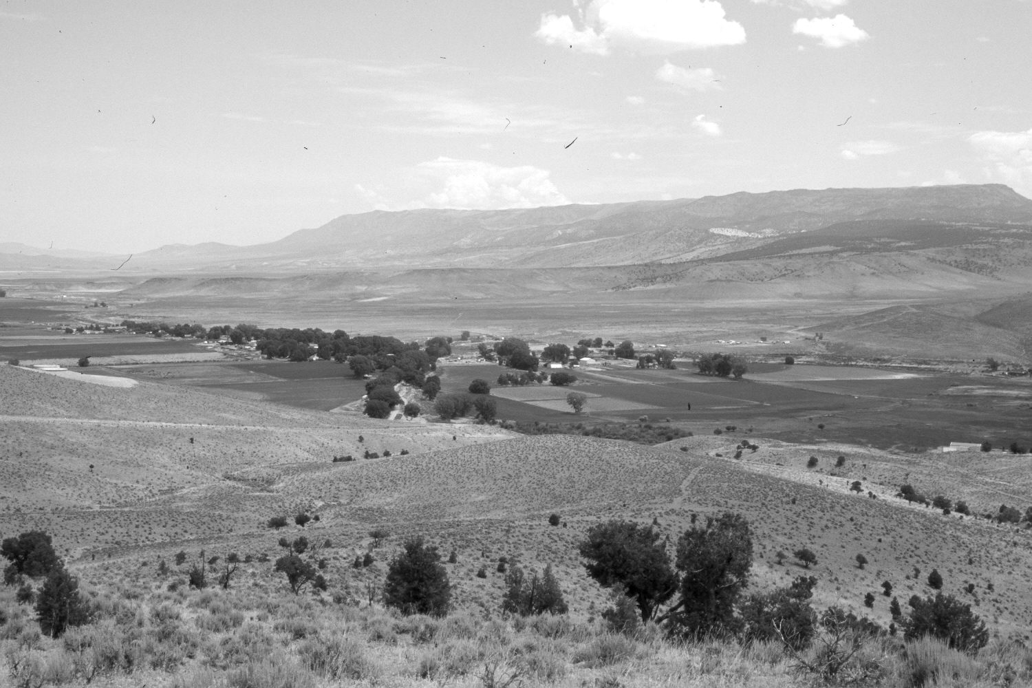
Plate 209X. Antimony 1915 - 2003 Viewed northeast to Antimony, Utah and the East Fork of the Sevier River Valley. Parker Mountain (9,440 ft.) is in the distance. Cottonwoods and other riparian trees have increased, but willows appear to have declined, primarily where they were cleared for additional cropland. Pinyon and juniper have increased, especially on the distant hillsides. The area in the foreground is heavily used by mule deer during winter, and there, sagebrush appears to have declined. Conversely, grass cover has increased despite the extended drought. The most common grass is needle and thread.
Photo Information:
Original photograph (UTHS-17879) taken on October 12, 1915; retake by Charles E. Kay on July 19, 2003 - - Photo No. 5193-32A. Original photograph held by the Utah Historical Society, Salt Lake City, UT.
Vegetative Community:
Riparian, Sagebrush
Location:
South West: Section 21, Range 2 West, Township 31 South; UTM 411500E, 4217100N; elevation 6,860 ft.