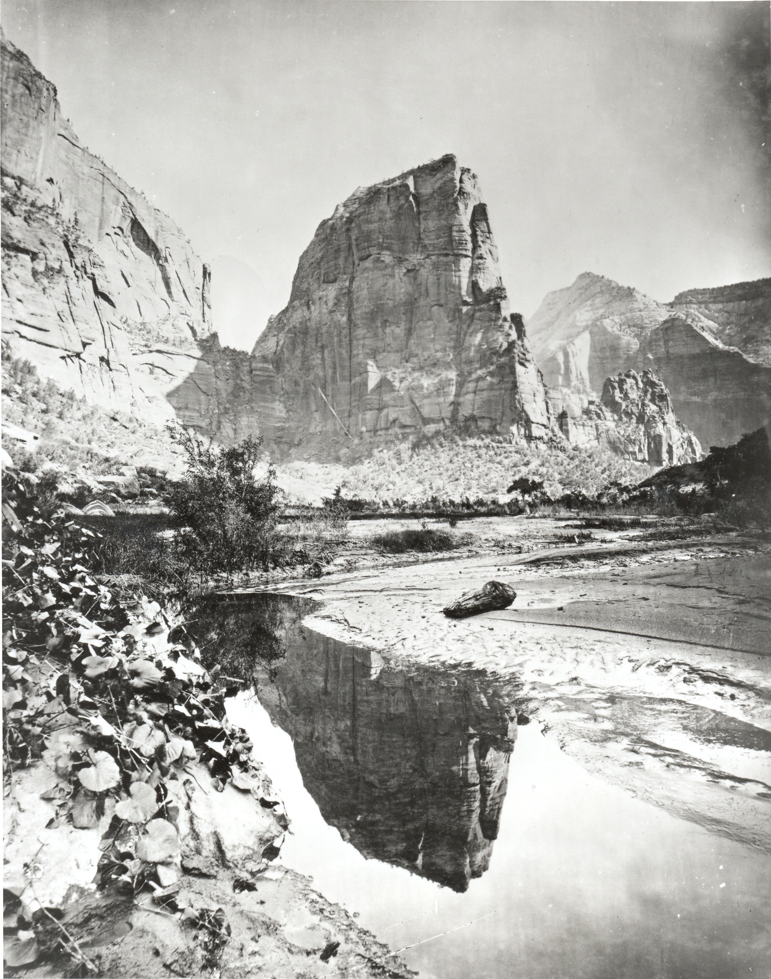
Angels Landing
1872
2006
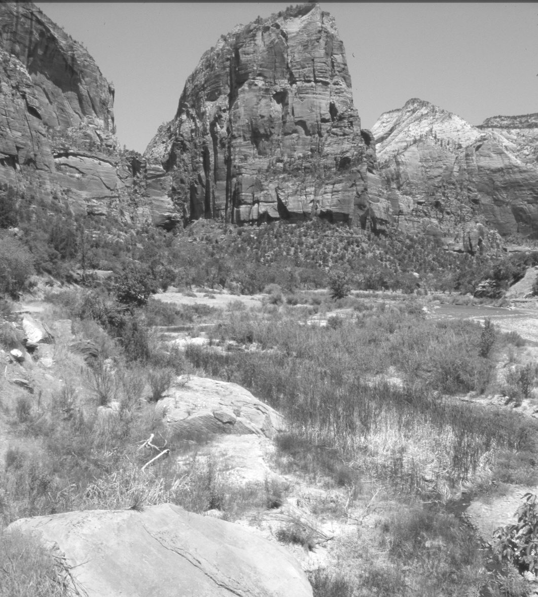
Description:
Plate 1196X. Angels Landing 1872 – 2006 Viewed north up the Virgin River to Angels Landing (5,790 ft) in Zion National Park. A single boX elder has grown-up and now blocks the original camera station, so the retake was made 30 feet to the left. Note the trail the Park Service has blown-out of the cliff face below the notch to the left of Angels Landing. One fork of that trail goes to the West Rim, while the other ascends to the top of Angels Landing. Pinyon, juniper, and turbinella oak have increased on the slope below Angels Landing. Note that there was only one mature cottonwood on the floodplain in 1872. That was probably due to the then rapid migration of the river and beaver activity - - see Plate 1194X. Today, the river channel has stabilized and downcut because the Park Service has constructed a number of revetments and gabions to protect park infrastructure (Hereford et al 1996, Grand Canyon Trust 2001). Also, note the present absence of willows and young cottonwoods. This is due to eXcessive browsing of seedlings by an abnormal concentration of mule deer (Steen 1999, Ripple and Beschta 2006). The floodplain is more vegetated today but that is due to the growth of cattails and unpalatable woody shrubs. EXcept for a few seedlings, tamarisk is absent because it has been removed by the Park Service, both by cutting and the application of herbicides.
Photo Information:
Original photograph taken by John Hillers (No. 73) in 1872; retake by Charles E. Kay on June 6, 2006 - - Photo No. 5635-12A. Original photograph held by the U.S. Geological Survey Photographic Library, Denver, CO.
Vegetative Community:
Pinyon, Juniper, Riparian
Location:
South West: Section 2, Range 10 West, Township 41 South; UTM 327100 E, 4125400 N; elevation 4,280 ft.