Cattle Improve Elk Use In The Bookcliffs
Project Participants: Roger Banner, Greg Cunningham, Bill Cunningham, and Stan Baker
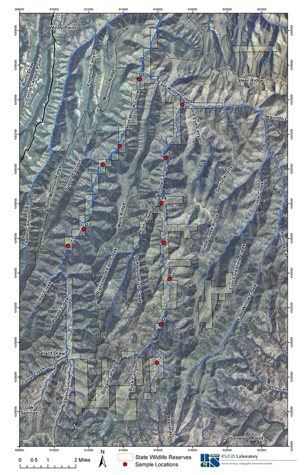
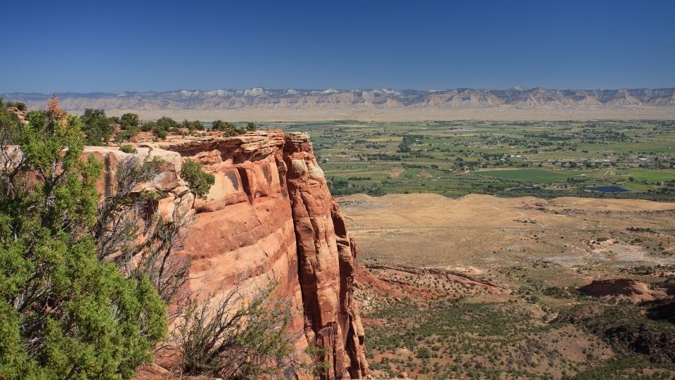
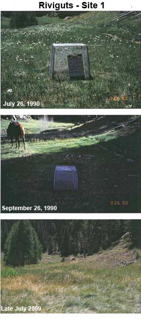
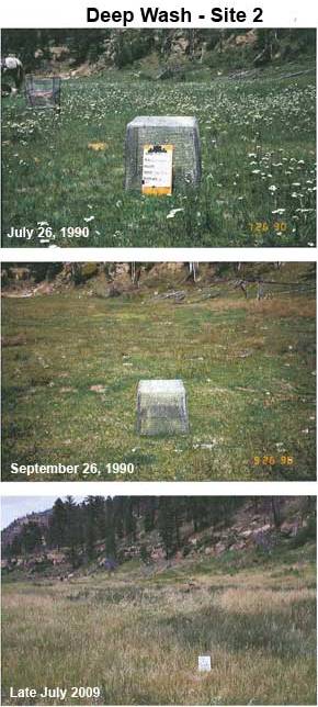
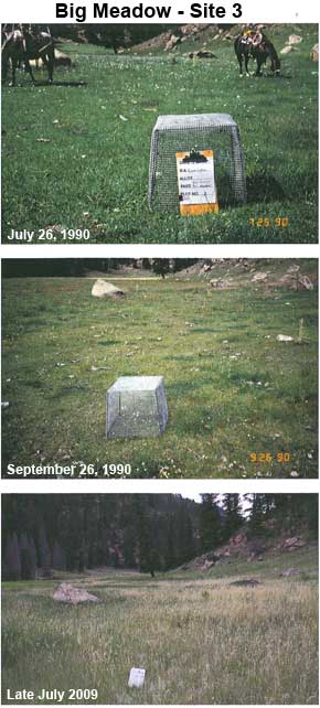
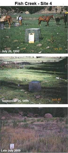
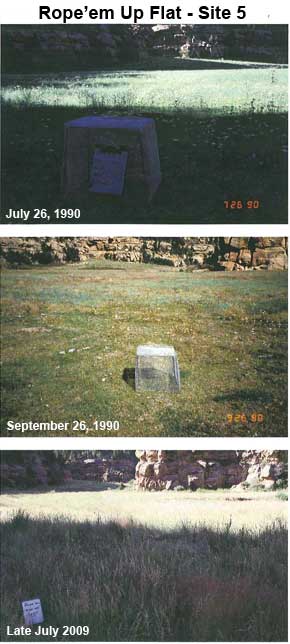
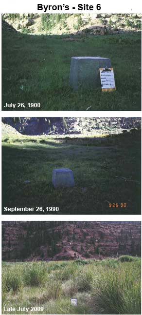
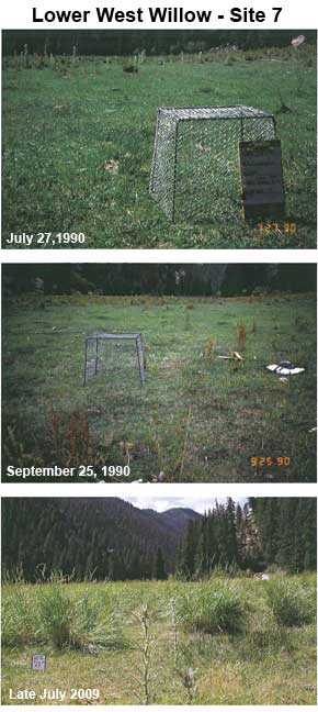
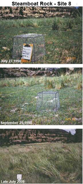
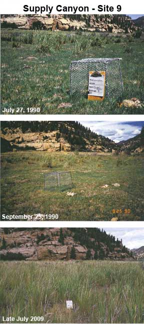
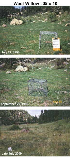
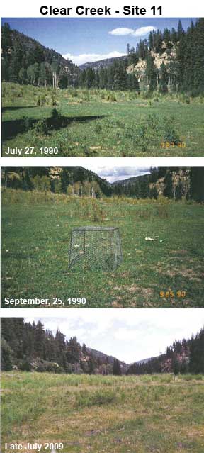
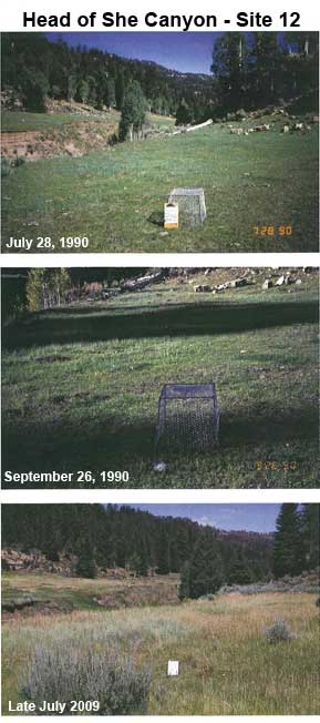
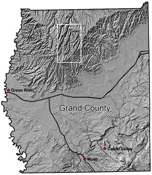 The study was conducted in Grand County on private land and the Roadless Area State Land Block in the Bookcliff Mountains of Utah (map on right). In July 1990, immediately after cattle left the area for higher ground. Utilization cages were put out throughout the area to determine use of vegetation by elk in late summer and early fall. Photos were also taken at each location so repeat photography would be possible. In late September 1990, caged and uncaged plots were clipped and photos of each location were taken.
In July and September of 1990, Roger Banner, USU Rangeland Extension Specialist, and several producers encountered numerous elk in both She Canyon and West Willow. In September 1990, they saw numerous elk wallows in the canyon bottoms as well. Spring of 1990 was the last time cattle grazed this allotment or the private land adjacent to it.
In late July 2009, Banner and producers returned to photograph the same areas where utilization cages had been placed in 1990. They encountered no elk and saw very little recent sign of elk in the 2.5 days they were in the area. The vegetation in these areas showed no sign of use and the bottoms that were now dominated by dense stands of weeds and perennial grasses, including dense stands of coarse vegetation, such as basin wildrye (to see photos 1-12 scroll down the page).
The conclusion was cattle grazing that occurred on private land and permit use of the Roadless Area State Land Block was not competitive with elk. Cattle grazing was complementary for elk. Numerous studies have shown that properly managed cattle grazing can increase elk use and forage quality for elk. In the same time period (1990-2009) elk numbers in Utah increased by 8,000 or 14%, so reduced elk use in the area was not due to declining state elk populations. After cattle left the area, so did the elk.
For more information see Effect of Cattle Grazing on Elk Use in the Bookcliffs (pdf)
Map of caged and uncaged plots and repeat photography in the study area.