Bringing the Public Up to Speed on Land Use Planning with a Story Map
By Susan Drumheller
Most people become engaged in land use issues when someone next door plans to do something that could change the neighborhood – like building an asphalt batch plant to serve the growing need to pave roads for increased traffic. They are often totally unaware of or disengaged from the larger questions of land use planning and zoning on a countywide scale, which can have enormous impacts on individual residents and the broader community, ranging from traffic impacts to loss of rural character to toxic algae blooms.
This seems to be particularly problematic in the case in GNAR communities, where effective land use planning is key to protecting the natural amenities, recreation opportunities, and open spaces people hold dear. Unfortunately, while land use planning is vital in shaping the future character of a community AND the fate of its natural resources, how land use planning works and how to influence it is a mystery to most people. It’s a challenge to even communicate how relevant it is to people’s lives. So how can we communicate this wonky topic of planning and zoning in a way that engages the public and helps them meaningfully get involved in influencing land use decisions?
This was the question our organization Project 7B ran up against after years of using lots of words to (not very successfully) explain the topic. Project 7B is a non-profit community group based in Sandpoint, Idaho, whose mission is to educate and involve the public in land use planning and to promote responsible growth. We had a simple goal: to give residents a basic understanding of land use planning before our county started to rewrite its comprehensive land use plan. Since words weren’t cutting it, we decided to try using maps and visuals instead.
We were fortunate to benefit from grants from the Equinox Foundation and the Union Pacific Foundation who were willing to take a chance on our idea. With those grant funds, we hired Gage Cartographics, a GIS firm in Bozeman, MT.
GIS whiz Josh Gage took our rough outline, gathered data from Bonner County and other sources, and – working closely with us – pieced together a series of maps that helped tell the story of what’s happening in our county, and - projecting forward into the future - what could happen with unrestrained growth. We provided specifics about Bonner County’s policies and history, compiled data that wasn’t readily available, and solicited photos to help illustrate the story.
The result is the Bonner County Story Map.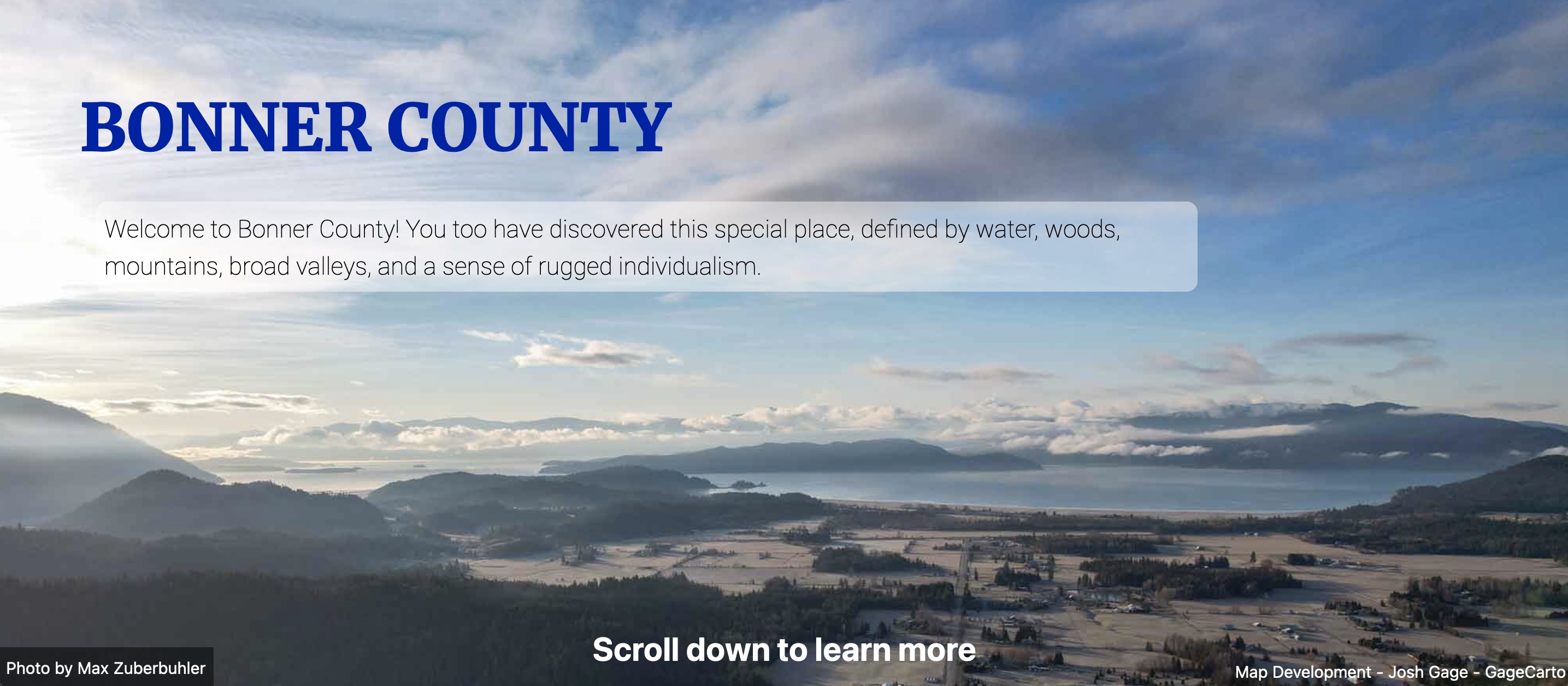
We have been sharing the Story Map through social media, in on-line advertising, e-mail newsletters and posted on the Project 7B website, and we plan to use it in educational materials leading up to the Comprehensive Land Use Planning workshops and hearings. The feedback from people who have seen the Story Map has been gratifying – as it appears to be achieving the goal of helping to demystify the land use process
We plan to continue to share it in our public communications, but because the Story Map itself does not have metrics attached to it, we don’t have solid data on how far our reach has been. Still, we know anecdotally that the visual, map-based story-telling medium is far superior than just using the tired terminology of land use planning to try to educate the public and impart the relevancy of zoning and comprehensive plans.
The experience of working with an expert at ARC GIS was positive enough that we would like to do it again. But anyone embarking on a similar project should be aware that –
as with any data-driven project – garbage in means garbage out.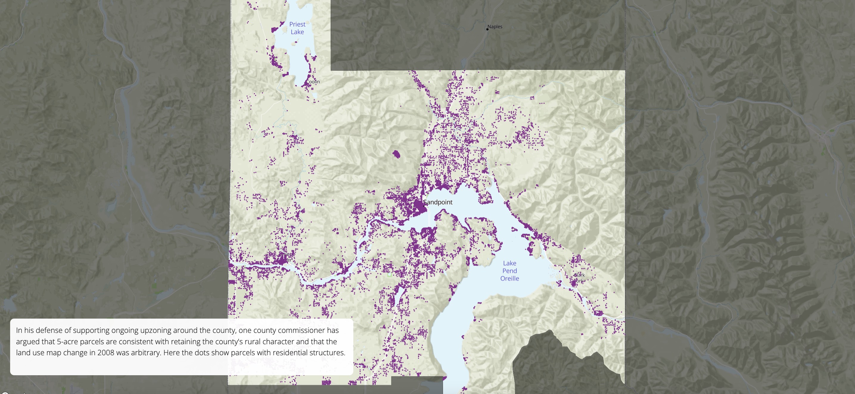
The project sponsor will need to be actively engaged in helping to source good, relevant data to provide accurate and relevant maps that tell an authentic story. In our case, we had to manually comb through public records and create our own database to come up with the data we needed to fully tell the story. Similarly, we provided the outline, the text and the photos.
But the creative process was as invigorating as it was challenging, and the resulting product and feedback made it all well-worth the effort.
Susan Drumheller is a board member of Project 7B, a non-profit based in Sandpoint, ID, whose mission is to educate and involve the public in land use planning and to promote responsible growth. Drumheller learned about land use issues originally as a North Idaho bureau reporter for the Spokesman-Review newspaper. After 15 years in journalism, Drumheller joined the staff of the Idaho Conservation League, where she was involved in land use issues as they related to impacts to water quality. Now she works as an independent contractor providing grant writing and communication services