LANDFIRE in the Intermountain West - Impacts, Collaboration, and Notes from the Field
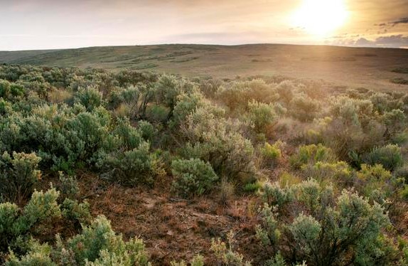
Figure 1: Sagebrush steppe landscape in Wyoming. photo by Hannah Letinich
USU Forestry Extension asked the LANDFIRE Program's Nature Conservancy team (the principal partner in a multi-agency program managed by the U.S. Department of Agriculture Forest Service and the U.S. Department of Interior), to explain what LANDFIRE is and how it has impacted the way scientists and managers approach land management.
LANDFIRE is an innovative program that creates comprehensive vegetation, fire, and fuel characteristics data for the entire U.S. by facilitating inter-agency/inter-organizational collaboration and cooperation. In doing this, they provide data for landscape assessment, analysis, and management on a large scale. LANDFIRE helps Federal and State agencies and other public and private organizations work together to address fire and other natural resource management issues.
Given the extent of public lands in the West, LANDFIRE's impact has been significant. LANDFIRE data are used because they include the best available science and expert review, they are publicly available at no cost, making the methods easy to replicate for other states, and they are regularly "refreshed" so that assessments and plans can be adjusted with every new data release.
LANDFIRE at Work
Western Watersheds and Fire Management
The Nature Conservancy’s New Mexico Chapter conducted a rapid landscape-scale assessment of the Upper Mimbres Watershed in southwest New Mexico which provided the foundation for developing a collaborative fire management plan. Using LANDFIRE data to assess the 535,000–acre multi-ownership area, the team calculated fire condition and modeled potential fire behavior. This information helped managers prioritize treatment areas in the assessment zone. Additionally, the Wilderness Ranger District and Silver City Ranger Districts are using the results in the Healthy Forest Restoration Act Environmental Assessment for the 125,000–acre Upper Mimbres area, focusing on prescribed fire, fuel reduction, and riparian restoration treatments.
Ecology and Conservation of Sage-grouse at Landscape Scales
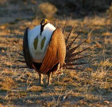
Figure 2: Male greater sage-grouse condicting mating behavior. Photo by The Nature Conservancy/Joe Kiesecker
LANDFIRE provides landscape-level vegetation and habitat data that scientists use to interpret sage-grouse movements and habitat use across the West. Through evaluating interactions between sagebrush and sage-grouse, land managers have gained a comprehensive understanding of sage-grouse, habitat connectivity, and, ultimately, regional conservation strategies. For example, LANDFIRE data has been used to compare the historical distribution of sagebrush vs. its current extent, it has been used to investigate the impacts of cropland expansion and how this land conversion affects sagegrouse in Montana, and it has been used in a study that quantified sage-grouse habitat and restoration in Idaho. These are just a few examples of the ability of LANDFIRE data to enrich current and ongoing studies.
Statewide Assessment of Riparian Vegetation Conditions
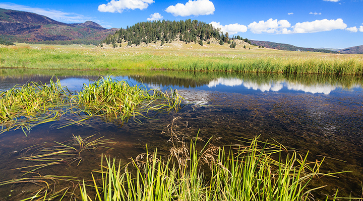
Figure 3: Upper Mimbres watershed in the Jemez Mountains, New Mexico where officials used LANDFIRE data to prioritize restoration and treatment efforts. Photo by Alan Eckert Photography.
In their study examining riparian vegetation as an indicator of riparian conditions across the North American West, Macfarlane and others[1] (at Utah State University) used LANDFIRE's data to measure the health and ecological composition of riparian areas in Utah. Because riparian ecosystems support diverse vegetation communities, understanding how and/or what impacts them is fundamental. These scientists provided Utah officials with state-wide maps that helped managers prioritize sites and actions for rivers and streams requiring restoration.
Fire Suppression Costs With and Without Fuel Treatments
LANDFIRE data informed a study[2] where the authors developed a model that simulated the cost of wildfire suppression with and without fuel treatments. The model was applied to Wyoming sagebrush steppe and mountain big sagebrush ecosystems in the Great Basin. The results indicate that, in terms of wildfire suppression cost savings, fuel treatments are costefficient if ecosystems are in “good” ecological health, and inefficient when systems are in “poor” ecological health. These predictive models help agencies to prepare for fire seasons and adjust to changing fire patterns and frequencies.
Effects of Climate Change on Cattle Production
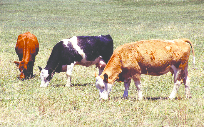
Figure 4: Cattle Grazing - Photo by USDA Agricultural Research Service
LANDFIRE provided landscape-level vegetation and climate data to Bagne & Reeves[3] for their study investigating climate change impacts to seven different regions of rangelands in the western U.S. to the year 2100. They modeled forage quantity, vegetation type trajectory, heat stress, and forage variability. Projections show an increase in forage quantity in northerly regions; a move toward grassier vegetation types overall, but with considerable spatial heterogeneity; a rapid increase in the number of heat-stress days across all regions; and higher forage variability for most regions. These findings inform landscape-scale scenario planning and provide baseline information that can help land managers respond to climate change challenges.
Adapting Data to Support Local Planning Efforts
In 2015, the South Central Idaho Fire Planning Unit (FPU) needed current data after four major fires burned 178,000 acres in 2013. The fire staff, working with a team of LANDFIRE and USFS colleagues, calibrated fire behavior fuel models to better fit local conditions. Because LANDFIRE data were applied and adjusted quickly, the FPU had the information they needed to plan and adapt management practices to address post-fire landscape conditions. LANDFIRE has been on the ground exploring, analyzing, and mapping the country since 2004. The Intermountain West has more applications of LANDFIRE Program products than anywhere else in the continental U.S. This suite of examples of biological data in action demonstrates the versatility of this free program. We hope you explore LANDFIRE's website and The Nature Conservancy's LANDFIRE site on Conservation Gateway.
- [1] Macfarlane, W.W., J. Gilbert, M. Jensen, J.D. Gilbert, N. Hough-Snee, P. McHugh, J. Wheaton, S. Bennett. (2016). Riparian vegetation as an indicator of riparian condition: Detecting departures from historic condition across the North American West. Journal of Environmental Management. 202: 447-460.
- [2] Taylor, M.H., K. Rollins, M. Kobayashi, R.J. Tausch. (2013). The economics of fuel management: Wildfire, invasive plants, and the dynamics of sagebrush rangelands in the western United States. Journal of Environmental Management. 126: 157-173.
- [3] Reeves, M.C., K.E. Bagne. (2016). Vulnerability of cattle production to climate change on U.S. rangelands. Gen. Tech. Rep. RMRS-GTR-343. Fort Collins, CO: U.S. Department of Agriculture, Forest Service, Rocky Mountain Research Station. 39 p.