Utah Water Week 2022 Results
This year was Utah Water Watch's 9th annual Utah Water Week, and it was amazing! Thank you to all the volunteers who monitored sites during Water Week and the month of May. You helped create a snapshot of Utah's water quality for May. The results show that all sites monitored were healthy and safe for the critters that live in these lakes and streams and for humans to enjoy.
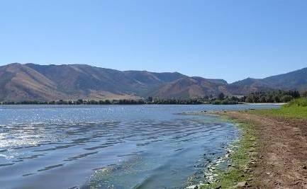
Click here to see some of the great photos submitted by our volunteers for Utah Water Week this year!
Some Utah Water Week Fast Facts:
Number of monitoring events/sites: 27
Total hours sampled by all volunteers: 28 hours
Total miles driven: 493 miles
Warmest air temperature sampled: 33.3ºC (92ºF)
Coldest air temperature sampled: 6.8ºC (44ºF)
Average water temperature: 10.7ºC (51ºF)
Average pH: 6.8
Average dissolved oxygen: 8.3 mg/L
Average turbidity: 41.2 cm
To view the keys for all interactive maps, click on the picture of the box and arrow in the top left corner. To interact with the maps from each category, click on the link below each map.
Water Temperature
Water temperature controls the kinds of organisms that can live in rivers and lakes. Each aquatic species has a preferred temperature range. As temperatures get too far above or below this preferred range, the number of individuals of each species continually decreases until there are none left, which means the body of water is no longer healthy.
The average water temperature for all sites was 10.7ºC, which was 2.3ºC colder than last year. The coldest temperature was 1.7ºC at Silver Lake in northern Utah. The warmest temperature of 20.1ºC was recorded at the Virgin River at Sullivan Park in southern Utah. These temperature differences can be attributed to elevation and location.
To learn more about water temperature, visit to the temperature information page.
For an interactive map, click here and "check" the temperature layer.
Dissolved Oxygen
Dissolved oxygen (DO) is critical for aquatic life. It is the air that aquatic organisms breathe under water.
Average dissolved oxygen was 8.3 mg/L, close to last year's average at 8.6 mg/L. When DO levels drop below 6 mg/L, it may be harmful for certain sensitive aquatic organisms. The lowest dissolved oxygen readings were 6 mg/L at Spanish Fork River and Birch Creek. The highest dissolved oxygen was 12 mg/L at East Canyon Creek.
To learn more, visit the dissolved oxygen page.
For an interactive map, click here and "check" the dissolved oxygen layer.
pH
A healthy pH range in Utah is 6.5 - 9. The pH determines what nutrients and heavy metals are present in our water. It also determines how many nutrients can be taken up by aquatic life.
The average pH of all the lakes and streams measured was 6.8, which is 0.4 lower than last year. The lowest pH was 5.5 in three different locations and the highest was 8 at three different locations.
To learn more, visit the pH page.
For an interactive map, click here and "check" the pH layer.
Stream Turbidity
Turbidity is the measure of how clear the water is. When the measurement is a large number, that means the body of water is extremely clear. When the measurement is a small number, that means the water is very cloudy.
The highest stream turbidity during Water Week was in the Yellow Fork river, which had a measurement of 5 cm. Water week is held in the spring, typically during spring runoff, which tends to make waters murky with sediment. The average turbidity level was 41.2 cm with eight sites having readings of 55 cm or more. There were ten sites measured this year using a secchi disk, which is the protocol for measuring lakes, reservoirs, or ponds; while streams are measured using a turbidity tube. The highest measurement for a lake was 2 meters at Jordanelle Reservoir, and the lowest being 0.15 meters at Utah Lake.
To learn more, visit the turbidity page.
For an interactive map, click here and "check" the turbidity layer.