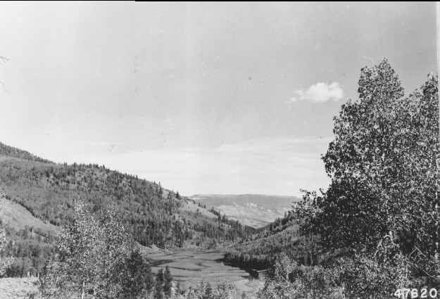
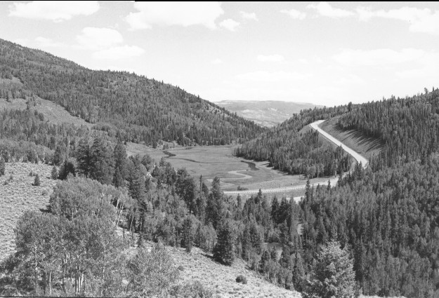
Zedds Meadow
1953
1999
Description:
Plate 77. ZEDDS MEADOW: 1953 - 1999 The aspen (Populus tremuloides) in the foreground of the 1953 photo increased in height to block visibility from that photo point. The 1999 photo was taken approximately 100 feet south, which slightly alters the perspective. Utah Highway 25 is visible in the 1999 photo whereas it wasn’t in 1953. Conifers are more abundant in the 1999 photo than in 1953, but aspen declined. Some aspen near the 1999 photo point have regenerated, but most have not.
Photo Information:
953 photo is U.S. Forest Service #476201 taken on Aug. 12; 1999 photo is Kay #4465-18A, taken on Aug. 11. Forest Service photo [2540-2-Municipal Supply Watersheds] held by the Forest Service Regional Office Photographic Collection housed at Weber State Univ. Ogden, UT
Vegetative Community:
Conifer, Aspen, Riparian
Location:
South Central: Fremont River, Fishlake National Forest, Loa Ranger District, T25S, R3E, Sect. 30, UTM 4272950 N, 445800 E; elevation 8,970 ft., viewed to southeast.1