White Pine Creek Pavant Mountains
1955
2000
Description:
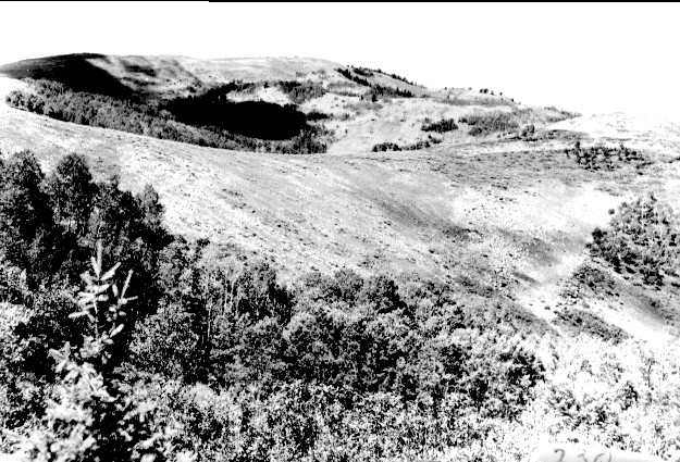
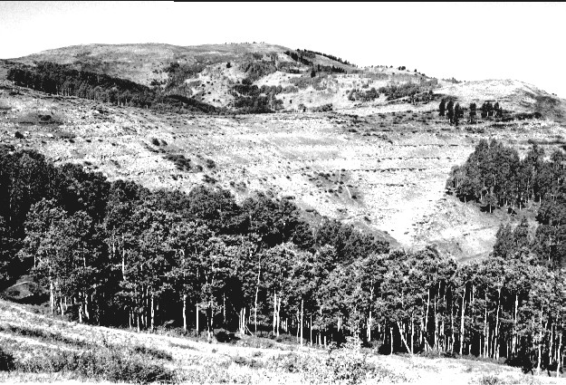
Plate 277. WHITE PINE CREEK PAVANT MOUNTAINS 1955-2000 Viewed southwest across the upper portion of White Pine Creek to White Pine Peak in the Pavant Mountains. This area was gully-plugged, contour-trenched, and reseeded by the Forest Service in 1962 to control erosion. The dark-colored shrubs are snowberry and currant. Aspen has increased in height but failed to regenerate due to excessive browsing.
Photo Information:
U.S. Forest Service photo (unnumbered) taken in August 1955; retake by Charles E. Kay on September 3, 2000 - - Photo No. 4679-27A; Original photo (2500-2-A230) held by Fillmore Ranger District, Fishlake National Forest, Fillmore, UT.
Vegetative Community:
Mountain Brush, Aspen
Location:
South Central: Section 33, Range 3 W, Township 22 S; UTM 395650 E, 4301600 N; elevation 9,220 ft.