White Pine Creek Pavant Mountains
1962

2000
Description:
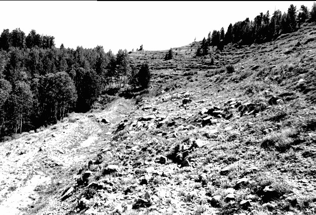
Plate 285. WHITE PINE CREEK PAVANT MOUNTAINS 1962-2000 Viewed east at the head of White Pine Creek in the Pavant Mountains. This area was contour-trenched, gully-plugged, and reseeded by the Forest Service to control erosion. Conifers have increased while aspen has not regenerated due to excessive browsing. This area is still heavily grazed by cattle. Note that trenching through aspen did not stimulate regeneration, or if it did, all the suckers were repeatedly browsed by wild and domestic ungulates. This has happened throughout White Pine and Chalk Creeks - - no new aspen trees have become established on any terraces through aspen stands.
Photo Information:
U.S. Forest Service photo (unnumbered) by L.A. Peterson in fall 1962; retake by Charles E. Kay on September 3, 2000 - - Photo No. 4714-3; Original photo (2500B) held by Fillmore Ranger District, Fishlake National Forest, Fillmore, UT.
Vegetative Community:
Conifer, Aspen
Location:
South Central: Section 33, Range 3 W, Township 22 S; UTM 395400 E, 4301500 N; elevation 9,240 ft.