West Fork Of Hunt Creek
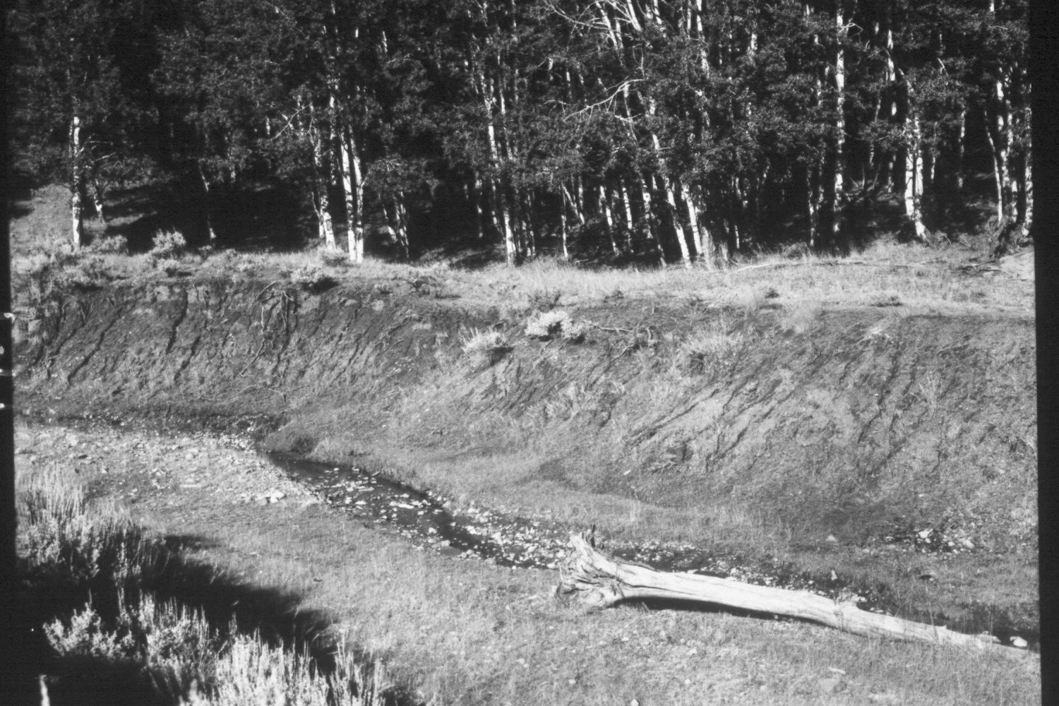
1959
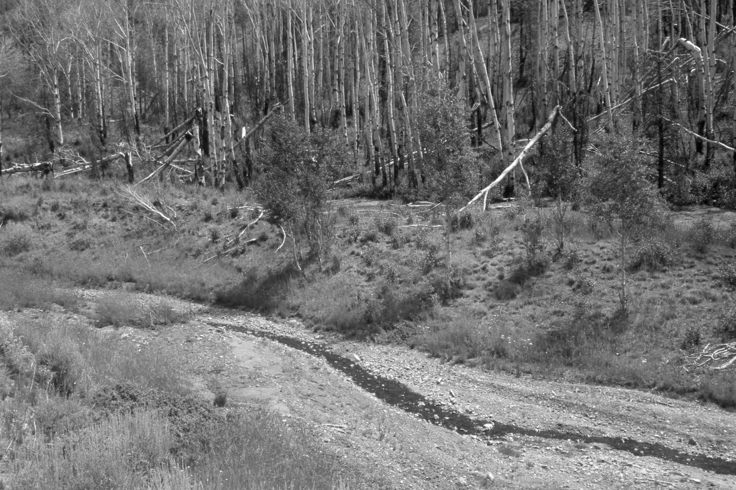
2003
Description:
Plate 174X. West Fork of Hunt Creek 1959 - 2003 The Photo Plot Transect on the West Fork of Hunt Creek was established in 1943 and reread in 1946, 1953, and 1959. Initial range conditions were described as very poor and all plant communities were heavily grazed by cattle and domestic sheep. According to early narrative reports, “the most noticeable thing…was the amount of dead willows. The creek bottom was formally covered [with willows] in all the little openings that we traversed from the head of the creek. Now [1943] most of them are dead….it may [also] be stated that the creek has cut down a deep channel and is still cutting during heavy runoffs…grasses are quite scarce.” In 1953, it was noted that “sheet and gully erosion [were] severe, not only at the transect site but from lower West Hunt Creek to [its] head…small recent alluvial deposits [were] common all along the transect…Existing gullies have been deepened considerably and some new ones formed…[even in the] aspen type sheet erosion is a real problem.” After remeasuring the transect in 1959, Range Conservationist I.H. Johnson noted that, “There is nothing from the analysis of transect records to give assurance that this range is on the mend. On the contrary, the data points very definitely to a continuation of the down trend for both vegetation and soil that was previously reported…” (unpublished reports in range files, Panguitch Ranger District, Panguitch, UT). Plate 174x is viewed northeast across the West Fork of Hunt Creek back to the transects’ starting point near the three, clumped aspen trees seen in the distance (photo left-center). The stream banks are more heavily vegetated today than they were in 1959. A few aspen stems have successfully regenerated on the far stream bank, as the steep slope limits use by cattle and wildlife. Those stems have now been high-lined, however, and all the smaller suckers repeatedly browsed. Conifers invaded the more distant aspen stand only to be killed by the Sanford fire in 2002 - - that clone was also top-killed by the fire, but resprouted profusely in 2003. Large portions of this drainage were burned by the Sanford fire and recent summer storms have triggered debris flows - - something that had not happened prior to the fire. The newly deposited material in the creek bottom is from an upstream debris flow. Downstream flash floods were even more severe, generating 10 to 20 foot walls of water and mud.
Photo Information:
U.S. Forest Service photograph (unnumbered) taken by I.H. Johnson on August 19, 1959; retake by Charles E. Kay on July 12, 2003 - - Photo No. 5184-5. On both the USGS 1:24,000 Adams Head (1971) topographic map and the 1995 Dixie National Forest map, this area has not been surveyed, thus there is no Section, Range, or Township; UTM of transect starting point 393150E, 4195500N; elevation 8,960 ft. Original photographs, negatives, and narrative reports held in the range files on the Panguitch Ranger District, Dixie National Forest, Panguitch, UT.
Vegetative Community:
Riparian, Aspen, Conifer
Location:
South West