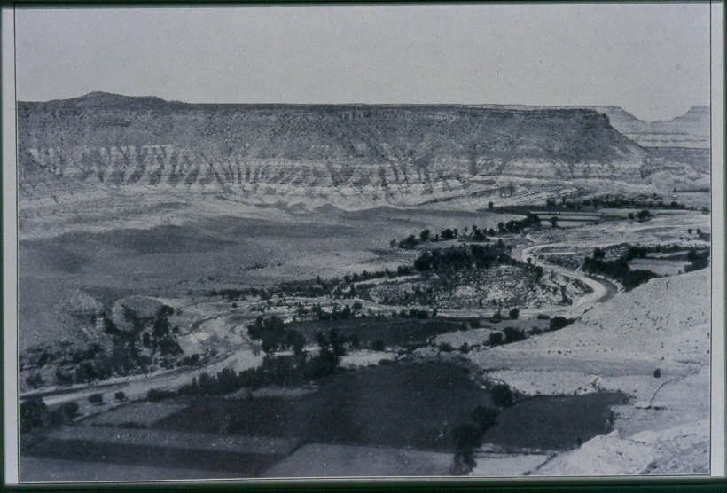
Virgin River
1902
2006
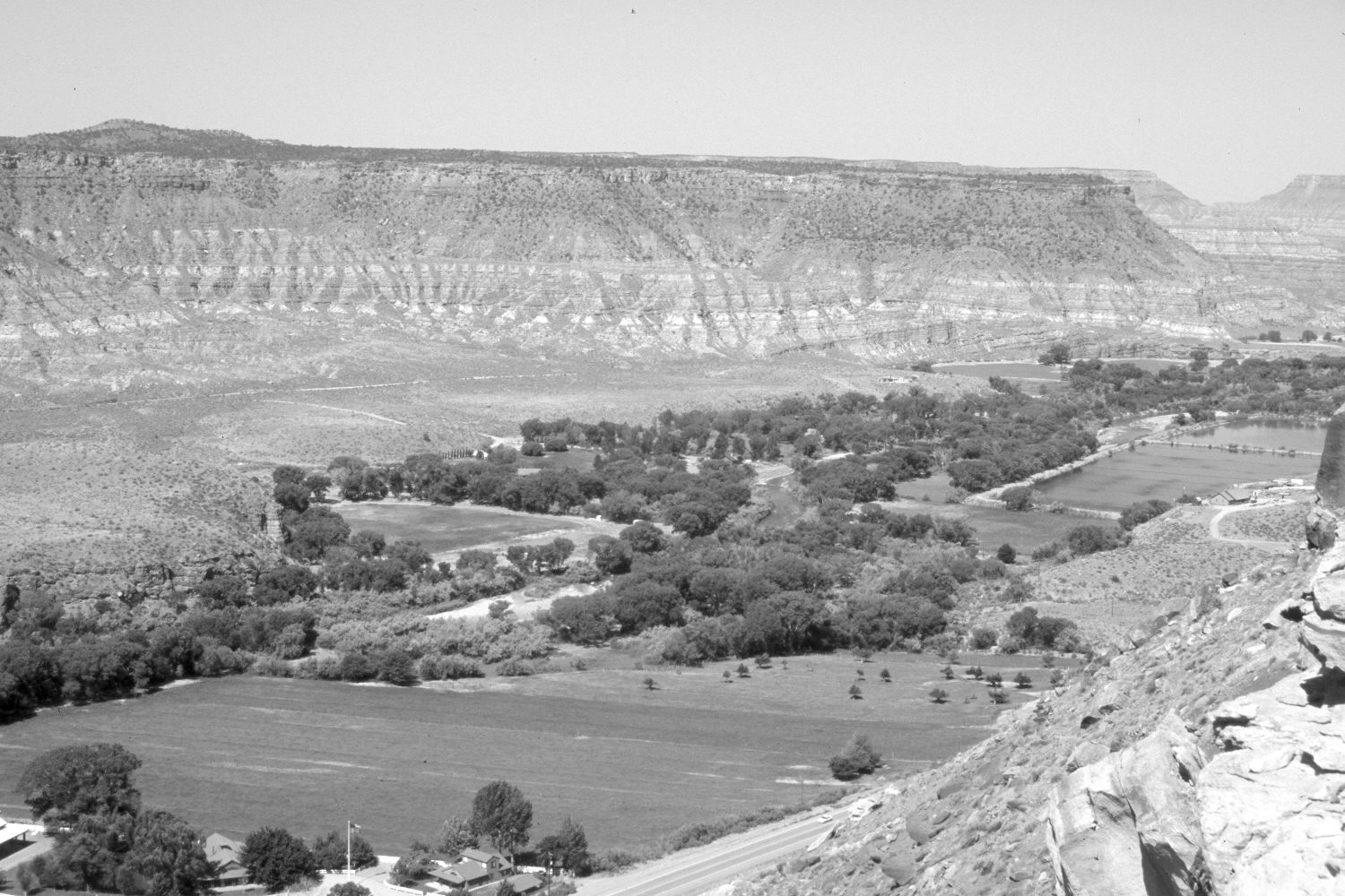
Description:
Plate 1232X. Virgin River 1902 – 2006 Viewed west down the Virgin River between the towns of Rockville and Grafton south of Zion National Park. Utah Highway 9 has been built at the base of the cliff. The river channel has been straightened and rip-rapped to protect the agricultural fields. Nonetheless, woody riparian vegetation has increased - - cottonwoods, willows, tamarisk, and Russian olive. The two large square ponds in the retake (photo right edge) are part of Rockville’s waste water system.
Photo Information:
Original photograph taken in 1902; retake by Charles E. Kay on June 10, 2006 - - Photo No. 5651-26. Original photograph from Mead (1903: Plate 17 – Figure 1).
Vegetative Community:
Riparian
Location:
South West: Section 1, Range 11 West, Township 42 South; UTM 318000 E, 4114750 N; elevation 4,200 ft.