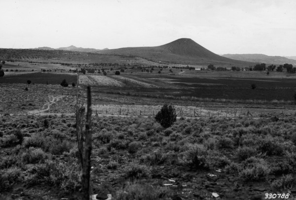
Veyo Cemetary
1936
2004
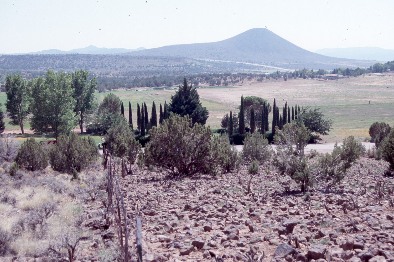
Description:
Plate 655X. Veyo Cemetery 1936 – 2007 Viewed to the cinder cone - - a.k.a. Veyo Volcano (5,239 ft.) - - south of Veyo, Utah. The Veyo town cemetery is in the center of the 1936 image. The cemetery has been landscaped and extended to the east (photo-left). Pinyon and juniper have increased both in the foreground, as well as in the distance. The area to the right of the fence has been heavily grazed by horses eliminating everything except rocks and P/J. Pinyon and juniper now block the original camera station, so the retake was made a little further up the hill. The area to the left of the fence is now part of the local fairgrounds and is no longer grazed by livestock.
Photo Information:
U.S. Forest Service photograph (330788) taken on September 2, 1936; retake by Charles E. Kay on August 23, 2007 - - Photo No. 5834-9A. Original photograph held by the Utah Historical Society, Reed W. Bailey Collection (Box 12, C-439), Salt Lake City, UT.
Vegetative Community:
Pinyon, Juniper
Location:
South West: Section 1, Range 16 West, Township 39 South; UTM 262242 E, 4136817 N; elevation 4,610 ft.