Utah Highway 12
1935
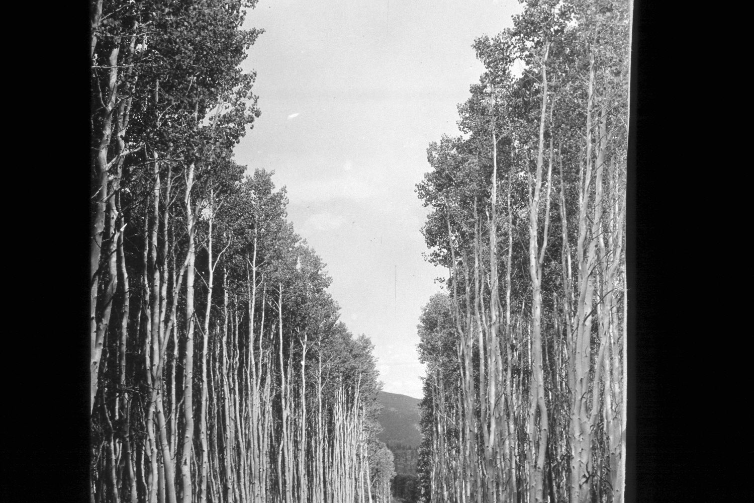
2002
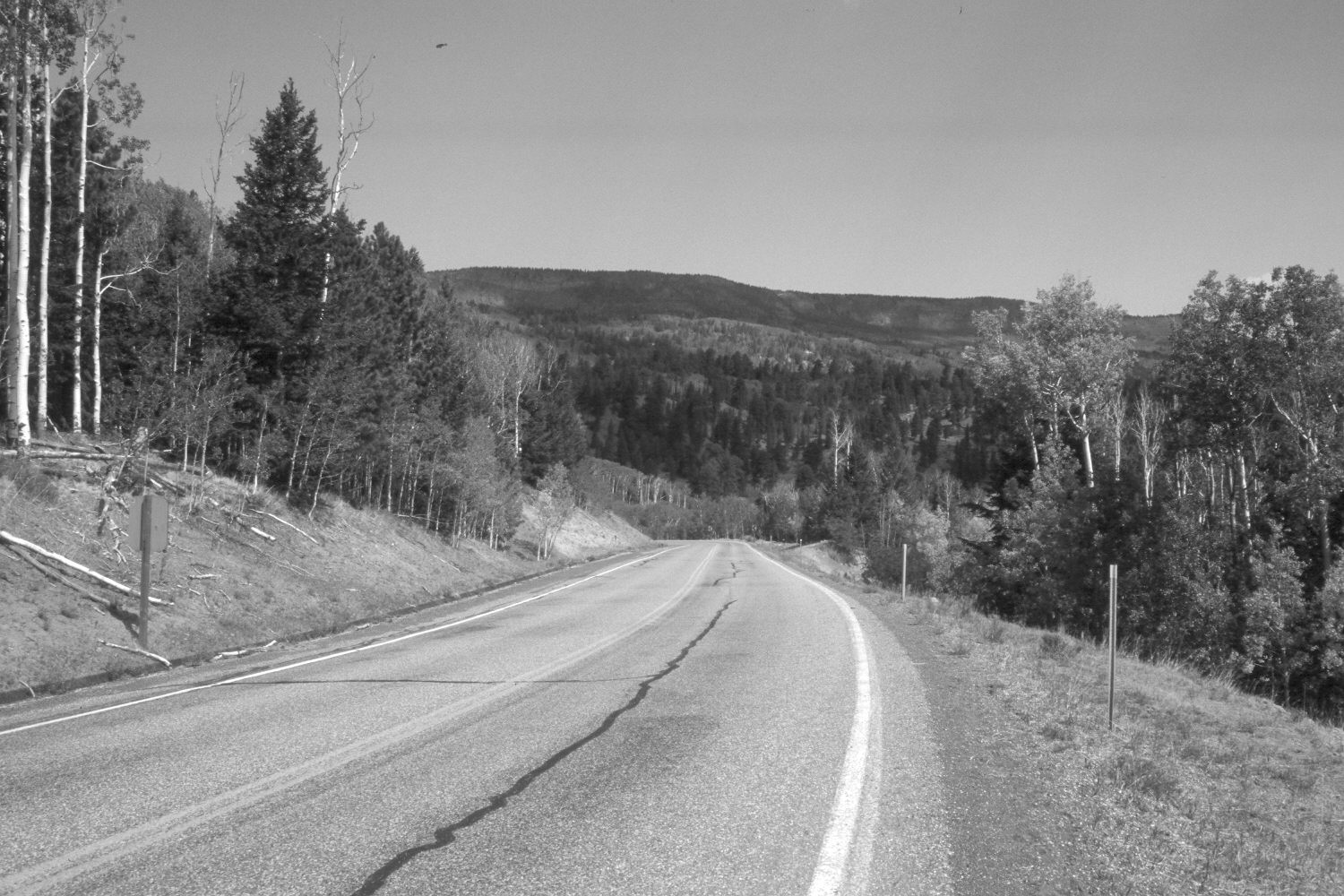
Description:
Plate 86X. Utah Highway 12 1935-2002 Viewed northwest down Utah Highway 12 on the eastside of Boulder Mountain. The road has been widened, realigned, and paved since the original photograph. Nonetheless, aspen has declined and conifers have increased. In the distance is Boulder Top (10,800 ft.). The photopoint is just north of Oak Creek Campground.
Photo Information:
U.S. Forest Service photograph 308985 taken by K.D. Swan on September 21, 1935; retake by Charles E. Kay on July 31, 2002 - - Photo No. 4988-28. Original photograph held by U. S. Forest Service Regional Photographic Collection (2400-Dixie-15) housed at Weber State University, Ogden, UT.
Vegetative Community:
Conifer, Aspen
Location:
South West: Section 22, Range 5 East, Township 31 South; UTM 469950E, 4215600N; elevation 8,860 ft.