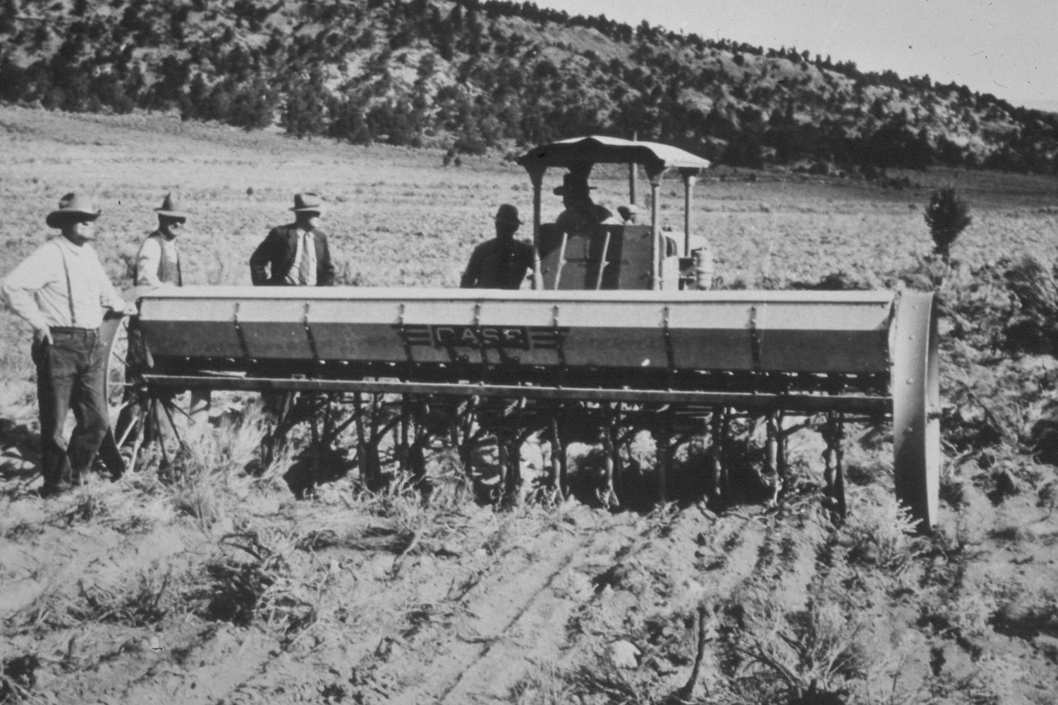
Upper Valley
1942
2003
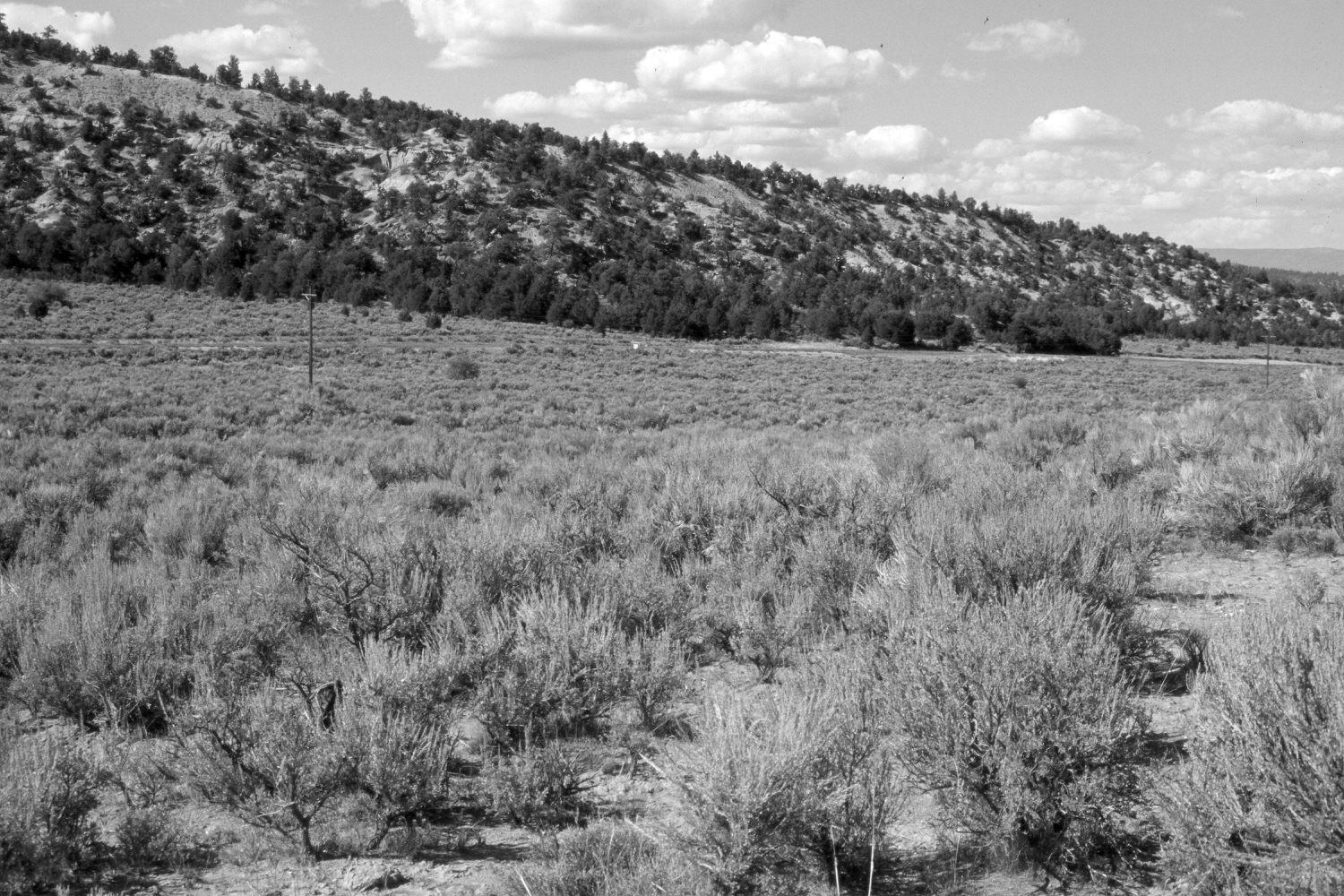
Description:
Plate 388X. Upper Valley 1942 - 2003 Viewed north in Upper Valley south of Utah Highway 12. The original image was taken as the area was being reseeded with crested wheatgrass after first being root-plowed to eliminate sagebrush. Sagebrush, however, has reinvaded the site and it is now difficult to tell the area was ever treated. Utah Highway 12 is visible in the retake.
Photo Information:
U.S. Forest Service photograph (424713) taken by Charles De Moisey on September 2, 1942; retake by Charles E. Kay on August 30, 2003 - - Photo No. 5277-12. Original photograph held by the Utah Historical Society, Reed W. Bailey Collection (Box 1), Salt Lake City, UT.
Vegetative Community:
Sagebrush
Location:
South West: Section 30, Range 1 East, Township 36 South; UTM 426100 E, 4167250 N; elevation 7,420 ft.