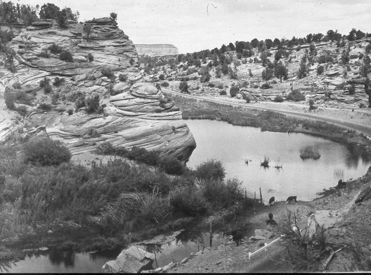
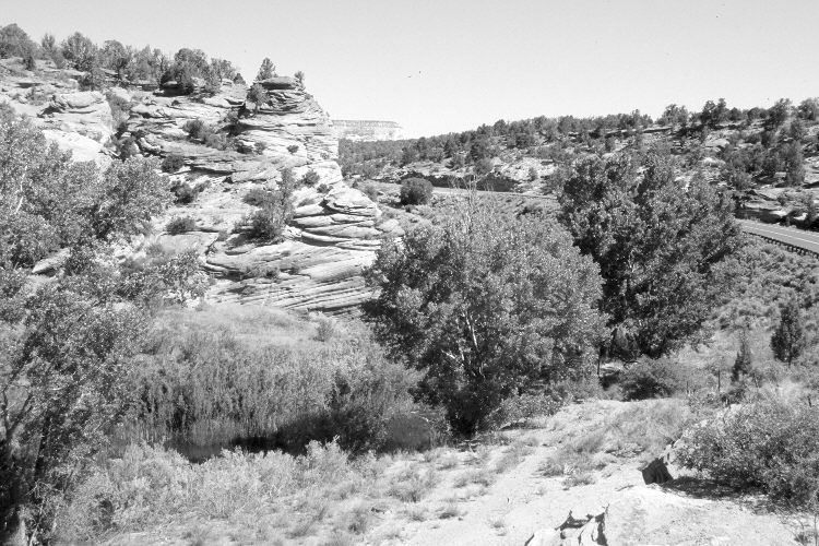
Upper Three Lakes
1938
2005
Description:
Plate 865X. Upper Three Lakes 1938 – 2005 Viewed north to the upper most of the Three Lakes above Kanab, Utah. U.S. Highway 89 is on the right and has been realigned from where it was in 1938. That construction damaged the original camera station. Cottonwoods have increased, while willows appear unchanged - - except where overtopped by cottonwoods. Pinyon, juniper, and sagebrush have increased in the distance.
Photo Information:
Original photograph taken by J.C. Anderson (No. 73) in 1938; retake by Charles E. Kay on June 19, 2005 - - Photo No. 5455-11. Original photograph held by the U.S. Geological Survey Photographic Library, Denver, CO.
Vegetative Community:
Riparian, Pinyon, Juniper, Sagebrush
Location:
South West: Section 30, Range 6 West, Township 42 South; UTM 360950 E, 4110850 N; elevation 5,460 ft.