Upper Swains Creek
1951
2004
Description:
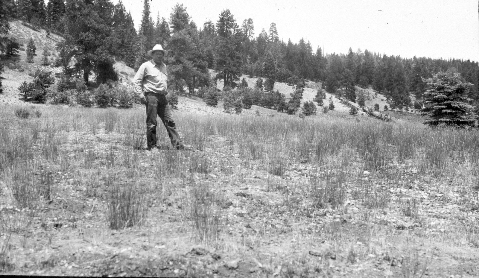
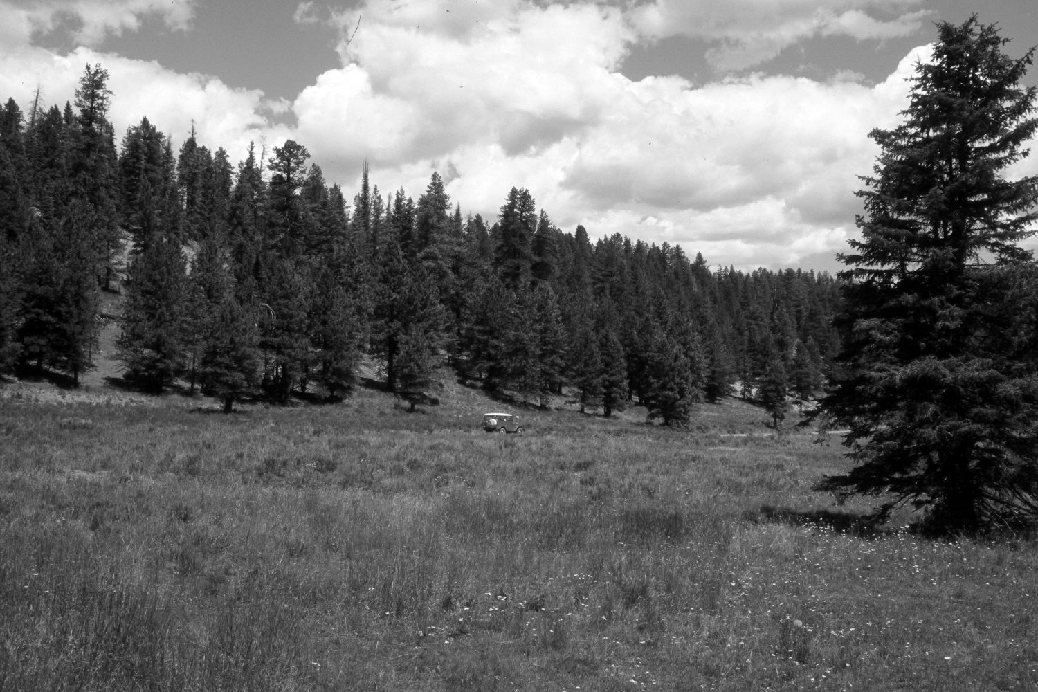
Plate 563X. Upper Swains Creek 1951 – 2004 Viewed northwest down Swains Creek from just below Adair Hollow. According to the caption on the original photograph, in 1938 this area was root-plowed and planted to crested wheatgrass. In 1951, all the grasses’ basal leaves were eaten by grasshoppers, while the seedheads were removed by domestic sheep. The original camera station has been flooded by construction of a stock pond, so the retake was made from the top of that dam. This is why the spruce on the right is closer to the camera in the retake than in 1951. Conifers, primarily spruce, white fir, and ponderosa pine, have increased. Rubber and green rabbitbrush have invaded the seeding. A new road has been built up Swains Creek.
Photo Information:
U.S. Forest Service photograph taken on August 24, 1951; retake by Charles E. Kay on August 7, 2004 - - Photo No. 5369-18. Original photograph held by Southern Utah University Archives and Special Collections, Cedar City, UT.
Vegetative Community:
Dry Meadow, Conifer
Location:
South West: Section 8, Range 7 West, Township 39 South; UTM 353150 E, 4144200 N; elevation 7,920 ft.