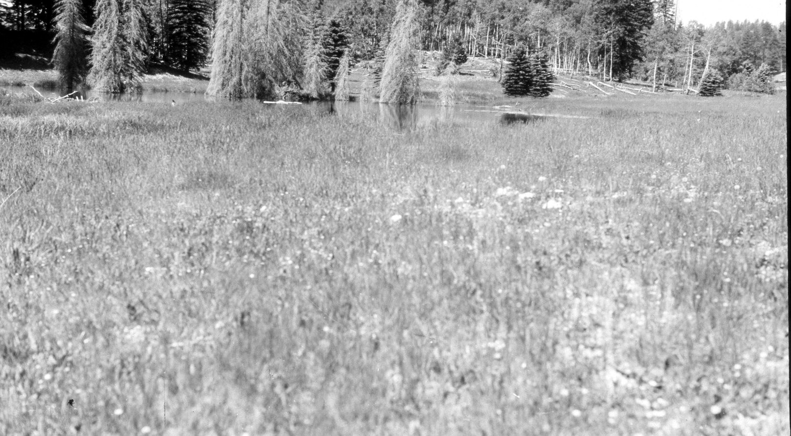
Upper Swains Creek
1949
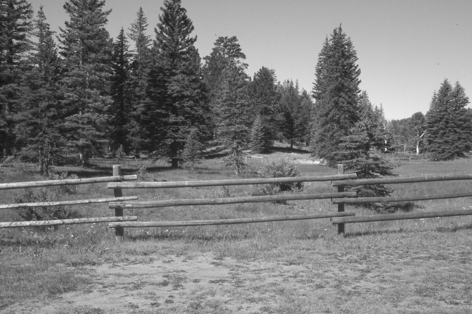
2004
Description:
Plate 559X. Upper Swains Creek 1949 – 2004 Viewed southwest up Swains Creek about a half-mile above Adair Hollow. The beaver dam present in 1949 has failed and Swains Creek has downcut 6 to 8 feet. The area has now been fenced to exclude livestock. Spruce, white fir, and ponderosa pine have increased, while aspen has declined. The shrubs along the stream are currants.
Photo Information:
U.S. Forest Service photograph taken by Wilford Bentley on July 15, 1949; retake by Charles E. Kay on August 7, 2004 - - Photo No. 5367-33. Original photograph held by Southern Utah University Archives and Special Collections, Cedar City, UT.
Vegetative Community:
Conifer, Aspen, Riparian
Location:
South West: Section 7, Range 7 West, Township 39 South; UTM 352150 E, 4143950 N; elevation 7,960 ft.
January 2018