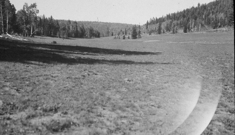
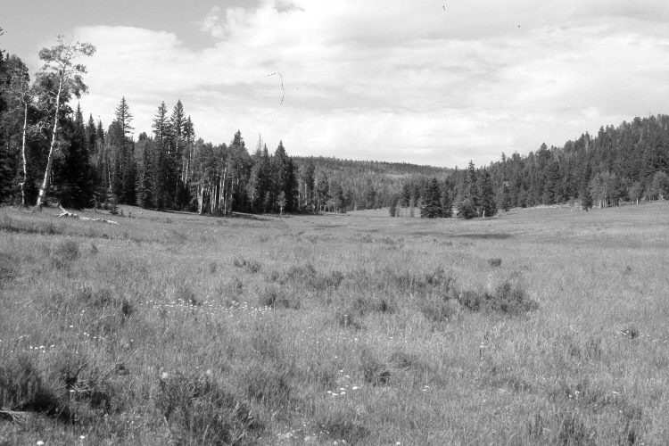
Upper Strawberry Valley
1951
2005
Description:
Plate 940X. Upper Strawberry Valley 1951 – 2005 Viewed southwest just above Lars Fork in upper Strawberry Valley. Strawberry Creek is at the base of the light-colored soil in the 1951 image and is usually dry at this point, but was flowing in 2005. Aspen has declined except for a few stems that regenerated 30 years ago when mule deer numbers were low (Kay and Bartos 2000). Spruce, white fir, and ponderosa pine have increased, as has green rabbitbrush in the foreground. The area was actively being grazed by cattle in 2005. Needle and thread was the most common grass. The Forest Service road is on the far right.
Photo Information:
U.S. Forest Service photograph (unnumbered) taken on August 24, 1951; retake by Charles E. Kay on July 29, 2005 - - Photo No. 5483-7. Original photographs, negatives, and reports held in the range files on the Cedar City Ranger District, Dixie National Forest, Cedar City, UT.
Vegetative Community:
Conifer, Aspen, Dry Meadow
Location:
South West: Section 31, Range 7 West, Township 38 South; UTM 351700 E, 4147200 N; elevation 8,260 ft.