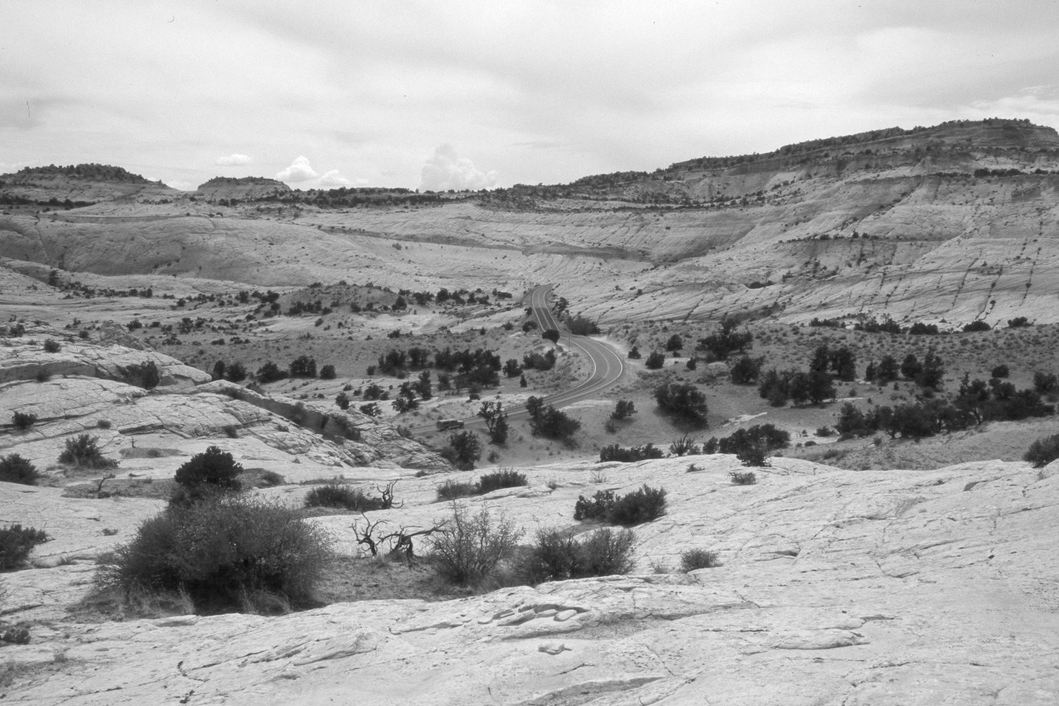
Upper Phipps Wash
ca. 1935
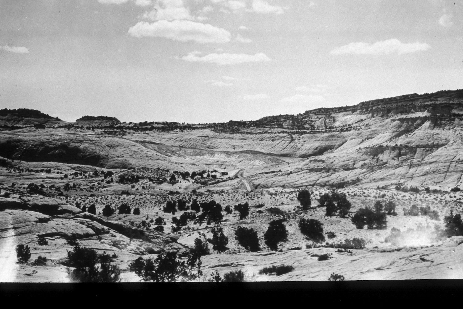
2002
Description:
Plate 50X. Upper Phipps Wash ca. 1935-2002 Viewed west across the upper section of Phipps Wash. The original was taken while the Escalante to Boulder road was under initial construction. That road, now Utah Highway 12, has been widened and paved, but the general alignment has not changed. Pinyon and juniper have increased in height and a few new trees have become established, but otherwise there has been little apparent change.
Photo Information:
U.S. Forest Service photograph (unnumbered) taken ca. 1935; retake by Charles E. Kay on July 10, 2002 - - Photo No. 4970-31. Original photograph held by Southern Utah University Archives and Special Collections, Cedar City, UT.
Vegetative Community:
Pinyon, Juniper
Location:
South West: Section 22, Range 4 East, Township 35 South; UTM 461000E, 4178100N; elevation 5,800 ft.