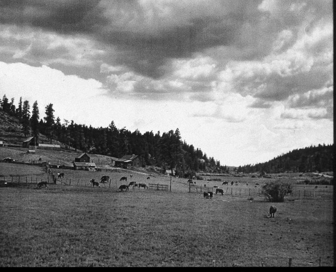
Long Valley
1911
2005
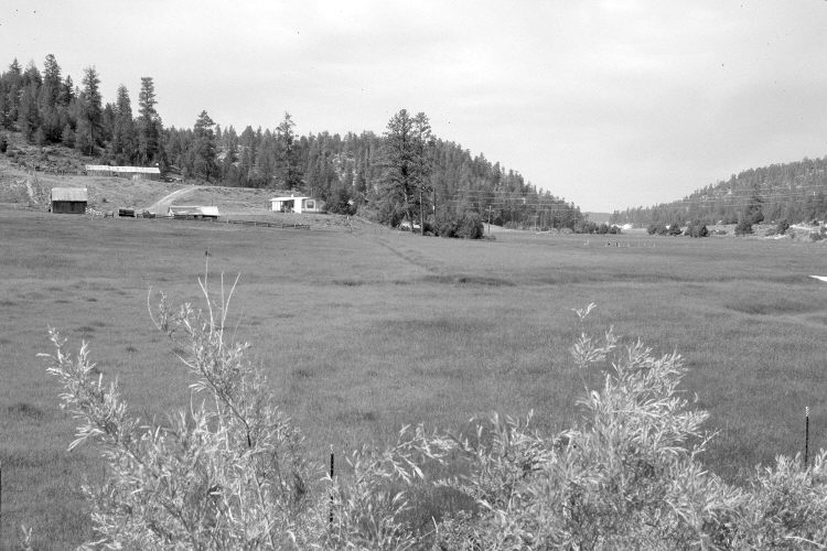
Description:
Plate 883X. Long Valley 1911 – 2005 Viewed southwest down Long Valley and the East Fork of the Virgin River from the Alton Road. Willows have grown-up along the road embankment below the photopoint, but otherwise willows have declined. U.S. Highway 89 is on the right. Only a few of the original buildings remain. Pinyon, juniper, and ponderosa pine have all increased. The latter despite repeated logging. Pinyon and juniper have invaded the floodplain where the stream has downcut, lowering the watertable.
Photo Information:
Original photograph taken in 1911; retake by Charles E. Kay on June 21, 2005 - - Photo No. 5459-17. Original photograph held by the Kanab Museum, Kanab, UT.
Vegetative Community:
Pinyon, Juniper, Conifer
Location:
South West: Section 16, Range 6 West, Township 39 South; UTM 364200 E, 4143150 N; elevation 6,930 ft.