Tushar Mountains
1920
2001
Description:
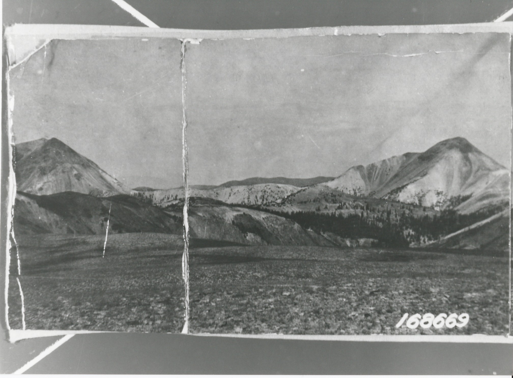
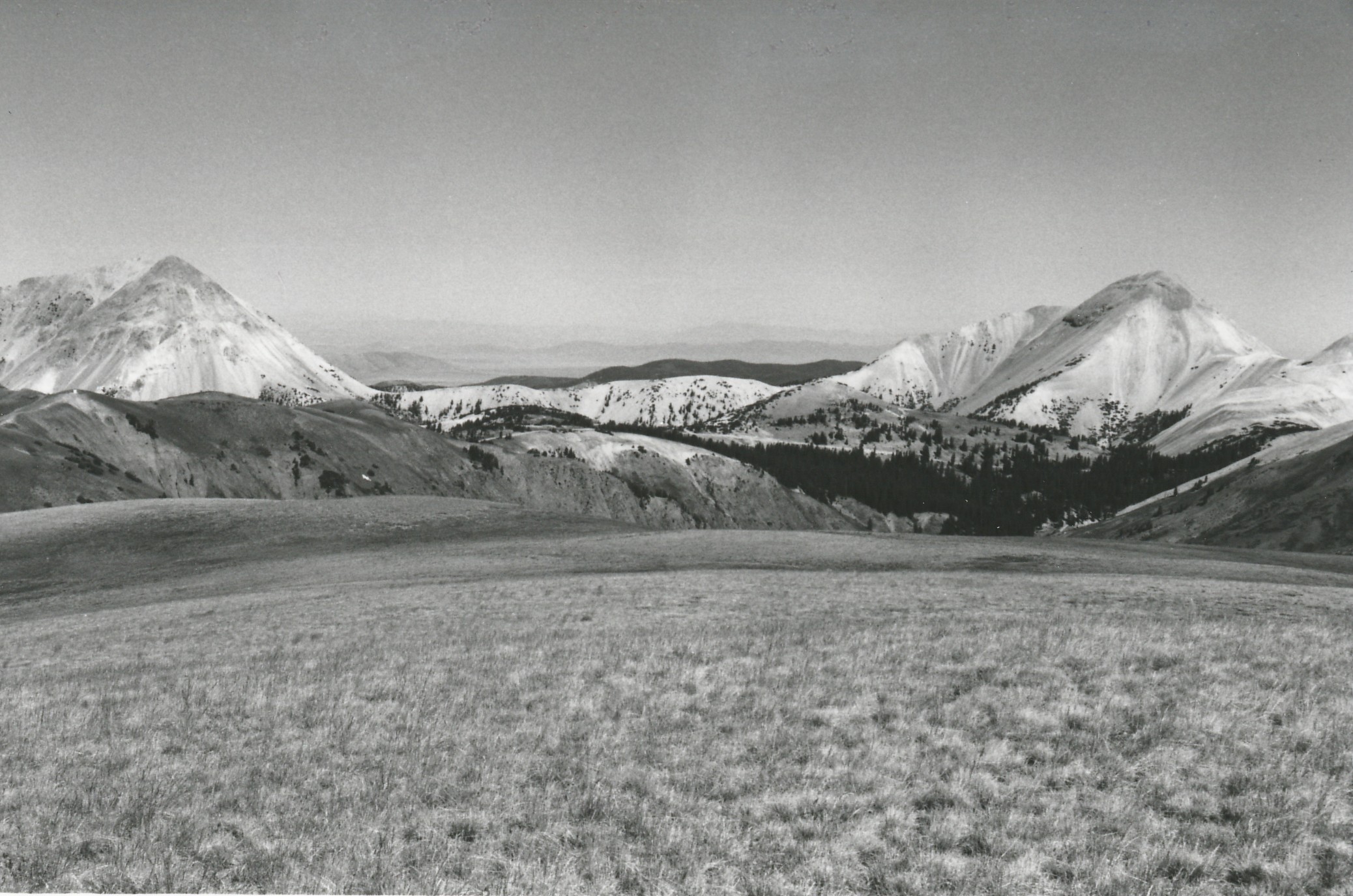
Plate 314. TUSHER MOUNTAINS 1920-2001 Plates 314 to 316 form a panorama from northwest to northeast in the center of the Tusher Mountains. Plate 314 is viewed northwest with Mount Baldy (12,122 ft) on the left and Mount Belknap (12,137 ft) on the right. The area no longer is grazed by domestic sheep and plant cover in the foreground has increased. Conifers, primarily spruce, have increased in height and numbers, but treeline is unchanged. A new access road is visible in the retake as is mining activity that took place since the original photo. New radio towers (photo left-center edge) are also visible in the retake. Shown is the head of Pine Creek, as well as the head of the South Fork of Lake Creek.
Photo Information:
U.S. Forest Service photo 168669 ca. 1920; retake by Charles E. Kay on August 8, 2001 - - Photo No. 4866-1; Original photo (2310-Fishlake-53) held by the Forest Service Regional Office Photographic Collection housed at Weber State University, Ogden, UT.
Vegetative Community:
Conifer
Location:
South Central: Section 13, Range 5 W, Township 28 S; UTM 379600 E, 4249550 N; elevation 11,826 ft.