White Pine Creek Pavant Mountains
1962
1962
2000
Description:
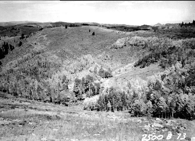
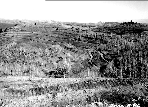
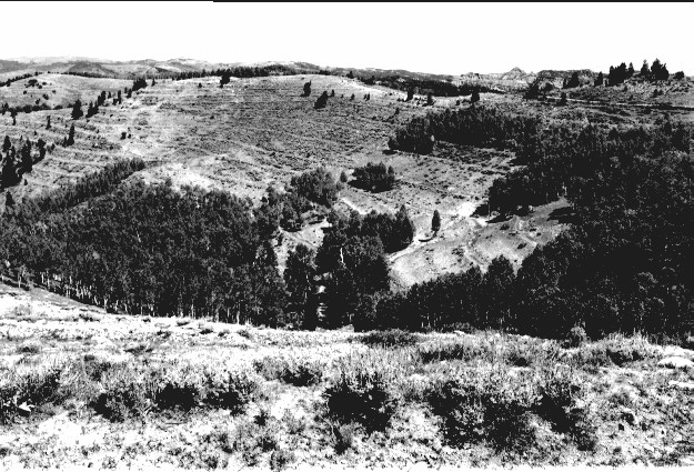
Plate 284. WHITE PINE CREEK PAVANT MOUNTAINS 1962-1962-2000 Viewed northwest at the head of White Pine Creek in the Pavant Mountains. This area was contour-trenched, gully-plugged, and reseeded by the Forest Service in 1962 to control erosion. The first photograph was taken in September before the area was treated while the second photograph was taken in November shortly after the area was terraced. Conifers have increased. Aspen has increased in height, but has not regenerated due to excessive browsing. USFS Road 096 is visible in all three photos. This is similar to Plate 276.
Photo Information:
U.S. Forest Service photos (unnumbered) by L. Glen Quigley on September 18 and November 7, 1962; retake by Charles E. Kay on September 3, 2000 - - Photo No. 4712-30; Original photos (2500B-73 and 2500B-86) held by Fillmore Ranger District, Fishlake National Forest, Fillmore, UT.
Vegetative Community:
Conifer, Aspen
Location:
South Central: Section 32, Range 3 W, Township 22 S; UTM 395350 E, 4301500 N; elevation 9,280 ft.