West Fork Of Hunt Creek
1943
1946
1953
Description:
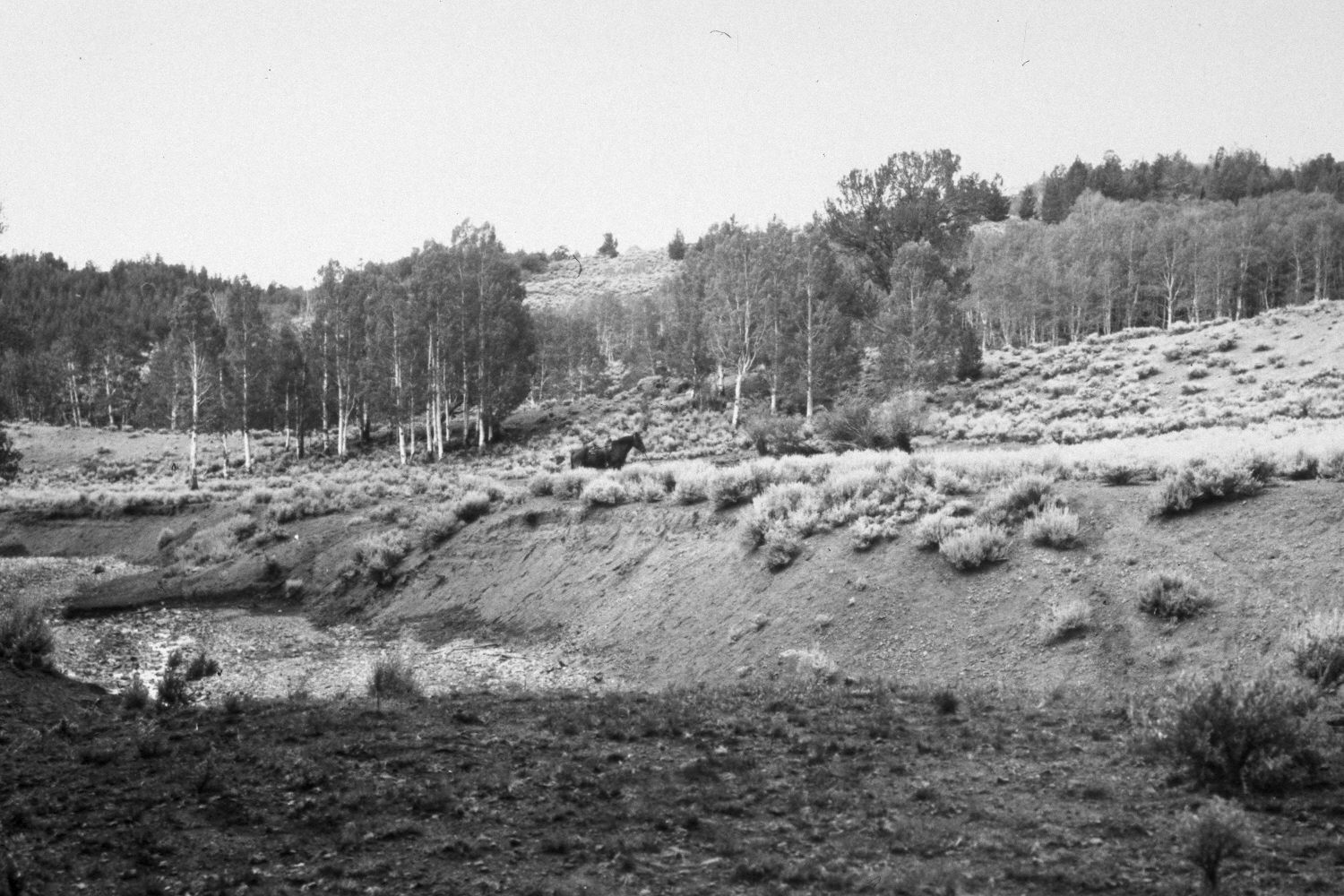
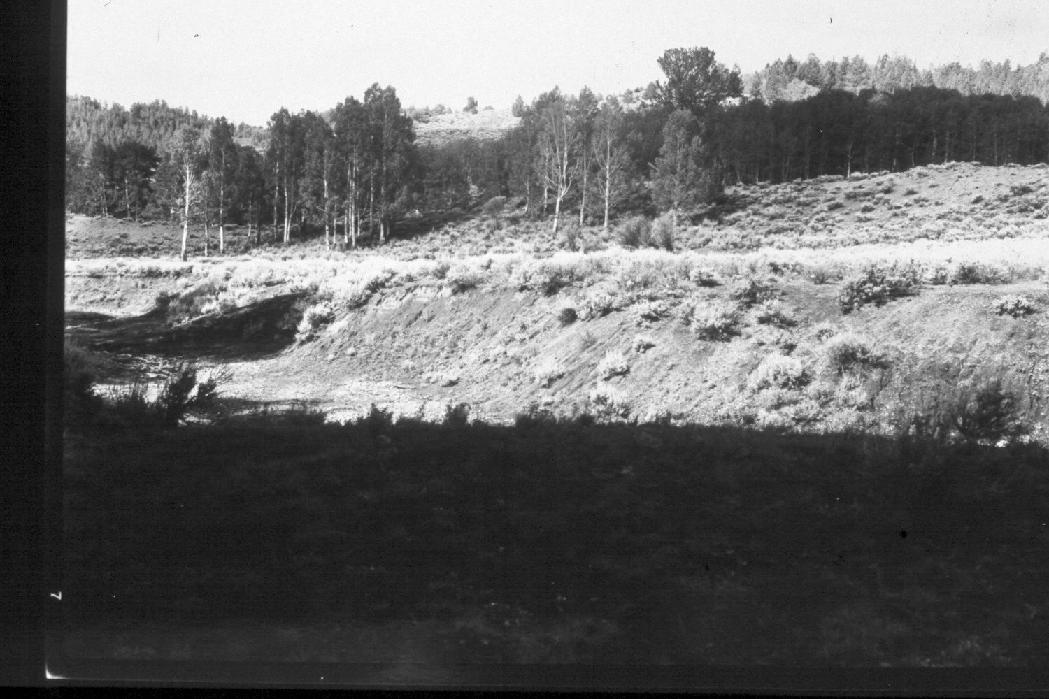
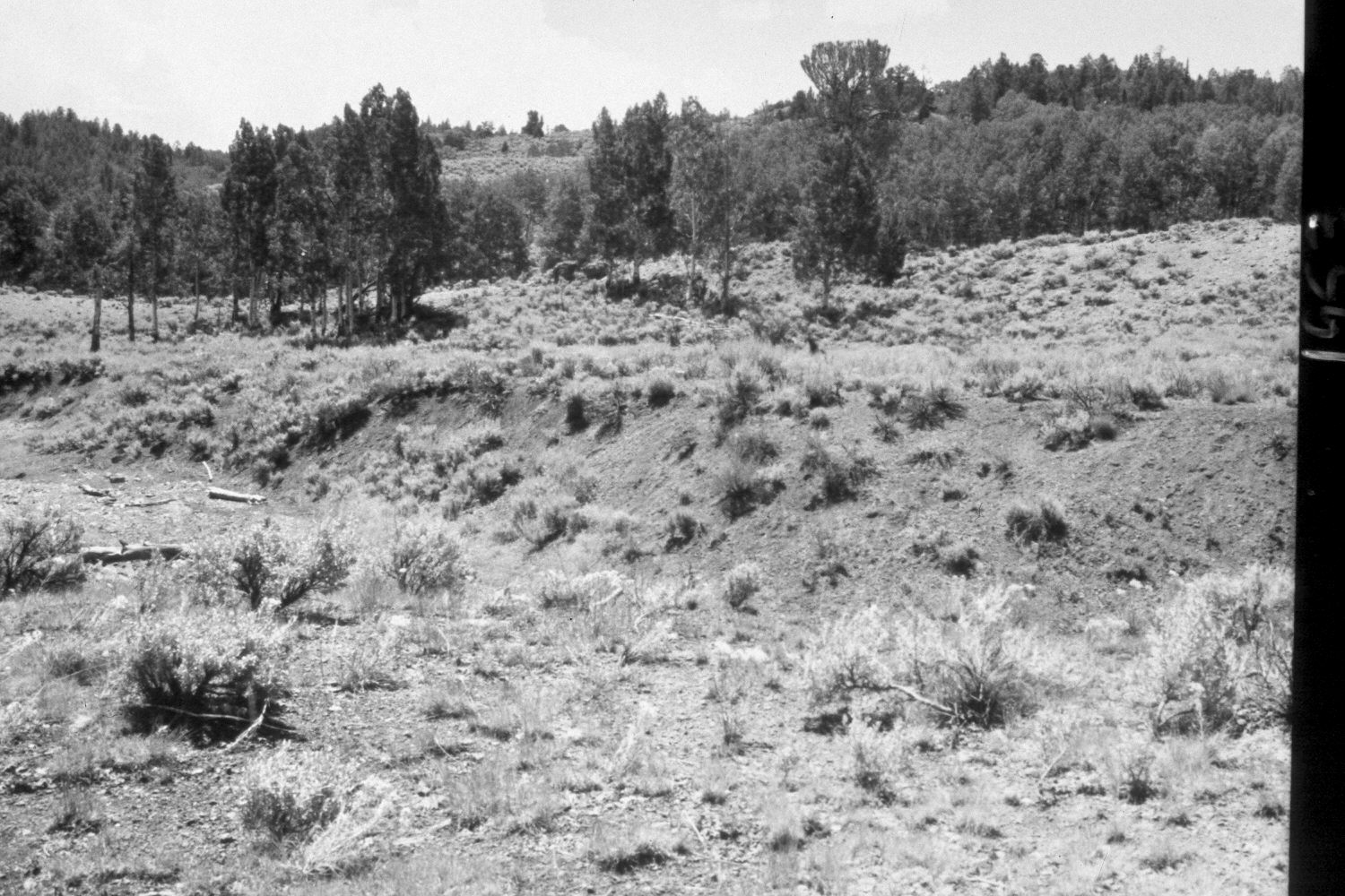
Plate 173X. West Fork of Hunt Creek 1943 - 1946 - 1953 - 1959 - 2003 The Photo Plot Transect on the West Fork of Hunt Creek was established in 1943 and reread in 1946, 1953, and 1959. Initial range conditions were described as very poor and all plant communities were heavily grazed by cattle and domestic sheep. According to early narrative reports, “the most noticeable thing…was the amount of dead willows. The creek bottom was formally covered [with willows] in all the little openings that we traversed from the head of the creek. Now [1943] most of them are dead….it may [also] be stated that the creek has cut down a deep channel and is still cutting during heavy runoffs…grasses are quite scarce.” In 1953, it was noted that “sheet and gully erosion [were] severe, not only at the transect site but from lower West Hunt Creek to [its] head…small recent alluvial deposits [were] common all along the transect…Existing gullies have been deepened considerably and some new ones formed…[even in the] aspen type sheet erosion is a real problem.” After remeasuring the transect in 1959, Range Conservationist I.H. Johnson noted that, “There is nothing from the analysis of transect records to give assurance that this range is on the mend. On the contrary, the data points very definitely to a continuation of the down trend for both vegetation and soil that was previously reported…” (unpublished reports in range files, Panguitch Ranger District, Panguitch, UT). Plate 173x is viewed southwest across the West Fork of Hunt Creek from the transect starting point. The horse in the 1943 photograph is on the transect centerline and the transect is 1,100 ft. in length ending on the most distant ridge - - see Plate 175x. Note the small clump of willows in front of the horse in 1943 - - those plants have since died, and today, very few willows are left on this section of stream. The creek bottom and banks, however, appeared more vegetated in 2003 than they did in earlier photos. Conifers, mostly limber pine and Douglas fir, have increased. The aspen stand on the low ridge immediately behind the horse in the 1943 photo is now largely dead and most aspen stands in this drainage are in very poor ecological condition due to repeated browsing by deer, cattle, domestic sheep and now elk - - a species absent in 1943. A few aspen stands, however, regenerated during the late 1970s when deer population declined (Kay and Bartos 2000), including the stand behind the photopoint, which expanded out towards the stream - - note the new aspen suckers and saplings in the 2003 retake. Much of this drainage was burned in 2002 by the Sanford fire - - note the fire-killed aspen and conifers on the more distant ridges. The hillside immediately behind the photopoint also burned in 2002 - - see Plate 174x. Grass cover appears to have increased and soil erosion has stopped, except on hillsides that were severely burned. Summer storms after the 2002 fire triggered debris flows down the creek - - note the newly deposited material on the stream bottom in the 2003 retake. This allotment was closed to livestock in 2003 to speed post-fire recovery. Except for the recent fire effects, range conditions appear to have improved since 1959.
Photo Information
U.S. Forest Service photographs (unnumbered) taken by Ray J. Davis on August 24, 1943; Walter Cottam on August 23, 1946; I.H. Johnson on August 10, 1953; and I.H. Johnson on August 19, 1959; retake by Charles E. Kay on July 12, 2003 - - Photo No. 5182-33. Original photographs, negatives, and narrative reports held in the range files on the Panguitch Ranger District, Dixie National Forest, Panguitch, UT.
Vegetative Community:
Riparian, Aspen, Conifer
Location:
South West: On both the USGS 1:24,000 Adams Head (1971) topographic map and the 1995 Dixie National Forest map, this area has not been surveyed, thus there is no Section, Range, or Township; UTM of transect starting point 393150E, 4195500N; elevation 8,960 ft.