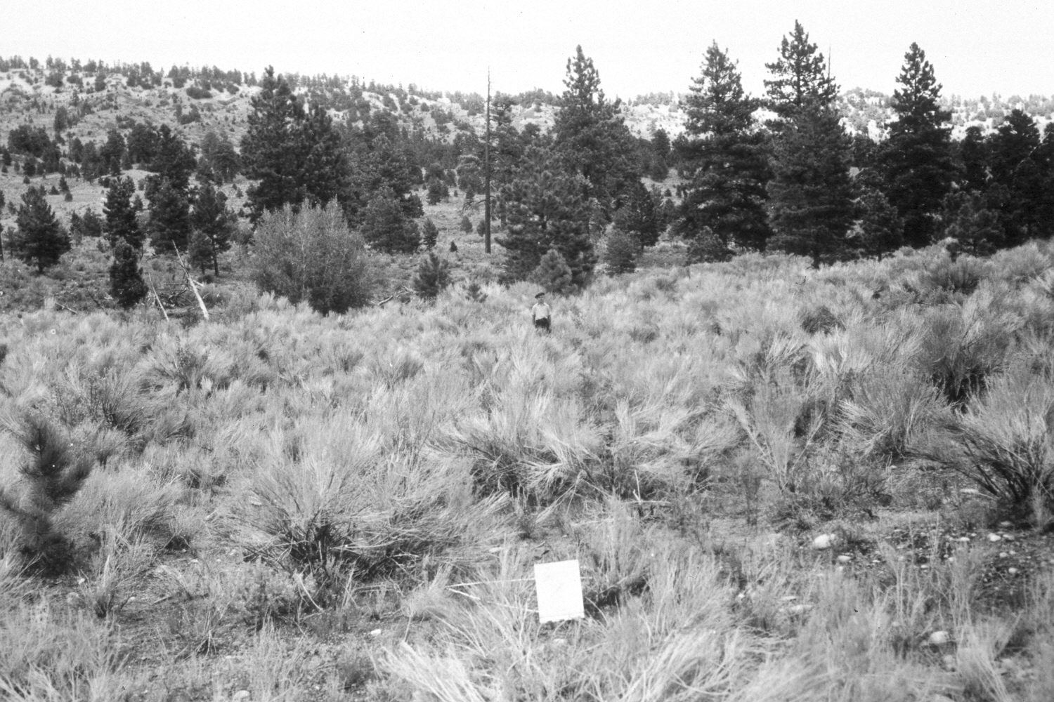
Upper Valley
1943
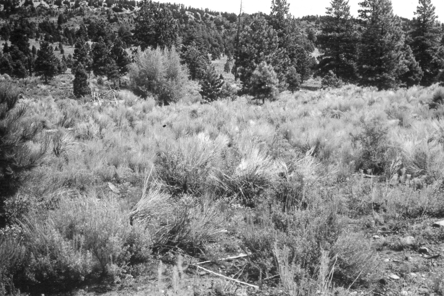
1948
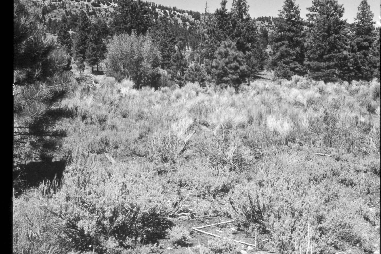
1953
Description:
Plate 386X. Upper Valley 1943 - 1948 - 1953 - 1961 - 2003 The Upper Valley Photo Plot Transect in Water Canyon was established in 1943 and reread in 1948, 1953, 1961, 1974, and 1979. The transect is just above the horse pasture associated with the now abandoned Upper Valley Guard Station. When the transect was established, the area was very heavily grazed by cattle, and green and rubber rabbitbrush were the most common shrubs. In 1953, Range Conservationist, Irwin Johnson concluded that “the increase in inferior and undesirable species in addition to the poor condition of snowberry and bitterbrush means [the] vegetation trend continues to be downward as it was from 1943 to 1948. Soil trend is also downward and to a very noticeable degree” Conditions had not improved by 1961 when it was noted that “this is a classic example of a seriously depleted range resource.” Range Conservationist Dan Baird reported that vegetation and soil conditions had improved by 1974, but that shrubs were declining as conifers on the transect increased. In 1979, Dr. Jim Bowns, range ecologist at Southern Utah University, observed that leader growth on bitterbrush and snowberry was excellent… Ponderosa pine trees are now more numerous and larger [than they were in 1943], which has changed the character of this site. At best it is an area of low productivity, but the condition is good and the trend has been up” (unpublished reports in the range files on the Escalante Ranger District, Dixie National Forest, Escalante, UT). Plate 386x is viewed northeast back towards the Photo Plot Transect starting point - - see Plate 384x. The person in the 1943 image is standing on the transect centerline. Ponderosa pine has increased. Despite repeated logging, the far hillside is now a densely stocked pine forest. Pinyon and juniper have also increased. Mountain big sage has increased, while both rubber and green rabbitbrush have declined. The tall deciduous shrub growing in the gully (photo left center) is mountain maple (Acer glabrum). Unless this area is logged or thinned, it will become a closed pine forest and most forage production will be eliminated. The area was not grazed by cattle in 2003 when the site was revisited. The camera station is just north of an old logging road and less than 150 feet below Forest Road 148.
Photo Information:
U.S. Forest Service photographs (unnumbered) taken by Ray J. Davis on August 13, 1943; Walter P. Cottam on August 17, 1948; I.H. Johnson on June 15, 1953; and I.H. Johnson in 1961; retake by Charles E. Kay on August 30, 2003 - - Photo No. 5274-34. Original photographs, negatives, and narrative reports held in the range files on the Escalante Ranger District, Dixie National Forest, Escalante, UT.
Vegetative Community:
Sagebrush, Pinyon, Juniper, Conifer
Location:
South West: Section 1, Range 1 West, Township 36 South; UTM of transect starting point 425900 E, 4173200 N; elevation 7,800 ft.