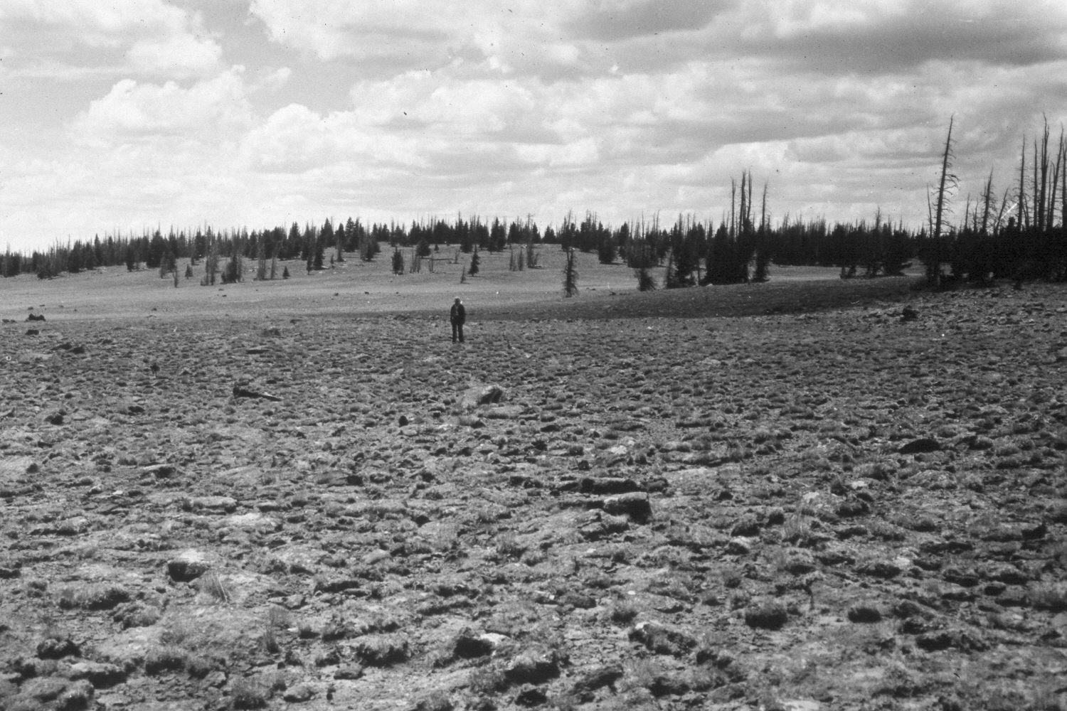
Stink Flats
1943
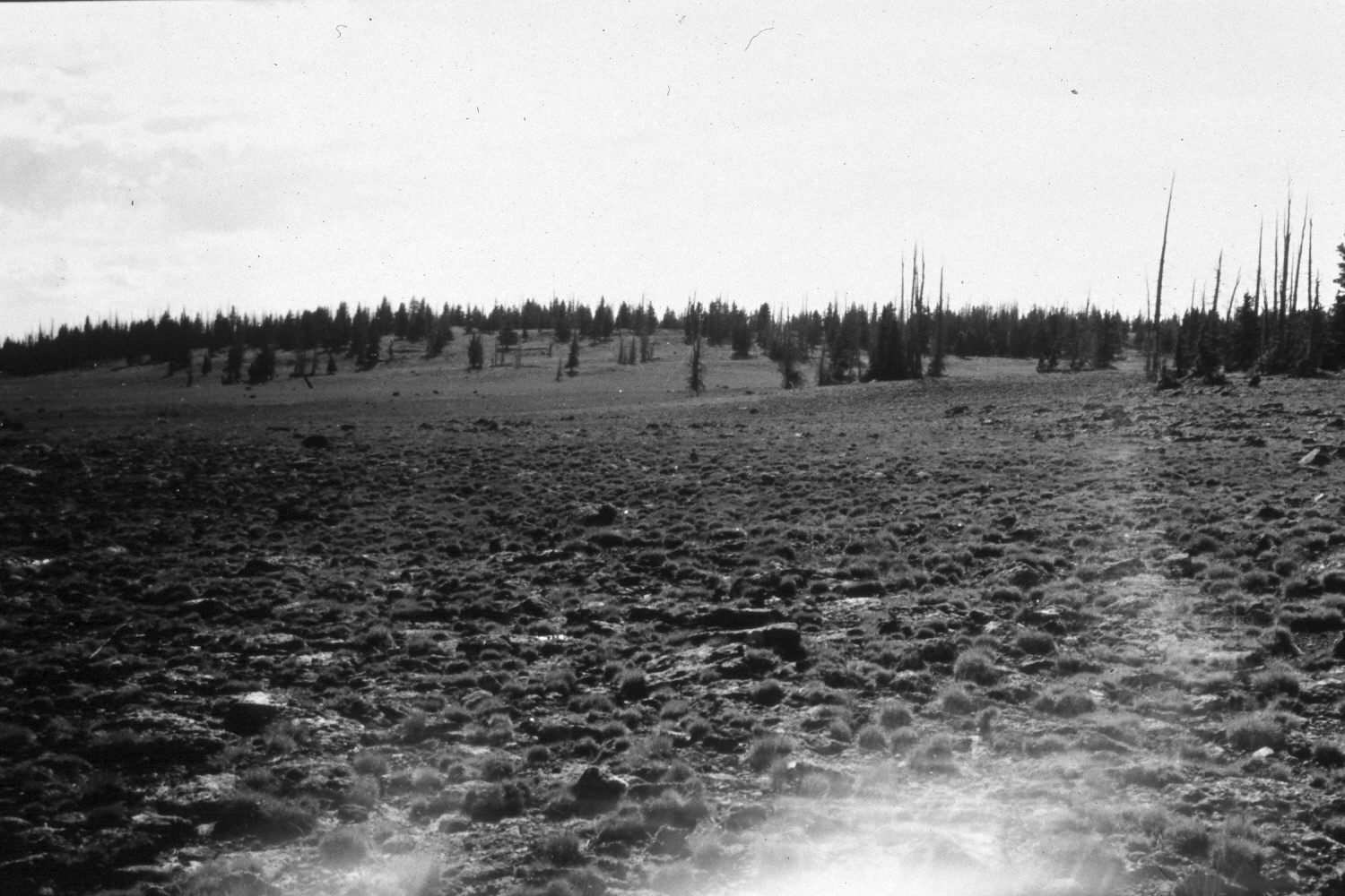
1948
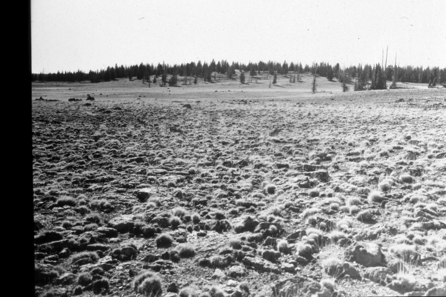
1953
Description:
Plate 352X. Stink Flats 1943 - 1948 - 1953 - 1959 - 2003 The Stink Flats Photo Plot Transect on Boulder Top was established in 1943 and reread in 1948, 1953, 1959, and 1979. When the transect was established the area was heavily grazed by domestic sheep and range conditions were described as poor. “The transect…samples sheep fescue (Festuca ovina) grassland[s]…typical of [Boulder Top]…There are small areas on Stink Flats that would rate in fair condition but mostly it is in the poor class.” After the transect was remeasured in 1953, I.H. Johnson noted that “both vegetation and soil trends [were] downward.” Johnson also reported that sheet erosion was “very active”. By 1979, when Dr. Jim Bowns, range ecologist at Southern Utah University, remeasured the transect, conditions had improved. “There are no problems in this area and the condition is good. There is fairly dense plant cover here and little soil movement. Trend has probably been upward since 1943, though this is difficult to ascertain. Hummocking [or plant pedestaling] is less pronounced on the slopes, but prominent in the depressions. This condition appears to be a cryopedogenic process [associated with frost] rather than erosion caused by grazing” (unpublished reports in the range files on the Teasdale Ranger District, Dixie National Forest, Teasdale, UT). Plate 352x is viewed west from the end of the Photo Plot Transect back to its starting point - - see Plate 351x. The person in the 1943 image is standing on the transect centerline. Spruce has increased. The area was actively being grazed by cattle, domestic sheep, and elk in 2003. The roads across Stink Flats were recently closed by the Forest Service to prevent resource damage. Plant cover may have increased, but that is difficult to evaluate due to the extended drought that has gripped southern Utah in recent years.
Photo Information:
U.S. Forest Service photographs (unnumbered) taken by Ray J. Davis on July 23, 1943; Walter P. Cottam on July 20, 1948; I.H. Johnson on September 22, 1953; and I.H. Johnson in 1959; retake by Charles E. Kay on August 26, 2003 - - Photo No. 5259-20. Original photograph held in the range files on the Teasdale Ranger District, Dixie National Forest, Teasdale, UT.
Vegetative Community:
Conifer, Dry Meadow
Location:
South West: Section 10, Range 4 East, Township 31 South; UTM of transect starting point 460750 E, 4219700 N; elevation 11,120 ft.