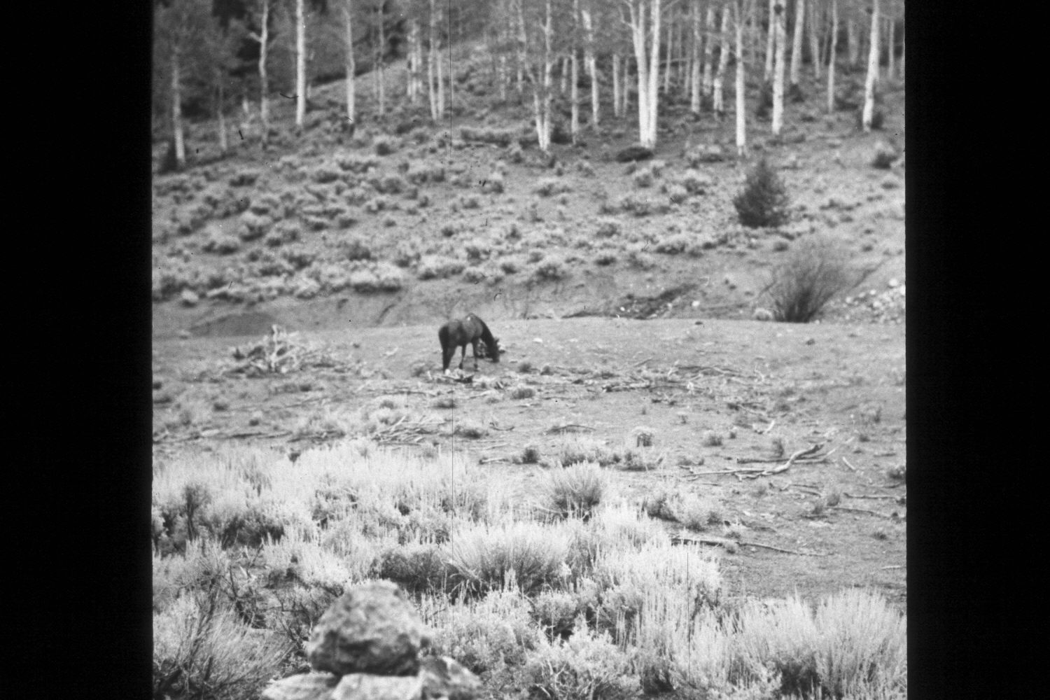
South Fork Of Prospect Creek
1943
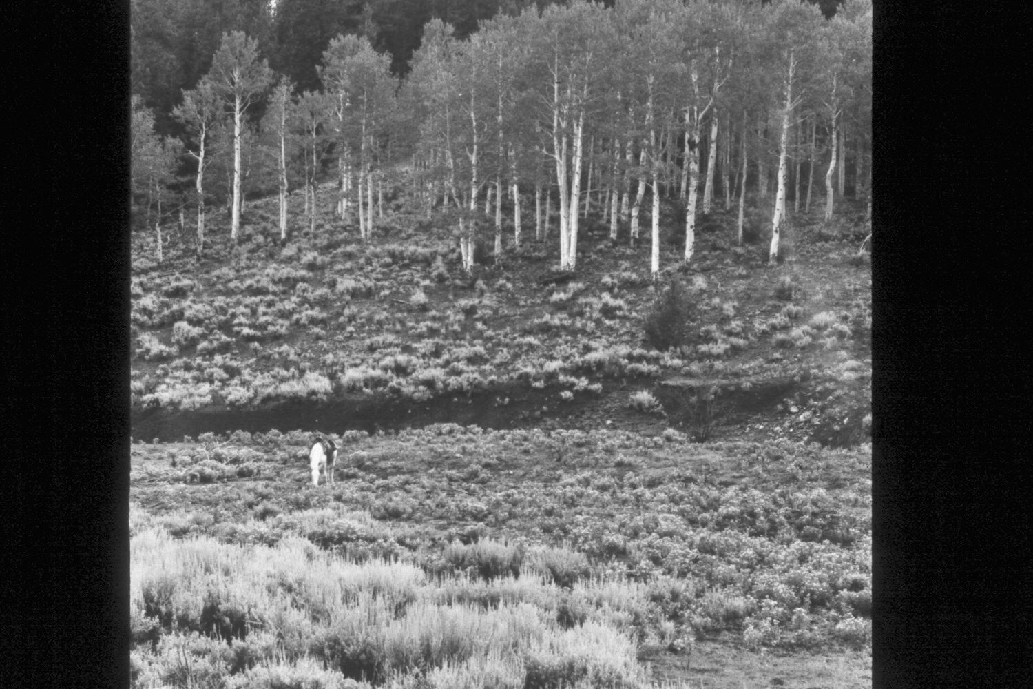
1946
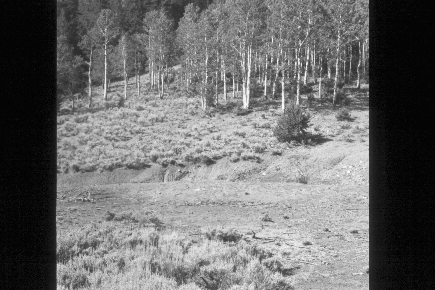
1953
Description:
Plate 170X. South Fork of Prospect Creek 1943 - 1946 - 1953 - 2003 The Photo Plot Transect on the South Fork of Prospect Creek was established in 1943 and reread in 1946, 1953, and 1959. Initial range conditions were described as poor and all plant communities were very heavily grazed. According to early narrative reports, the creek channel was “gutted by erosion” and dead willows were common. “Sheet erosion [was] severe over most of the sagebrush type and even into the fringes of the aspen.” The small meadow at the transect crossing was described as “very depleted” and native grass cover was minimal. In 1953, mule deer were described as “numerous” and gullies showed “considerable recutting due to recent summer storms….Alluvial deposits [were] conspicuous where gullies terminate on flat [areas] at the base of the slopes or empty into the main drainage channel…The condition of this range is very poor or poor”. By 1959, there had been “a slight upward trend” but soil erosion was still widespread (unpublished reports in range files, Panguitch Ranger District, Panguitch, UT). Plate 170x is viewed southwest across the South Fork of Prospect Creek from the transect starting point at the rock carin in the lower left foreground. This view is down the transect’s centerline. Note the one live willow in 1943 plus the woody remains of other willows in the small meadow between the rock carin and the creek. The small meadow was heavily utilized by cattle in 2003, but grass cover had increased despite the extended drought. The streambanks also appear to be more heavily vegetated today than they did in the past. The single live willow, however, has died and all the earlier woody debris has decomposed - - today there is no physical, on-site evidence that this was once a willow-lined stream. Conifers, primarily Douglas fir, limber pine, and spruce, have increased, while aspen has declined. Aspen has not successfully regenerated in many years due to repeated browsing by cattle, deer, and now elk - - a species that was absent in 1943. Sagebrush, though, appears to have declined. Much of the forest on the far hillside was burned by the Sanford fire in 2002, but not the rest of the transect. Except on heavily burned hillsides, excessive soil erosion was not evident in 2003 and general range conditions appear to have improved.
Photo Information:
U.S. Forest Service photographs (unnumbered) taken by Ray J. Davis on August 24, 1943; Walter Cottam on August 22, 1946; and I.H. Johnson on August 13, 1953; retake by Charles E. Kay on July 12, 2003 - - Photo No. 5182-14. Original photographs, negatives, and narrative reports held in the range files on the Panguitch Ranger District, Dixie National Forest, Panguitch, UT.
Vegetative Community:
Riparian, Sagebrush, Aspen, Conifer
Location:
South West: On both the USGS 1:24,000 Adams Head (1971) topographic map and the 1995 Dixie National Forest map, this area has not been surveyed, thus there is no Section, Range, or Township; UTM of transect starting point 396600E, 4196400N; elevation 9,140 ft.