Sidney Valley
1943
1948
1953
Description:
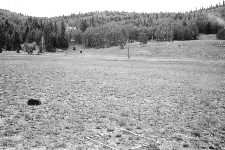
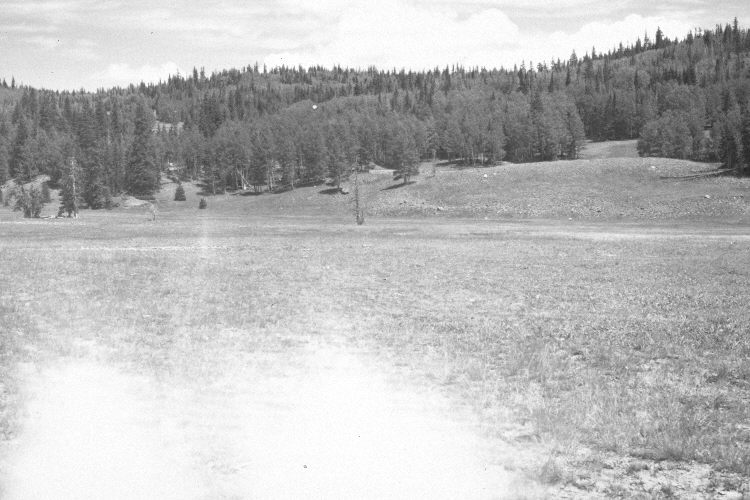
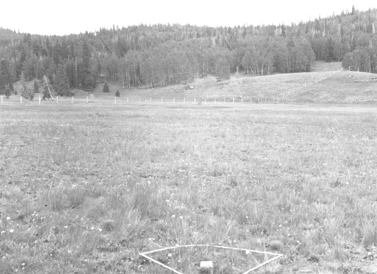
Plate 1140X. Sidney Valley 1943 – 1948 – 1953 – 2005 This Photo Plot Transect was established by the Forest Service in 1943 to monitor range conditions in Sidney Valley. According to early narrative reports, the area was heavily grazed by livestock when the transect was established. In 1948, W.P. Cottam noted, “that grazing is severe here is evidence by the fact that Stipa lettermani is utilized much more than is general throughout the ranger district. Soil erosion is a serious problem on these gentle slopes. Grass clumps are frequently hummocked and [erosion] pavement is frequently conspicuous on soil unprotected by grass”. After remeasuring the transect in 1948, W.P. Cottam noted that what was once a domestic sheep allotment, had been changed to cattle use, but that “the amount of utilization [was still] far too great…” However, I.H. Johnson reported that the soil and vegetation trends were up in 1953. While in 1978, Dr. James Bowns found that “species composition has improved and ground cover had increased. For this site the range condition is good and trend is up.” Plate 1140x is viewed northeast from the end of the Photo Plot Transect. Plant cover in the meadow has improved despite yearly grazing by cattle. The shrubs on the far hillside are mountain big sage. In the distance, conifers have increased, while aspen has declined. Many older spruce, though, were recently killed by insects and disease. Aspen has not regenerated due to repeated ungulate herbivory (Kay and Bartos 2000). A few aspen stands, however, regenerated 30 years ago when mule deer numbers were low. There is now a riparian-willow exclosure 150 yards to the east of the photopoint on Castle Creek. The area was actively being grazed by cattle in 2005.
Photo Information:
U.S. Forest Service photographs (unnumbered) taken W.P. Cottam on August 10, 1943 and August 12, 1948, and by I.H. Johnson on July 17, 1953; retake by Charles E. Kay on September 5, 2005 - - Photo No. 5562-26A. Original photographs, negatives, and narrative reports held in the range files on the Cedar City Ranger District, Dixie National Forest, Cedar City, UT.
Vegetative Community:
Dry Meadow, Conifer, Aspen
Location:
South West: Section 8, Range 8 West, Township 36 South; UTM of transect starting point 343700 E, 4172800 N; elevation 10,080 ft.