Sagebrush Control
1964
1968
2000
Description:
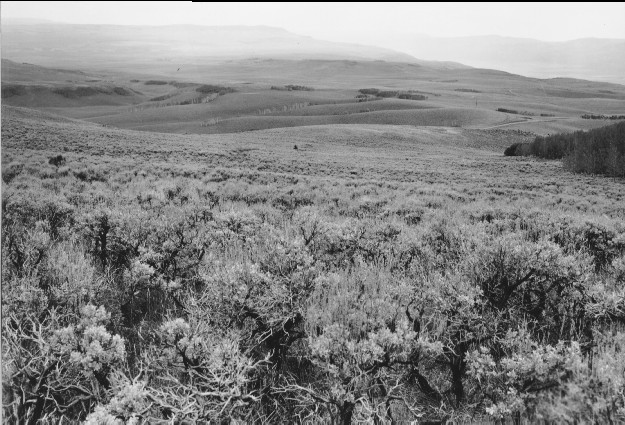
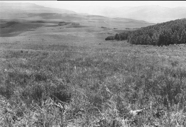
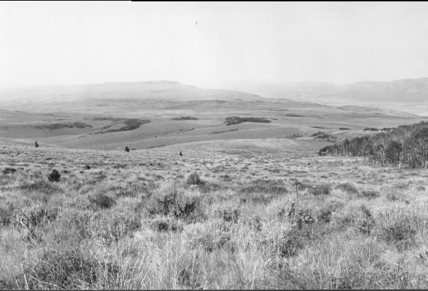
Plate 213. SAGEBRUSH CONTROL 1964-1968-2000 Viewed southwest to Utah Highway 25 below Fish Lake. This area was sprayed with herbicide by the Forest Service in 1964 to reduce sagebrush and to promote the growth of grasses and forbs. By 1968 most sagebrush had been killed, but it gradually reinvaded the site until part of the area was prescribed burned by the Forest Service during the early 1990’s. The photopoint is just below USFS Road 352. Snowberry is intermixed with sagebrush. Aspen has matured but has not regenerated due to repeated browsing. Conifers have increased near the Fish Lake road and a housing development has been established along that highway. In the distance are Parker Mountain, Koosharem or Grass Valley, and Monroe Mountain. Plates 213 and 214 form a panorama.
Photo Information:
U.S. Forest Service photos (unnumbered) taken in June 1964 and 1968; retake by Charles E. Kay on July 30, 2000 - - Photo No. 4649-1; Original photos held by the Loa Ranger District, Fishlake National Forest, Loa, UT.
Vegetative Community:
Sagebrush, Mountain Brush, Aspen, Conifer
Location:
South Central: Section 26, Range 1 E, Township 26 S; UTM 432750 E, 4263800 N; elevation 9,560 ft.