Sage Valley
1943
1948
1953
Description:
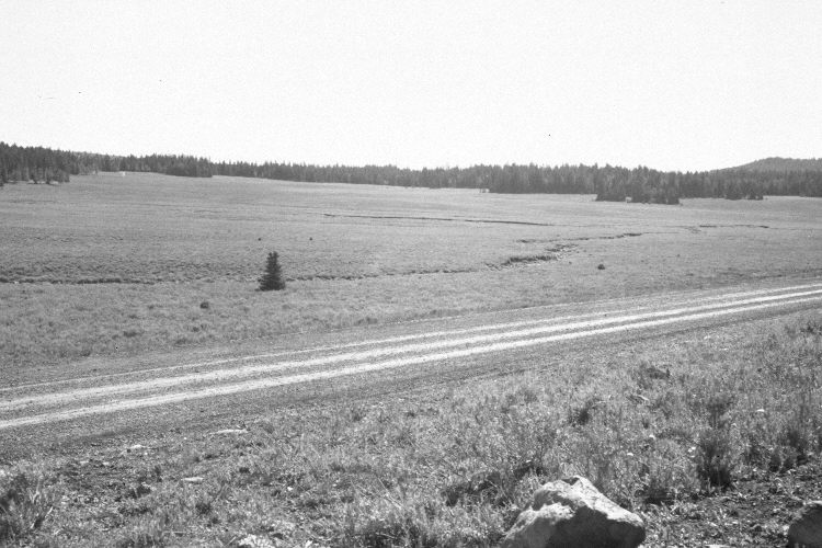
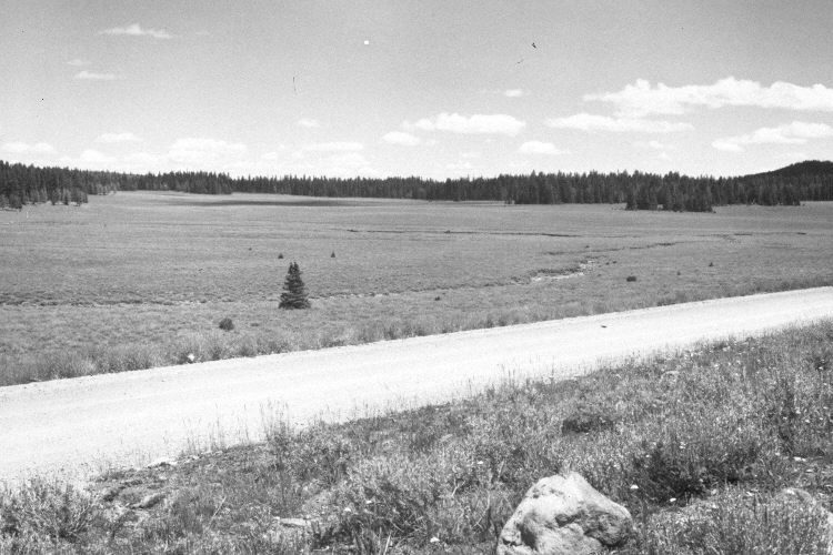
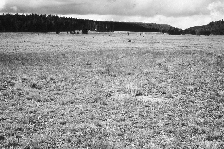
Plate 1083X. Sage Valley 1943 – 1948 – 1953 – 2005 This Photo Plot Transect was established by the Forest Service in 1943 to monitor range conditions in Sage Valley. The transect is 2,650 feet in length. According to early narrative reports, the area was very heavily grazed by domestic sheep when the transect was established. “The soil shows considerable signs of deterioration . . . [erosional] pavement is present…and many of the shrubs and grass clumps are mounded. A wash 4-6 feet deep drains the bottoms.” “The conditions that impressed me most were the very poor litter and excessive bare soil, widespread erosion pavement and quality of the cover. Recent storms caused much local soil disturbance both from sheet and splash erosion standpoints…erosion pavement is dense along the east portion of the transect…and the depressions between vegetation are most conspicuous.” In 1953, I.H. Johnson noted that the vegetation and soil trends were still downward, even though the amount of permitted sheep use had been reduced. When the transect was remeasured in 1978, however, Dr. Jim Bowns found that range condition had improved. “An overall assessment of this area is that the trend has been up since the 1940’s and the condition is presently high fair to low good. This is most apparent in improved soil conditions and species composition…The gully…mentioned by Cottam..[in 1943]…is hardly distinguishable at the present time.” Plate 1083x is viewed east from the start of the Photo Plot Transect. Utah Highway 143 has been widened and paved - - this removed the rocks in the foreground (photo lower-right). Spruce has increased in the meadow but elsewhere it has declined due to recent attacks by insects and disease, which have killed most of the larger trees. The meadow is mostly silver sage and native grasses - - the area has not been treated. Aspen on the right has declined. Smooth brome has been planted along the highway right-of-way. The distant gullies appear more vegetated today than they did in earlier times. The area is still grazed by domestic sheep and had been when the 2005 retake was made.
Photo Information:
U.S. Forest Service photographs (unnumbered) taken by W.P. Cottam on August 9, 1943 and August 11, 1948, and by I.H. Johnson on July 14, 1953; retake by Charles E. Kay on August 31, 2005 - - Photo No. 5536-21. Original photographs, negatives, and narrative reports held in the range files on the Cedar City Ranger District, Dixie National Forest, Cedar City, UT.
Vegetative Community:
Conifer, Dry Meadow, Sagebrush, Aspen
Location:
South West: Section 25, Range 8 ½ West, Township 37 South; UTM of transect starting point 341800 E, 4159150 N; elevation 9,610 ft.