Park Pasture Exposure
1957
2002
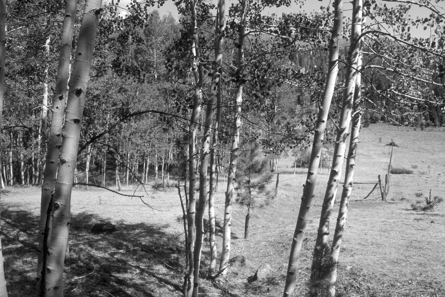
Plate 8X
Description:
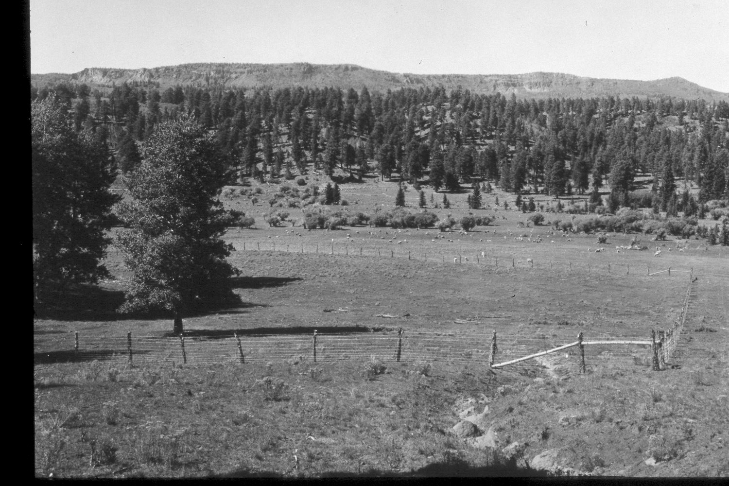
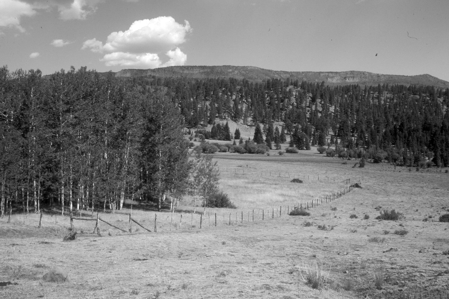
Plate 8X. Park Pasture Exclosure 1957-2002 Viewed north along the southeast corner of the Park Pasture Aspen Exclosure on the eastside of Boulder Mountain. When this exclosure was established by the Forest Service in 1957, it was part of a joint-use allotment - - note the domestic sheep in the original photograph. This view is similar to Plate 7x except the photopoint is further up the hill and the camera is turned more towards the northwest. With protection from livestock, aspen successfully regenerated inside the exclosure, without fire or any other disturbance. Aspen regenerated outside the exclosure, however, only when mule deer numbers declined during the late 1970’s (Kay and Bartos 2000). Note the boulders in the gully both in the retake and the original. As regenerated aspen now block the more distant view, a second retake was made 100 feet to the east. Willows appear unchanged except where replaced by spruce, while conifers have increased on the more distant hillsides. Seen in the distance is Boulder Top and Chokecherry Point (10,770 ft.).
Photo Information
U.S. Forest Service photograph (unnumbered) taken by H.L. Sorenson in 1957; retakes by Charles E. Kay on the July 6, 2002 - - Photo Nos. 4953-23 and 4953-28. Original photo held by, the Teasdale Ranger District, Dixie National Forest, Teasdale, UT.
Vegetative Community:
Riparian, Conifer
Location:
South West: Section 22, Range 5 East, Township 31 South; UTM 470000E, 4215800N; elevation 8,720 ft.