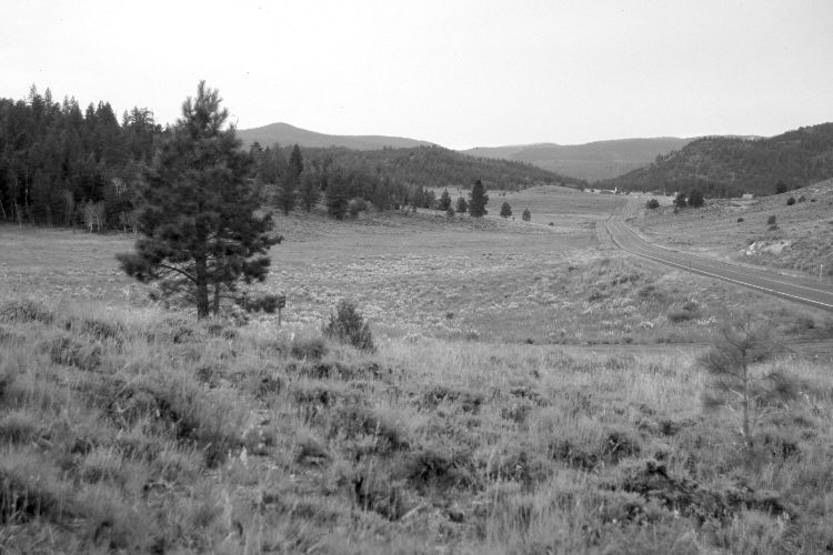
Panguitch Lake
1932
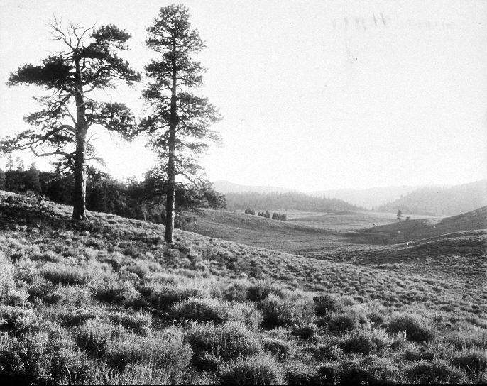
2005
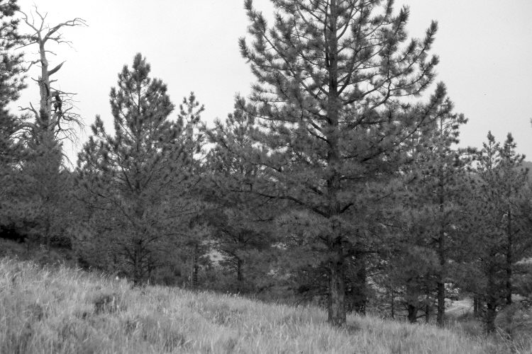
2005
Description:
Plate 1032X. Panguitch Lake 1932 – 2005 – 2005 Viewed west-southwest from southeast of Panguitch Lake. The large ponderosa pine on the left has died but is still standing, while the pine on the right has been logged. In the foreground are mountain big sage, snowberry, three-tipped sage, green rabbitbrush, currant, and bitterbrush. Native grasses include needle and thread and Poa sp. As pines now block the distant view, a second retake was made approximately 100 yards further west. Utah Highway 143 has been realigned, widened, and paved. Blue Spring Mountain (9,840 ft.) is on the center-left skyline. Conifers and summer homes have increased in the distance, while aspen has declined. USFS road 044 is at the base of the hill in the foreground.
Photo Information:
U.S. Forest Service photograph (315633) taken ca. 1932; retakes by Charles E. Kay on August 4, 2005 - - Photo Nos. 5511-31 and 5516-3. Original photograph (2310 – Dixie – 51) held in the U.S. Forest Service Regional Office Photographic Collection housed at Weber State University, Ogden, UT.
Vegetative Community:
Conifer, Sagebrush, Mountain Brush
Location:
South West: Section 3, Range 7 West, Township 36 South; UTM 356750 E, 4174450 N; elevation 8,212 ft.