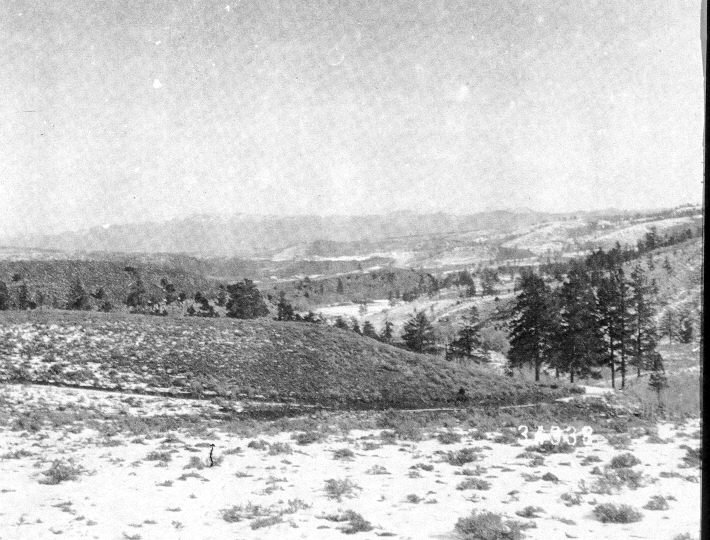
Panguitch Creek
1902
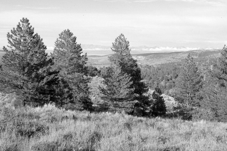
2005
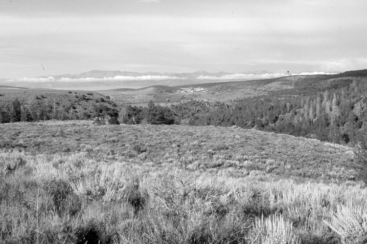
2005
Description:
Plate 1040X. Panguitch Creek 1902 – 2005 – 2005 Viewed east-northeast down Panguitch Creek from the top of the old Clayton Dugway. The White Cliffs are in the distance, while Mount Dutton is on the skyline. The road in the 1902 image has not been used in many years. Conifers now block the distant view, so a second retake was made from the nearest open area, which is approximately 100 yards further to the left (north). Mountain big sage, three-tipped sage, and bitterbrush have increased in the foreground, while pinyon, juniper, ponderosa pine and other conifers have increased in the distance, while aspen has declined. Utah Highway 143 has been built along the creek in the canyon to the right. The area in the foreground was apparently treated in the past because crested wheat is the most common grass. Native needle and thread is also present. The area is grazed by cattle and mule deer.
Photo Information:
U.S. Forest Service photograph (34338) taken by Albert Potter in 1902; retakes by Charles E. Kay on August 5, 2005 - - Photo Nos. 5518-33 and 5518-30. Original photograph held in the U.S. Forest Service Regional Office, Ogden, UT - - see Prevedel and Johnson (2005:86).
Vegetative Community:
Sagebrush, Mountain Brush, Pinyon, Juniper, Conifer, Aspen
Location:
South West: Section 25, Range 7 West, Township 35 South; UTM 359350 E, 4178000 N; elevation 8,190 ft.