Navajo Lake
1930
2004
2004
Description:
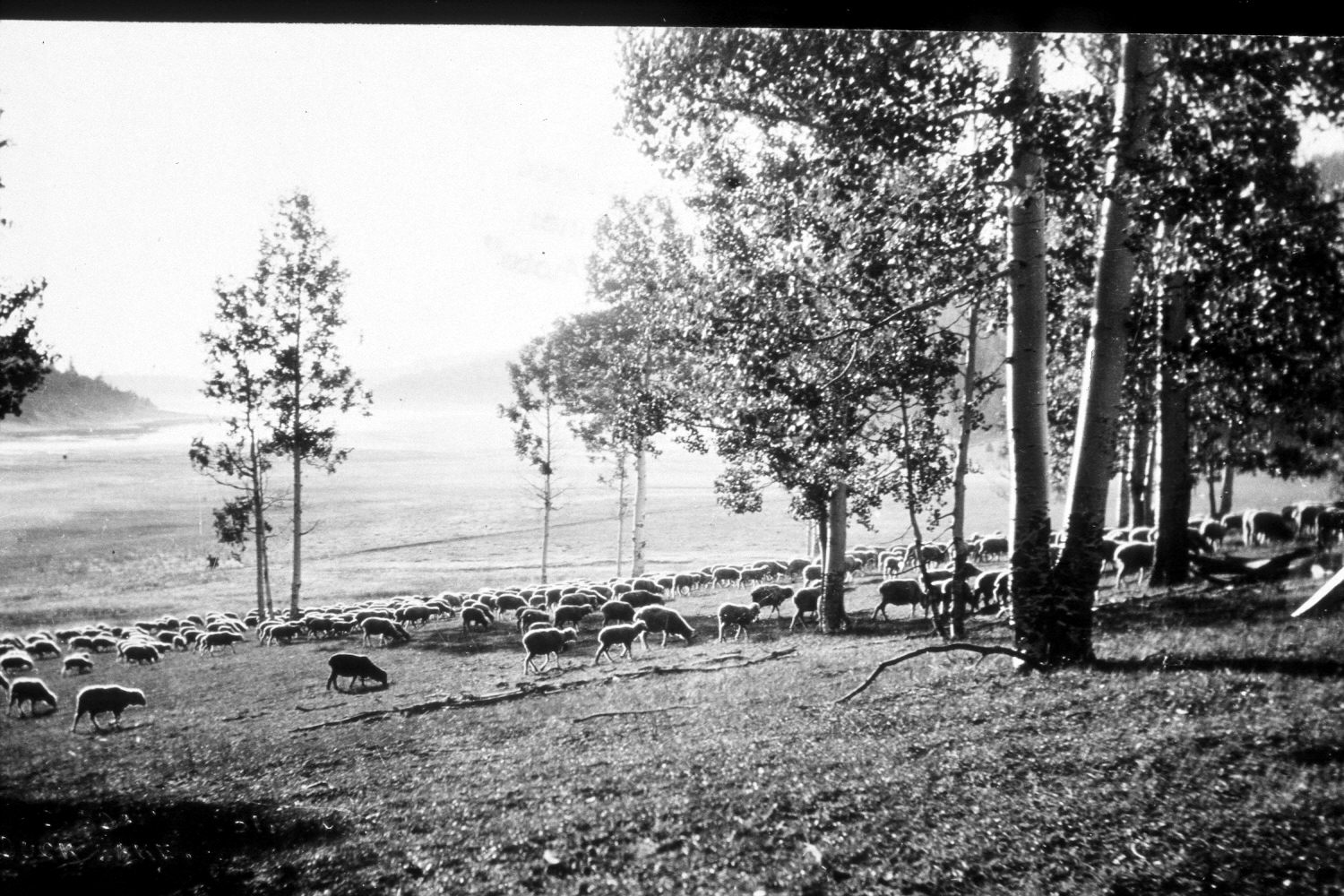
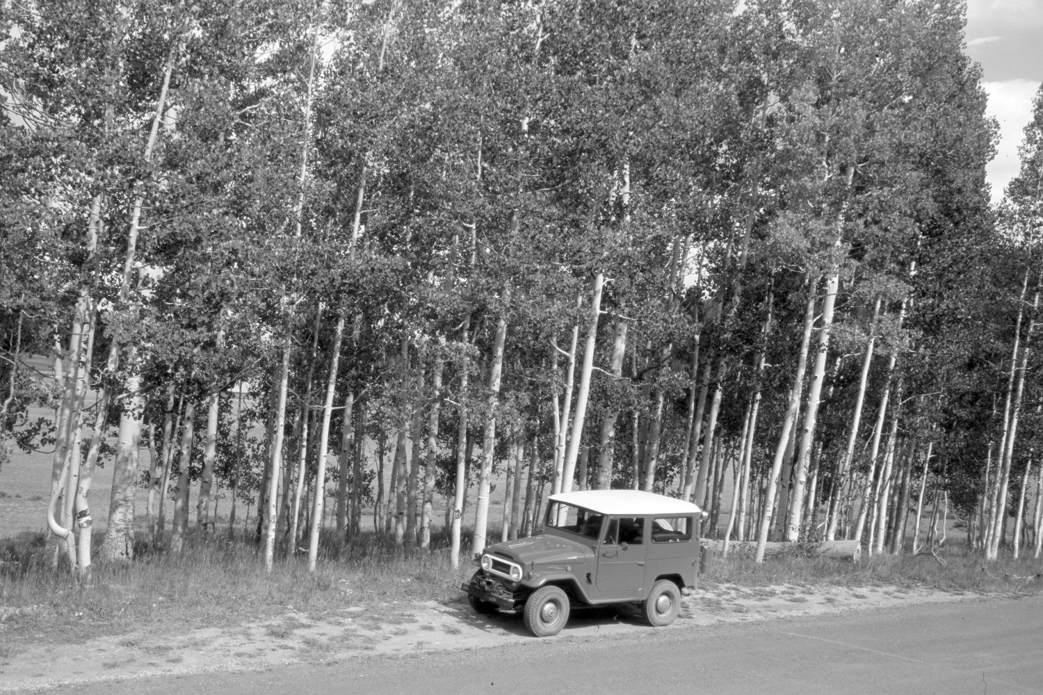
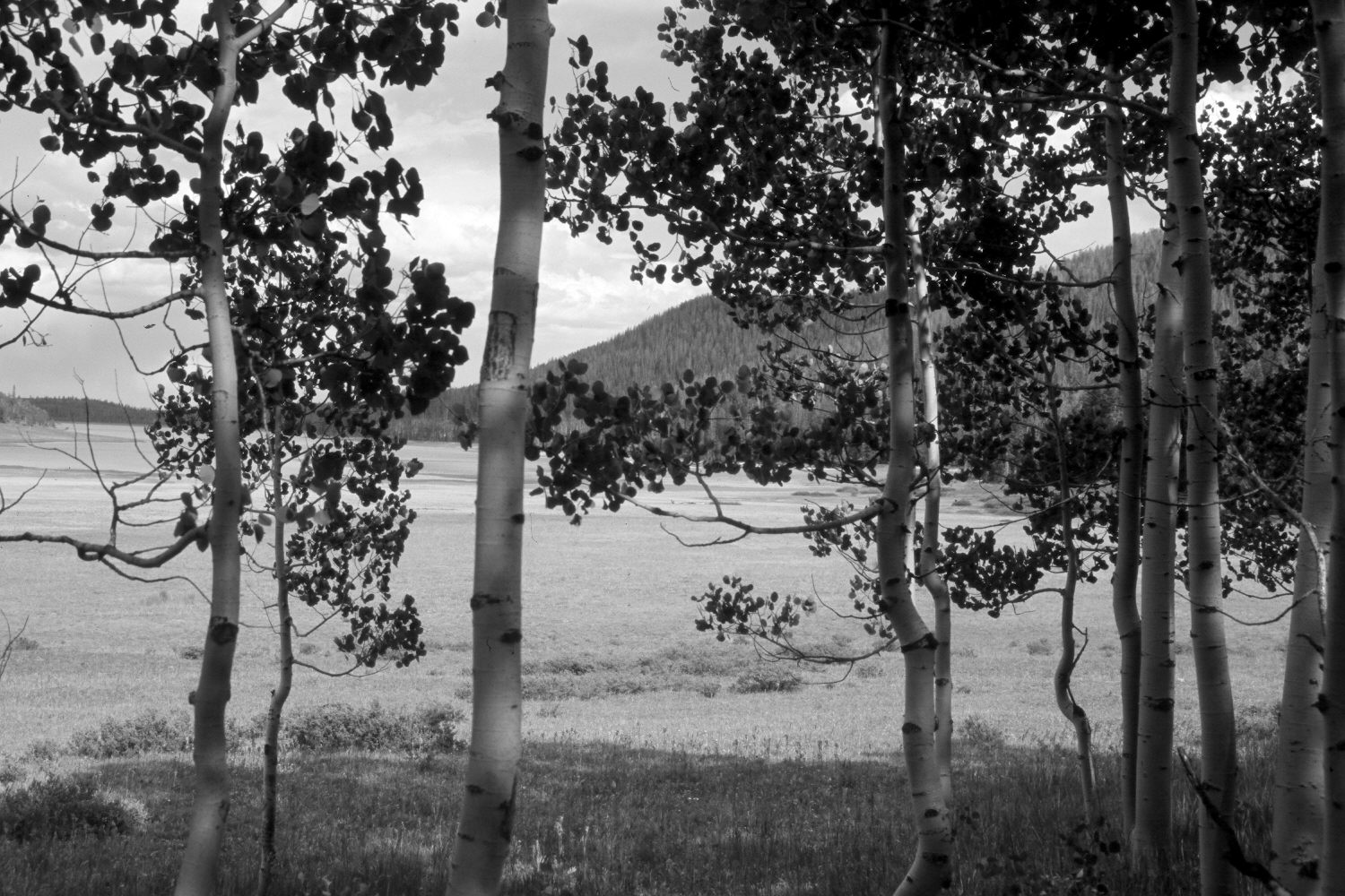
Plate 633X. Navajo Lake 1930 – 2004 – 2004 – 2004 Viewed east to the upper end of Navajo Lake on the Dixie National Forest. The area is no longer grazed by livestock, as the entire lakeshore is now a major recreation complex. A paved road has been built around the south side of the lake destroying the original photopoint, as well as the mature aspen seen in the 1930 image. About 30 years ago, however, some aspen successfully regenerated when mule deer populations declined (Kay and Bartos 2000). Today, however, most aspen suckers are heavily browsed by wildlife. As regenerated aspen now block the distant view, a second retake was made from just inside the eastern edge of the clone, and a third from just beyond the stand. The shrubs in the foreground of the third retake are shrubby cinquefoil - - a species that was absent when the area was heavily grazed by domestic sheep. The taller shrubs in the distance are willows, which too likely increased with the elimination of sheep grazing - - see Plates 637x, 638x, and 639x. Conifers have increased, but many spruce have recently been killed by insects and disease.
Photo Information:
U.S. Forest Service photograph (257063) taken ca. 1930; retake by Charles E. Kay on August 10, 2004 - - Photo Nos. 5391-2A, 5391-7A, and 5391-5A. Original photograph (2200-Dixie-8) held in the U.S. Forest Service Regional Office Photographic Collection housed at Weber State University, Ogden, UT.
Vegetative Community:
Riparian, Conifer, Aspen
Location:
South West: Section 11, Range 9 West, Township 38 South; UTM 339900 E, 41545000 N; elevation 9,120 ft.