Kane gulch - Cedar Mesa
1977
1998
1998
Description:
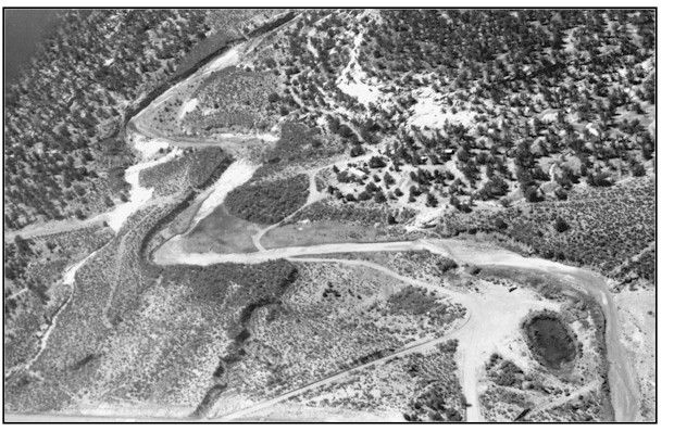
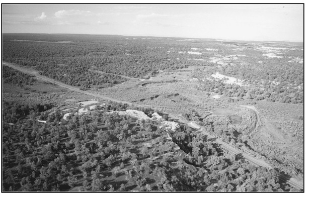
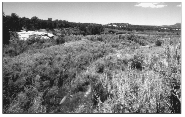
KANE gULCH - CEDAR MESA The 1977 photograph shows Kane gulch as a relatively wide (estimated from 30-40 feet in width) channel with sparsely vegetated banks. The 1998 retake, although not from the exact same location, still illustrates the fact that riparian vegetation along this stream segment has greatly improved. Surface photographs (- C looking downstream and - D looking upstream) taken at this location July 16, 1998 show fully vegetated streambanks with a good mixture of native woody and herbaceous species including: coyote willow, yellow willow, spike rush, bulrush, rush, and cattail. Tamarisk is also present but is not a major component of the vegetation community. Channel widths are now from 3-10 feet wide. This properly functioning stream segment is above the livestock barrier fence surrounding grand gulch and is still grazed each year.
Photo Information
Photograph Number: BLM No. 1 Original: Date: ca. 1977 (- A) Photographer: Unknown Source: Bureau of Land Management, Monticello, Utah Retake: Date: August 1998 (- B) Photographer: Paul Curtis Source: Bureau of Land Management, Monticello, Utah general Description: The original oblique photograph is of the original grand gulch Ranger Station. The general view is downstream west southwest toward grand gulch. It shows several hundred feet of riparian habitat near the station. Legal Description: SW1/4NE1/4 Section 35 T.37S., R.18E.
Vegetative Community:
Riparian
Location:
San Juan