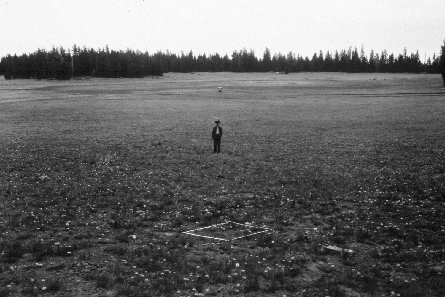
Griffin Top
1943
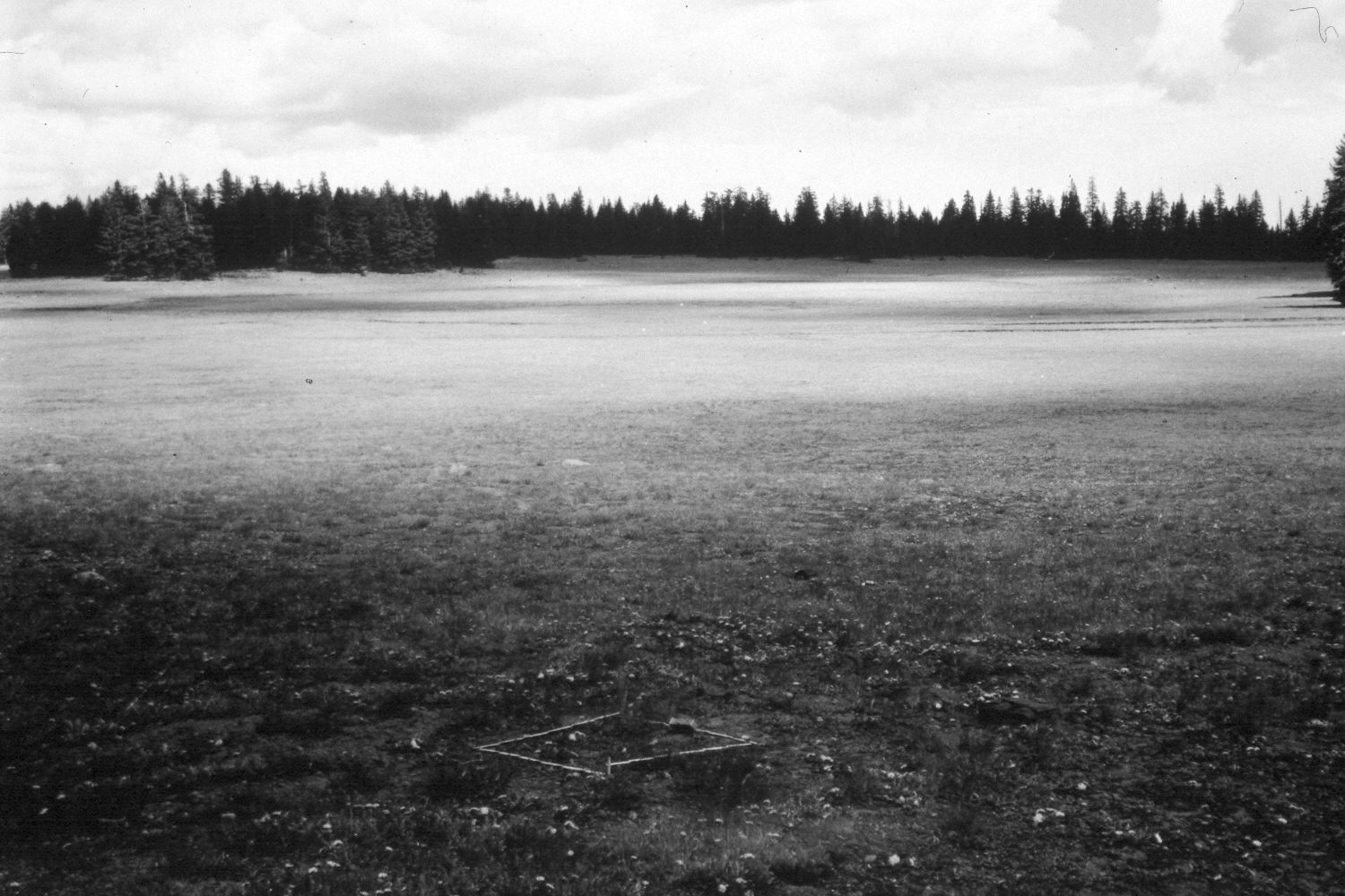
1948
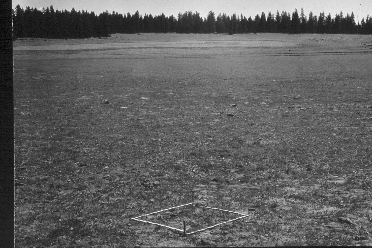
1953
Description:
Plate 342X. Griffin Top 1943 - 1948 - 1953 - 2003 The Griffin Top Photo Plot Transect was established in 1943 and reread in 1948, 1953, and 1979. The transect consists of five plots and is 900 feet in length. The transect is located three-quarters of a mile north-northeast of Griffin Spring. When this Photo Plot Transect was established, the allotment was very heavily grazed by domestic sheep and sheet erosion was common. In 1953, I.H. Johnson noted that the trend was still downward. By 1979, however, range condition was reported as “fair to good and [the] trend has been up since the transect was established” (unpublished reports in the range files on the Escalante Ranger District, Dixie National Forest, Escalante, UT). Plate 342x is viewed east back to the Photo Plot Transect starting point - - see Plate 341x. The person, vehicle, and plot in the 1943 image are all on the transect centerline. In 2003, the wet meadow was inundated despite the drought that has gripped southern Utah for several years. A new logging road has been built to the south of the transect, which accounts for the small boulders that have been moved into the meadow. The logs in the 2003 retake are aspen that have died and fallen. Spruce has increased despite logging. Note the steel pin in the foreground of the 2003 retake, which is the same steel stake seen in the earlier photos. Grass cover appears to have increased, and today there is little evidence of active soil erosion except for that associated with timber cutting. Sheep fescue is the most common grass. The area was actively being grazed by cattle in 2003.
Photo Information:
U.S. Forest Service photographs (unnumbered) taken by Ray J. Davis on June 28, 1943; Walter P. Cottam on June 27, 1948; and I.H. Johnson August 19, 1953; retake by Charles E. Kay on August 25, 2003 - - Photo No. 5255-3A. Original photographs, negatives, and narrative reports held in the range files on the Teasdale Ranger District, Dixie National Forest, Teasdale, UT.
Vegetative Community:
Wet Meadow, Conifer, Aspen
Location:
South West: Section 23/26 (the transect is on the section line), Range 1 West, Township 33 South; UTM of transect starting point 423900 E, 4196550 N; elevation 10,580 ft.