Griffin Top
1943
1948
1953
Description:
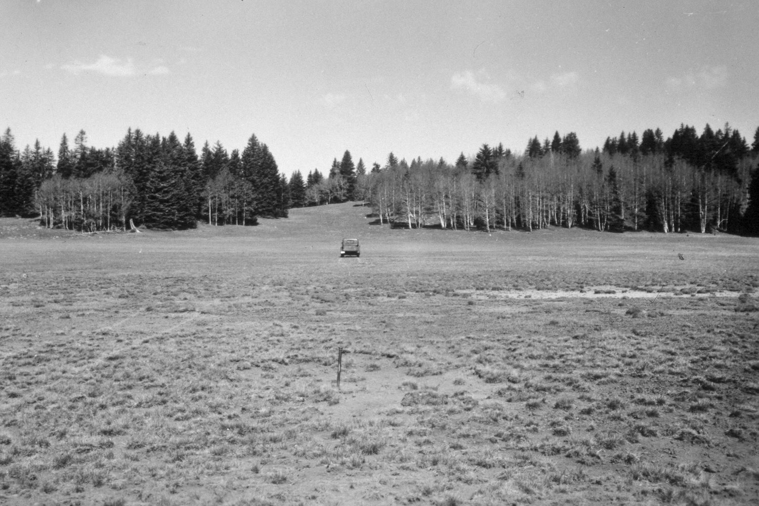
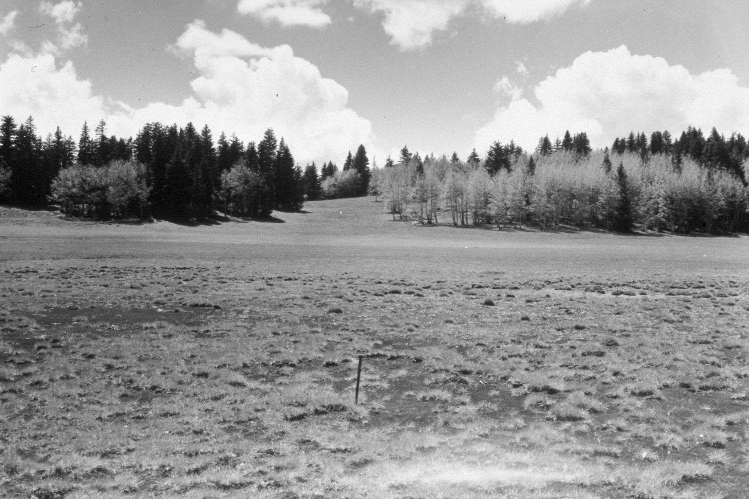
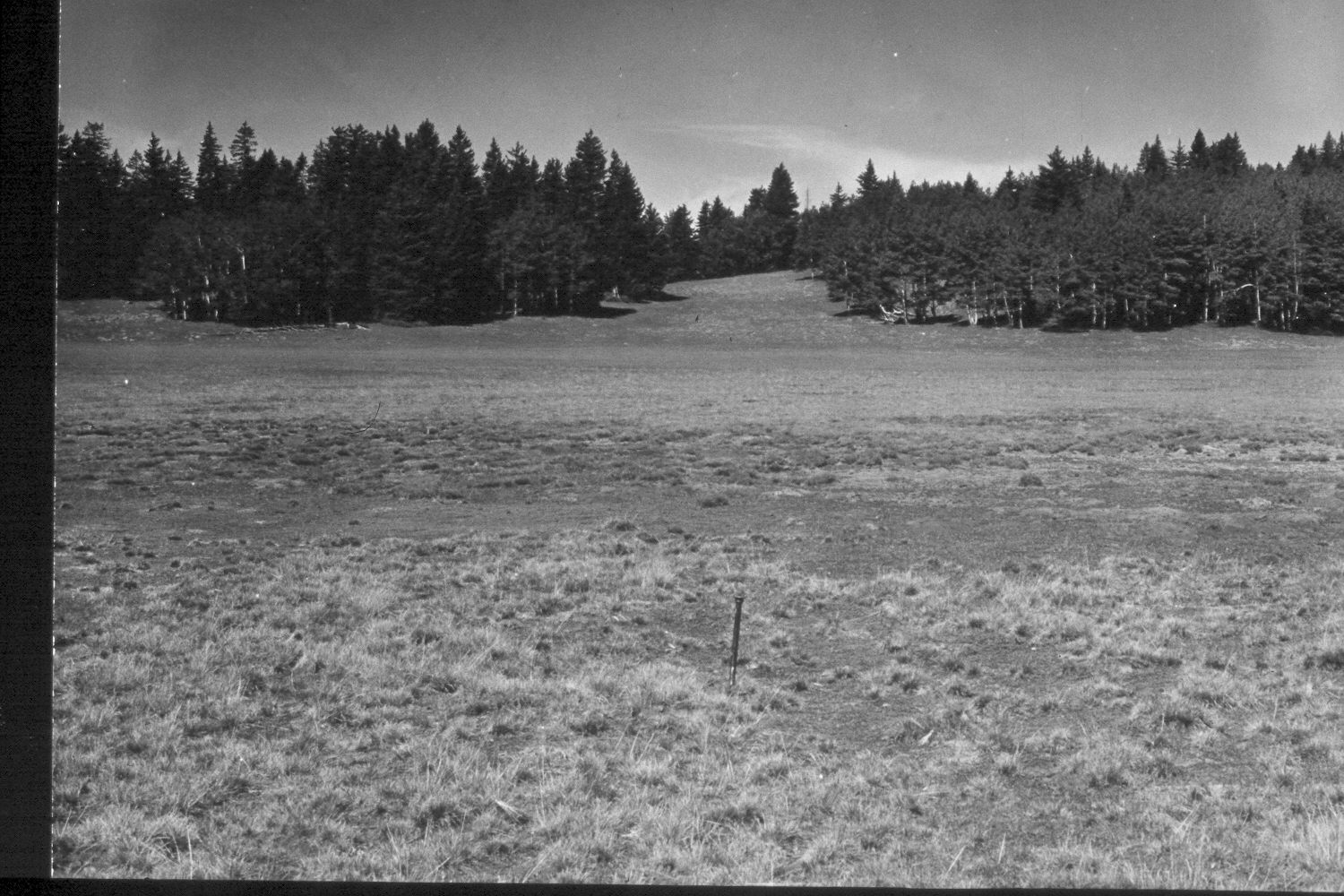
Plate 341X. Griffin Top 1943 - 1948 - 1953 - 2003 The Griffin Top Photo Plot Transect was established in 1943 and reread in 1948, 1953, and 1979. The transect consists of five plots and is 900 feet in length. The transect is located three-quarters of a mile north-northeast of Griffin Spring. When this Photo Plot Transect was established, the allotment was very heavily grazed by domestic sheep and sheet erosion was common. In 1953, I.H. Johnson noted that the trend was still downward. By 1979, however, range condition was reported as “fair to good and [the] trend has been up since the transect was established” (unpublished reports in the range files on the Escalante Ranger District, Dixie National Forest, Escalante, UT). Plate 341x is viewed west from the Photo Plot Transect starting point at the steel stake in the early images. The first 600 feet of this transect were described as a wet meadow that was only inundated after spring snowmelt. When the site was revisited late August 2003, however, the area was still covered with water, which is surprising as a severe drought has gripped southern Utah for several years. The area was actively being grazed by cattle in 2003 - - note the hoofprints along the shoreline. A new road has been added, but despite repeated logging, spruce has increased while aspen has declined. All aspen suckers showed evidence of repeated browsing and most aspen stands have not successfully regenerated in 100 years. The steel post was missing in 2003. The truck in the 1943 image is on the transect centerline.
Photo Information
U.S. Forest Service photographs (unnumbered) taken by Ray J. Davis on June 28, 1943; Walter P. Cottam on June 27, 1948; and I.H. Johnson August 19, 1953; retake by Charles E. Kay on August 25, 2003 - - Photo No. 5253-24. Original photographs, negatives, and narrative reports held in the range files on the Teasdale Ranger District, Dixie National Forest, Teasdale, UT.
Vegetative Community:
Wet Meadow, Conifer, Aspen
Location:
South West: Section 23/26 (the transect is on the section line), Range 1 West, Township 33 South; UTM of transect starting point 423900 E, 4196550 N; elevation 10,580 ft.