East Fork Of The Sevier River
1943
1948
1953
Description:
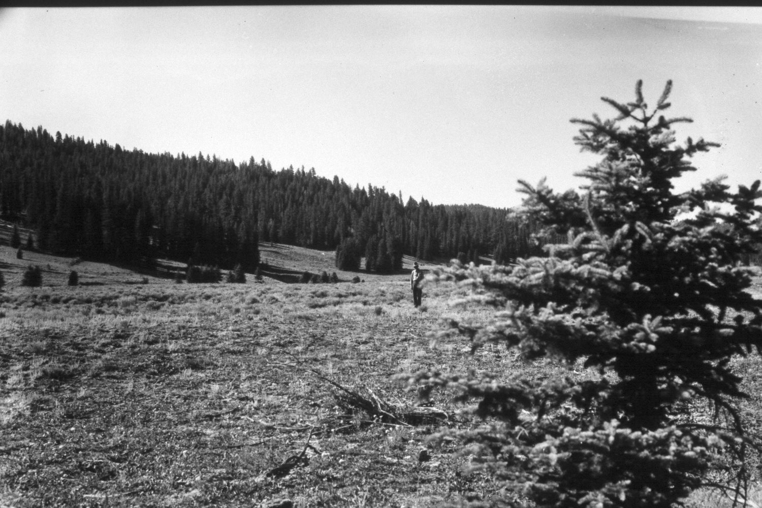
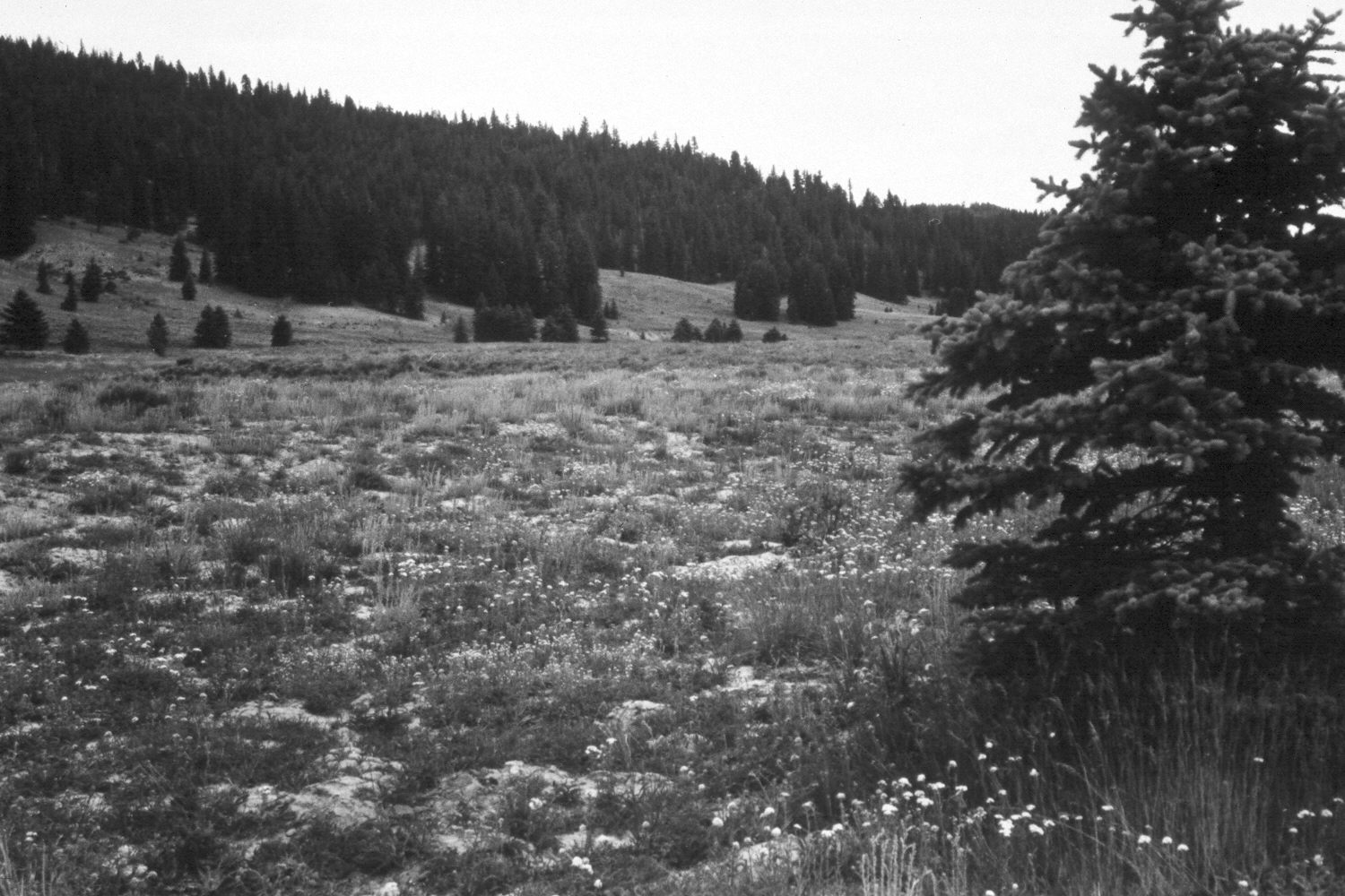
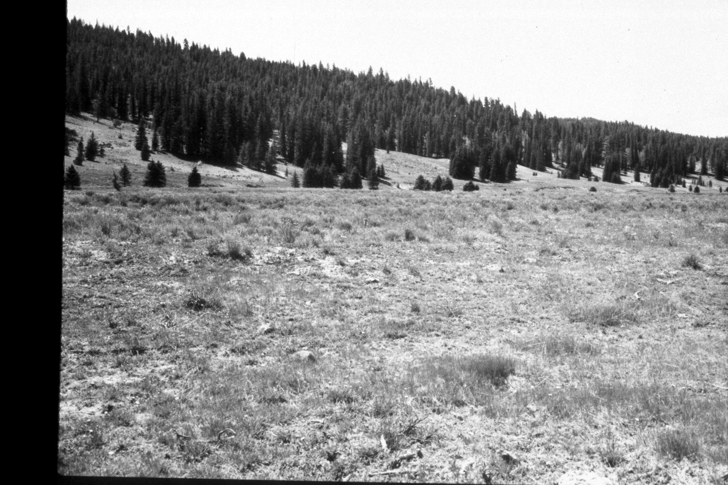
Plate 269X. East Fork of the Sevier River 1943 - 1948 - 1953 - 1961 - 1979 - 2003 The East Fork of the Sevier River Photo Plot Transect was established in 1943, and re-read in 1948, 1953, 1961, and 1979. Two plot-lines were set-out from a common starting point approximately one-half mile north of Blubber Creek. The first line runs in a southwesterly direction for 1200 feet, while line two runs in a southeasterly direction for 600 feet. According to the 1943 narrative report, the area was once a wet meadow but as the East Fork eroded and down-cut 5 to 7 feet “the plants growing there have died out and Artemisia, Gutierrezia, Chrysothamaus, and Kochia have come in. Much of the area is still entirely barren [from overgrazing] or has valueless weeds growing on it.” Willows were described as having once been abundant along the stream, but most were killed-out by repeated browsing and the lowered watertable. Heavy grazing had “obliterated” most native grasses and the hillsides were described as “severely eroded”. In 1961, “Fresh alluvial deposits [were] common [and] drainage ways [had] deepened.” By 1979, however, “the area [showed] tremendous improvement” after much of the East Fork had been reseeded by the Forest Service during the early 1960s (unpublished reports in the range files on the Panguitch Ranger District, Dixie National Forest, Panguitch, UT). Plate 269x is viewed southeast along the second leg of the Photo Plot Transect from that transect’s common starting point just to the left of the spruce tree in the foreground - - see Plate 268x. The East Fork of the Sevier River is at the base of the far hillside. Spruce and ponderosa pine have increased in the distance. The spruce tree on the right now blocks the distant view so the 1979 and 2003 retakes were made a little further forward. Today, the meadow is primarily smooth brome and Kentucky bluegrass, while the low-growing shrubs are mostly shrubby cinquefoil and rubber rabbitbrush. Mountain big sage is common on the drier hillsides. The person in the 1943 image is standing on the transect centerline. The area had not been grazed by livestock in 2003 when the transect was revisited.
Photo Information:
U.S. Forest Service photographs (unnumbered) taken by Ray Davis on July 16, 1943; Walter Cottam on July 15, 1948; I.H. Johnson on June 18, 1953; I.H. Johnson on August 16, 1961; and Jim Bowns and Al Tait on July 17, 1979; retake by Charles E. Kay on August 6, 2003 - - Photo No. 5218-25A. Original photographs, negatives, and narrative reports held in the range files on the Panguitch Ranger District, Dixie National Forest, Panguitch, UT.
Vegetative Community:
Dry Meadow, Conifer
Location:
South West: Section 25, Range 4½ West, Township 37 South; UTM of transect starting point 387350E, 4157100 N; elevation 7,120 ft.