Durfey Creek
1935
2002
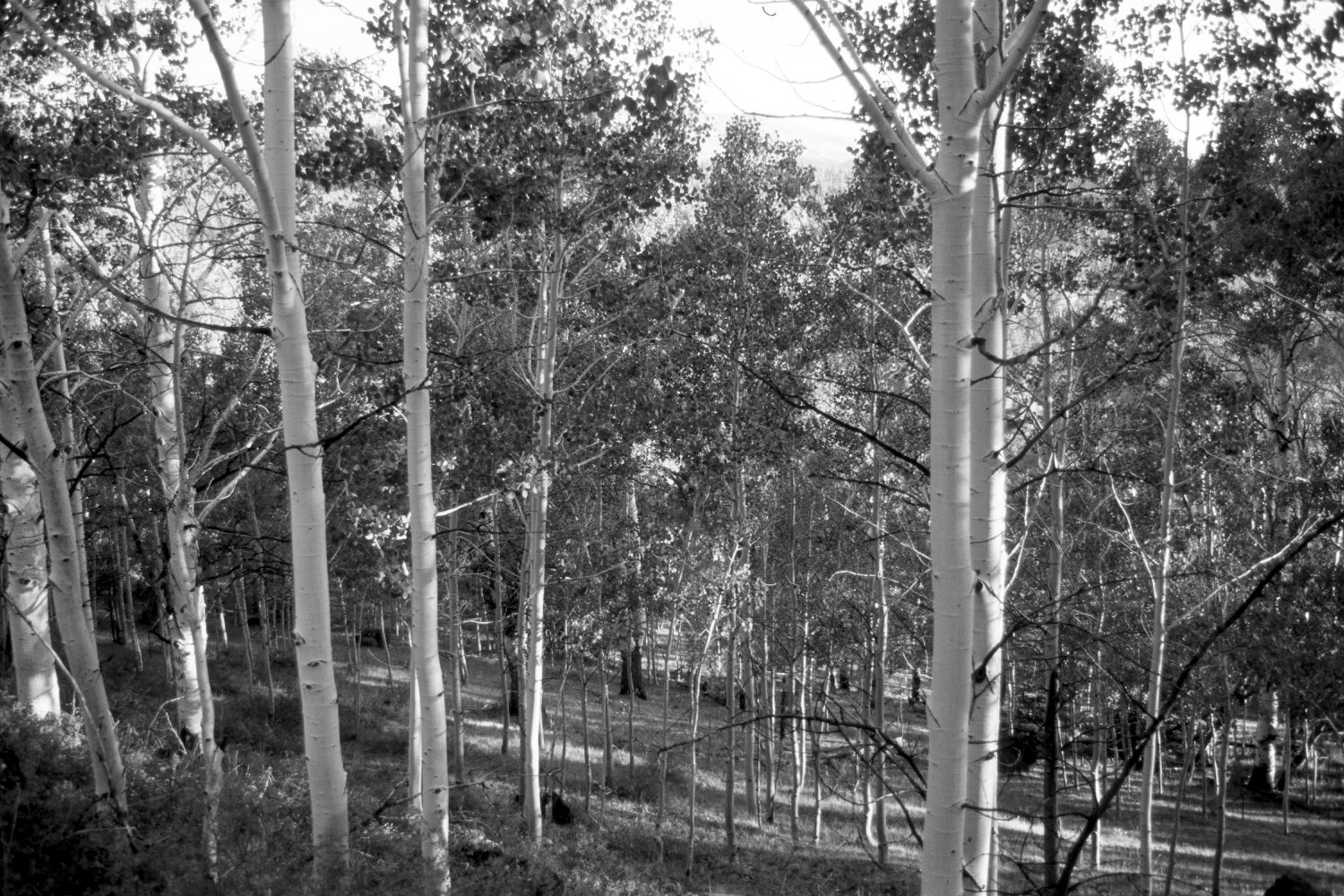
Plate 12X
Description:
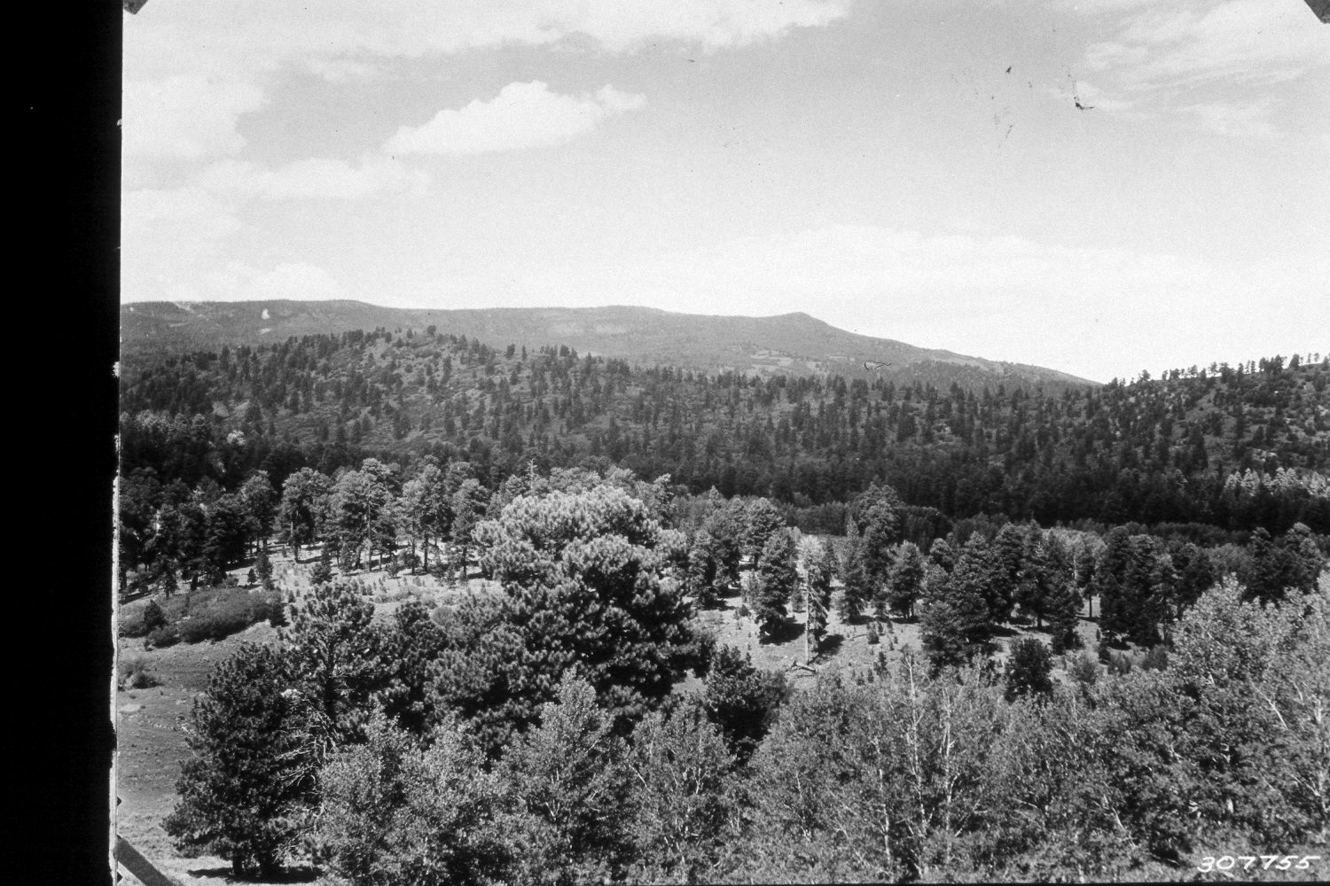
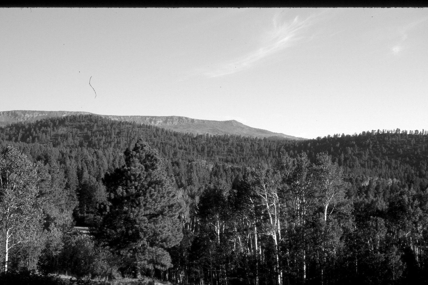
Plate 12X. Durfey Creek 1935-2002 Viewed northwest across Durfey Creek to Park Ridge (9,131 ft.) with Boulder Top and Chokecherry Point (10,770 ft.) in the distance. The original camera station is on the old Boulder to Grover Road, which has since been replaced by Utah Highway 12. Aspen have matured and now block the original photopoint, so the retake was made from the nearest open area, which is approximately 100 yards straight down the hill from the old road. Thus, the perspective is slightly different in the retake. Nevertheless, conifers have increased in the foreground and on Park Ridge, despite years of selective logging. Some aspen stands regenerated during the late 1970’s when mule deer numbers declined (Kay and Bartos 2000), but aspen around the photopoint has not regenerated in the last 35 years due to repeated browsing by elk, deer, and cattle. Aspen below Chokecherry Point has also been heavily invaded by conifers.
Photo Information:
U.S. Forest Service photograph 307755 taken in 1935, retake by Charles E. Kay on July 7, 2002 - - Photo No. 4956-14. Original photo held by Southern Utah University Archives and Special Collections, Cedar City, UT.
Vegetative Community:
Conifer, Aspen
Location:
South West: Section 26, Range 5 East, Township 31 South; UTM 471900E, 4214100N; elevation 8,600 ft.