Burr Top
1943
1948
1954
Description:
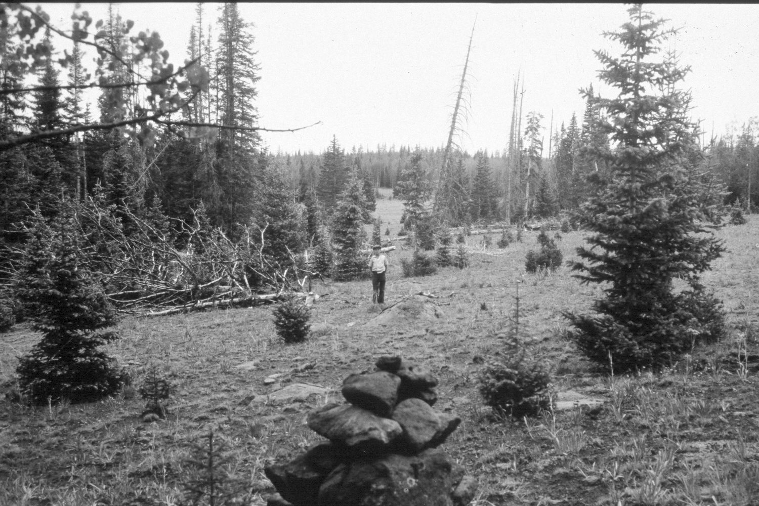
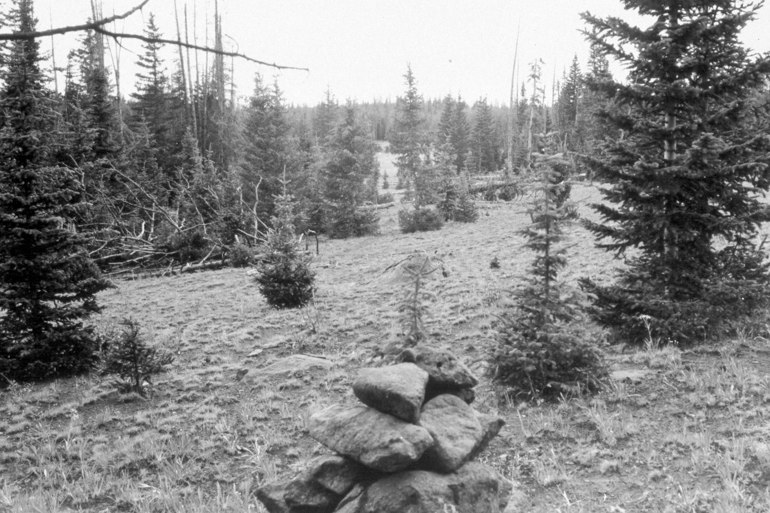
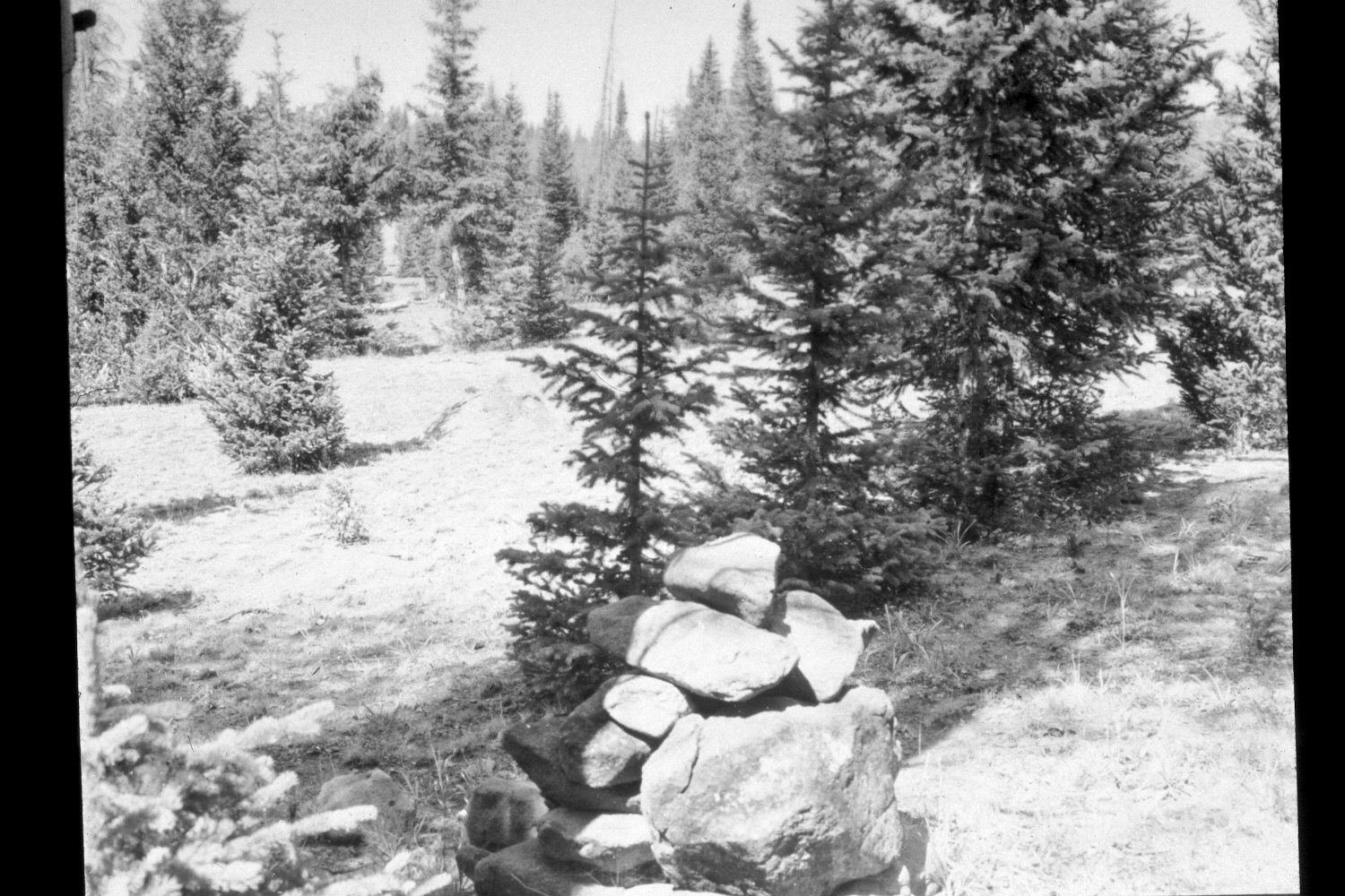
Plate 346X. Burr Top 1943 - 1948 - 1954 - 2003 The Burr Top Photo Plot Transect (a.k.a. Roger Peak II) on the Aquarius Plateau was established in 1943 and reread in 1948, 1954, and 1979. The transect contains eight plots and is 1460 feet in length. The transect was situated to sample a “small parklike area surrounded by a dense stand of Engelmann spruce and [sub]alpine fir.” The area was heavily grazed by domestic sheep and range conditions were described as poor when the transect was established. After remeasuring the transect in 1954, I.H. Johnson noted that the vegetation trend was “downward…[and] with evidence of active soil erosion on each of the eight plots, the only logical conclusion that can be made is that [the] soil trend is downward [as well].” Sheep use was subsequently eliminated and in 1979 Dr. Jim Bowns, range ecologist at Southern Utah University, found that “plant cover and species diversity have increased considerably since the transect was established. It is apparent that this range has improved, especially since 1954. The trend has definitely been up and the present condition is good. This site is near its productive potential.” Dr. Bowns noted, however, that conifers had invaded much of the original meadow, and if left unchecked, would dramatically alter the site (unpublished narrative reports in the range files on the Escalante Ranger District, Dixie National Forest, Escalante, UT). Plate 346x is viewed southwest from the starting point of this Photo Plot Transect at the rock carin in the foreground. The person in the 1943 image is standing on the transect centerline. Due to forest ingrowth, this site was extremely difficult to relocate. The starting point is 50 feet north of the ATV trail that now crosses the transect at two locations. In addition, the rock carin was so overgrown that a number of small trees had to be removed before the 2003 retake was made. Needless to say, conifers primarily spruce, have increased markedly and today very little of the original meadow is left - - see Plate 347x. The rock carin is now at least 200 yards east of the remaining open meadow. As conifers have increased, forage production has declined (Kay 2003). The remaining meadow was heavily used by elk in 2003, a species absent in 1943. A few cattle had also grazed the meadow in 2003.
Photo Information
U.S. Forest Service photographs (unnumbered) taken by Ray J. Davis on August 5, 1943; and Walter P. Cottam on August 3, 1948; and I.H. Johnson on August 23, 1954; retake by Charles E. Kay on August 26, 2003 - - Photo No. 5257-9. Original photographs, negatives, and narrative reports held in the range files on the Escalante Ranger District, Dixie National Forest, Escalante, UT.
Vegetative Community:
Conifer, Dry Meadow
Location:
South West: Section 17, Range 3 East, Township 32 South; UTM of transect starting point 447100 E, 4208300 N; elevation 10,240 ft.