Black Birch Canyon
1943
1979
2004
Description:
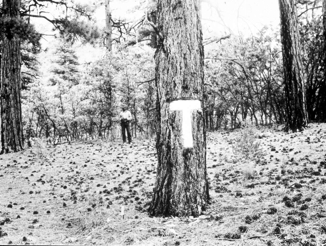
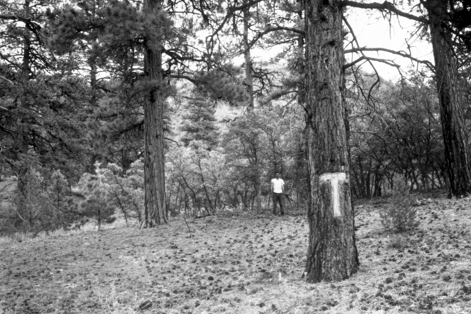
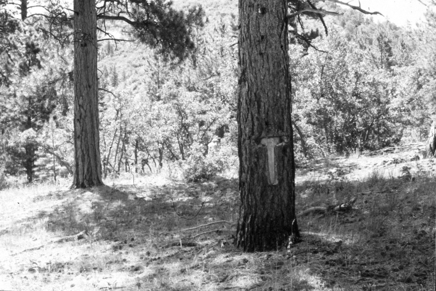
Plate 423X. Black Birch Canyon 1943 – 1948 – 1979 – 2004 This Photo Plot Transect was established by the Forest Service in 1943 to monitor range conditions on the East Fork of Black Birch Creek below Bryce Canyon National Park. The lower two plots on this Transect are situated in the ponderosa pine type, while the upper three plots sample mountain brush communities. According to early narrative reports, this area was very heavily grazed by livestock when the transect was established and most of the shrubs were severely hedged by repeat browsing. Soil erosion was also described as common. The primary brush species included birchleaf mountain mahogany, Utah serviceberry, Gambel’s oak, snowberry, rose, and mountain big sage. Grass cover was described as minimal and consisted mostly of Indian rice grass, needle and thread, western wheatgrass, squirreltail, and Letterman’s needlegrass. Plate 423x is viewed southeast at the Photo Plot Transect’s starting point in the ponderosa pine type. A number of the largest pine in the area were removed 80 to 100 years ago - - judging by the stumps that are still present. Fire-killed snags are spread throughout the stand and several of the older pine are also fire-scarred - - indications that light, ground-fires were once common on a site that has now not burned in more than 100 years. The large ponderosa pine on the right edge of the early images has died and fallen. Pine regeneration has increased and replaced some of the oakbrush in the original photos. Oakbrush in the 2004 retake had not yet leafed-out. The area was not grazed by livestock in 2004 and there was very little use by mule deer - - and none by elk.
Photo Information:
U.S. Forest Service photograph taken by Ray J. Davis on August 28, 1943; W.P. Cottam on August 21, 1948, and Al Tait on July 19, 1979. Retake by Charles E. Kay on May 12, 2004 - - Photo No. 5299-7. Original photographs, negatives, and narrative reports held in the range files on the Panguitch Ranger District, Dixie National Forest, Panguitch, UT.
Vegetative Community:
Mountain Brush, Oakbrush, Sagebrush, Conifer
Location:
South West: Section 15, Range 4 West, Township 38 South; UTM of Transect starting point 392750 E, 4151050 N; elevation 7,160 ft.