Assay Bench
1957
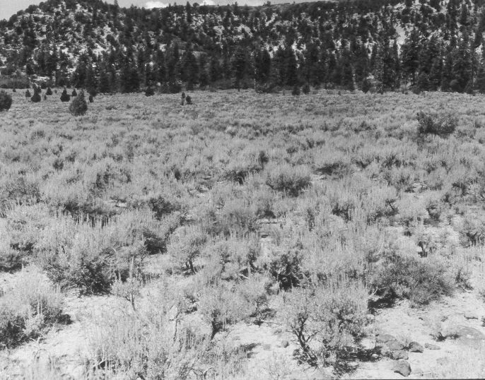
1958
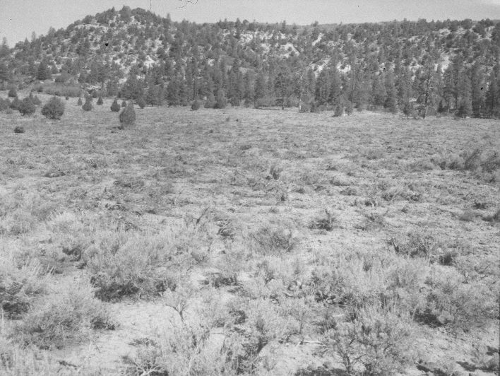
1959
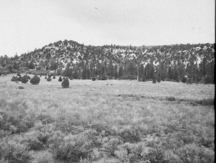
Description:
Plate 972X. Assay Bench 1957 – 1958 – 1959 – 2005 Viewed north from Assay Bench to Little Mountain (8,104 ft.). The 1957 photo was taken before the area was treated, while the 1958 image was made immediately after the site had been root-plowed to eliminate sagebrush and reseeded to improve range conditions. The 1959 photograph was taken the first growing season after the treatment. The seeded area is mostly smooth brome with some intermediate and crested wheatgrass. Mountain big sage and bitterbrush have begun to reinvade the seeding. Part of the area was burned by the Uinta Flat Wildfire in 1989. Plates 970x, 971x, and 972x were taken from the same photopoint marked with a rock carin on top of a low, lava out-crop approximately 100 feet north of the access road.
Photo Information:
U.S. Forest Service photographs (unnumbered) taken in August 1957, June 1958, and September 1959; retake by Charles E. Kay on July 30, 2005 - - Photo No. 5492-23. Original photographs, negatives, and narrative reports held in the range files on the Cedar City Ranger District, Dixie National Forest, Cedar City, UT.
Vegetative Community:
Dry Meadow, Sagebrush, Mountain Brush
Location:
South West: Section 29, Range 6 West, Township 37 South; UTM 363900 E, 4158400 N; elevation 7,520 ft.